MyTopo
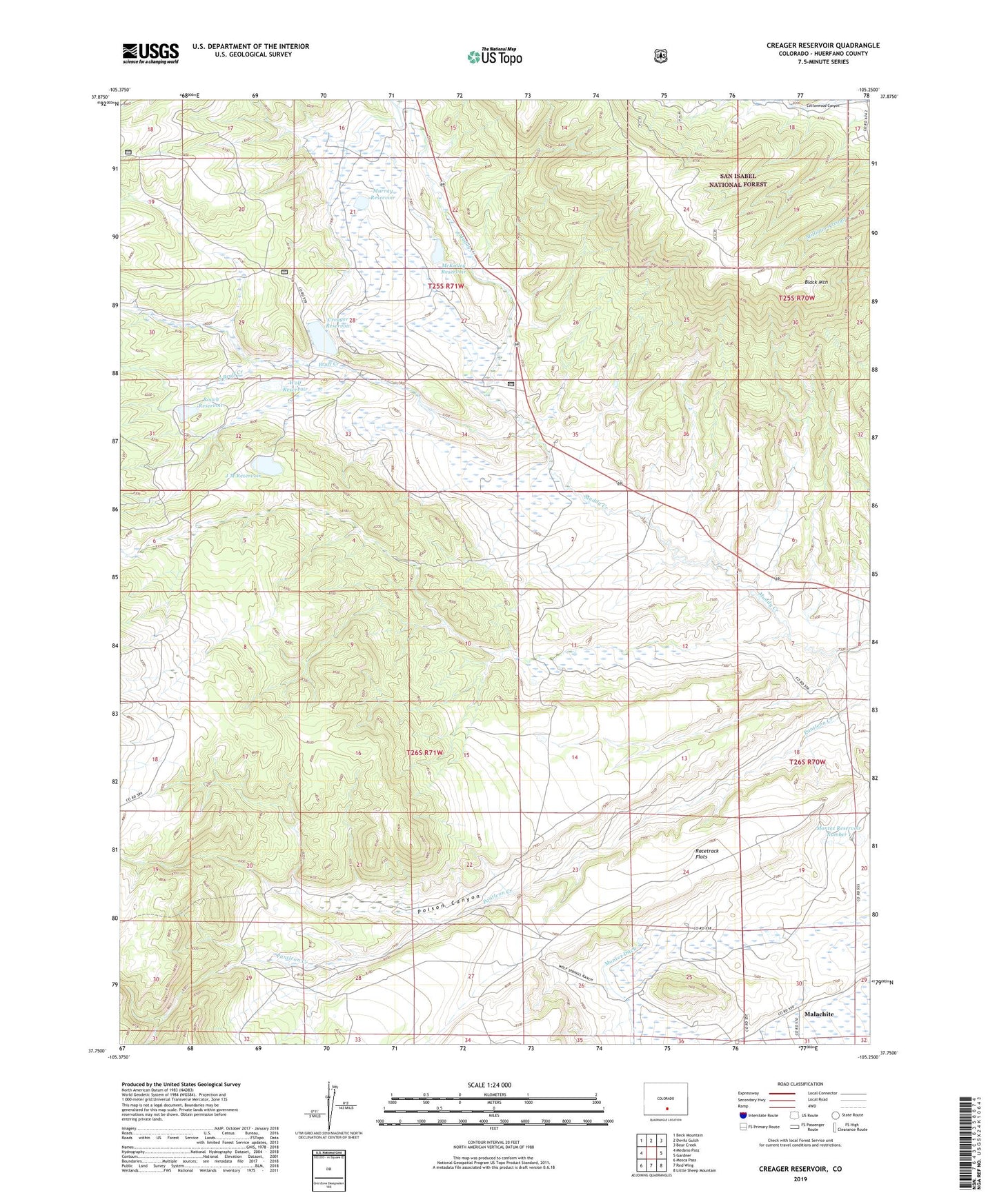
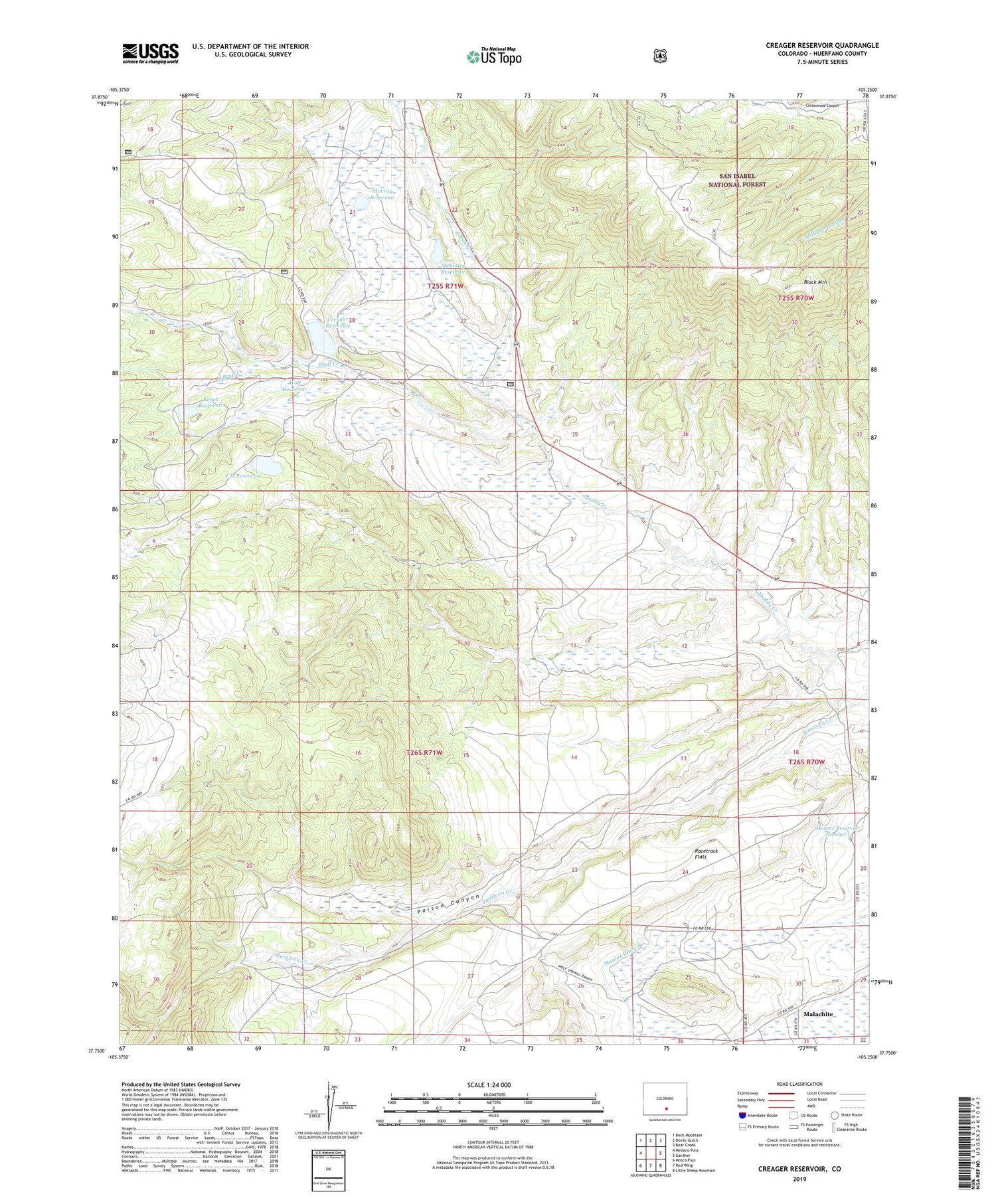
Creager Reservoir Colorado US Topo Map
Couldn't load pickup availability
Also explore the Creager Reservoir Forest Service Topo of this same quad for updated USFS data
2022 topographic map quadrangle Creager Reservoir in the state of Colorado. Scale: 1:24000. Based on the newly updated USGS 7.5' US Topo map series, this map is in the following counties: Huerfano. The map contains contour data, water features, and other items you are used to seeing on USGS maps, but also has updated roads and other features. This is the next generation of topographic maps. Printed on high-quality waterproof paper with UV fade-resistant inks.
Quads adjacent to this one:
West: Medano Pass
Northwest: Beck Mountain
North: Devils Gulch
Northeast: Bear Creek
East: Gardner
Southeast: Little Sheep Mountain
South: Red Wing
Southwest: Mosca Pass
This map covers the same area as the classic USGS quad with code o37105g3.
Contains the following named places: Beeman Dam, Black Mountain, Bruff Creek, Creager Dam, Creager Reservoir, Glade Ditch, J M Dam, J M Reservoir, Malachite, McKinley Reservoir, Meadow Ditch, Montez Number 1 Dam, Montez Number 5 Dam, Montez Number 5 Reservoir, Montez Reservoir Number 1, Murray Reservoir, Poison Canyon, Racetrack Flats, Roach Reservoir, Roache Dam, South Bruff Creek, Wolf Reservoir