MyTopo
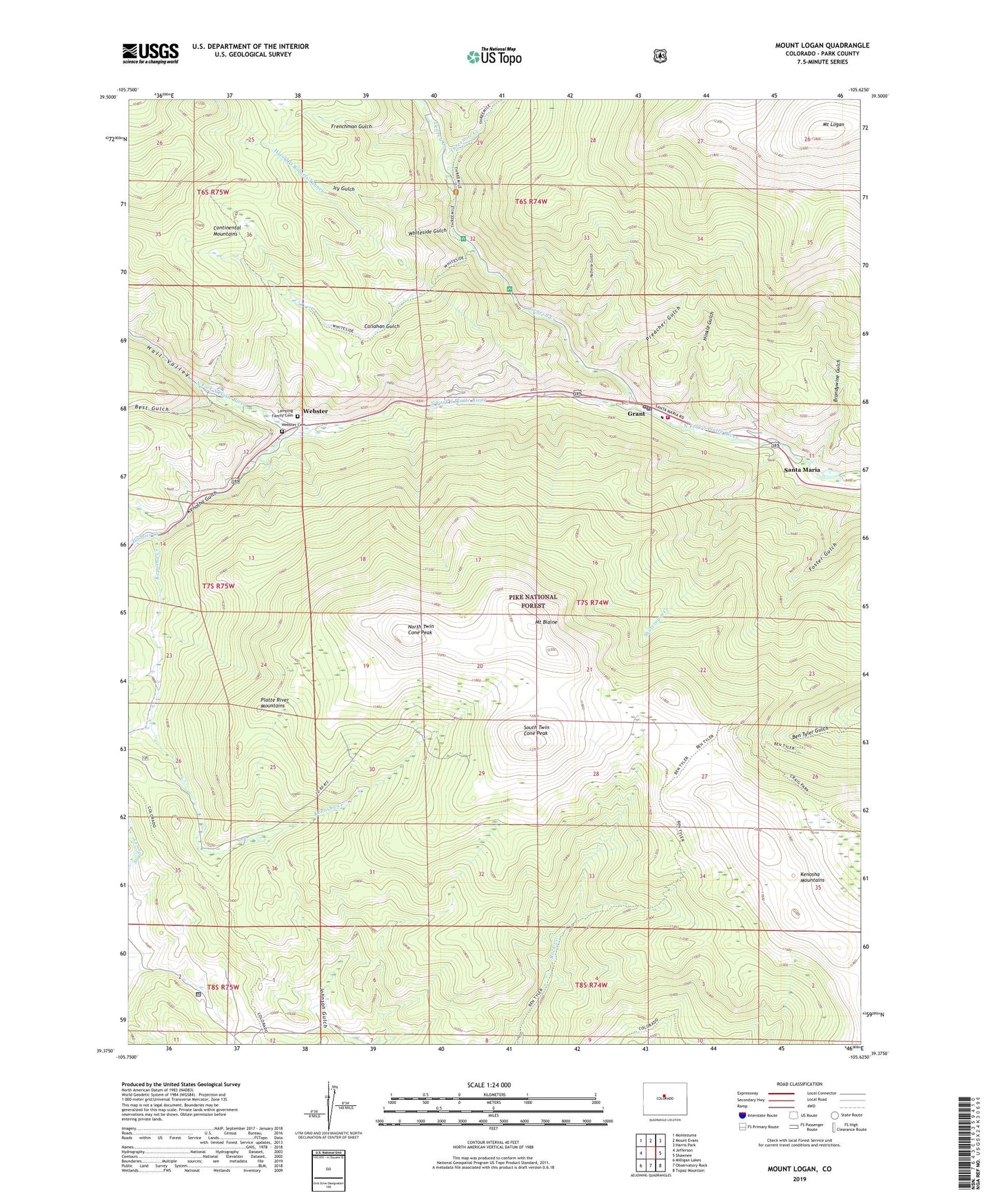
Mount Logan Colorado US Topo Map
Couldn't load pickup availability
Also explore the Mount Logan Forest Service Topo of this same quad for updated USFS data
2022 topographic map quadrangle Mount Logan in the state of Colorado. Scale: 1:24000. Based on the newly updated USGS 7.5' US Topo map series, this map is in the following counties: Park. The map contains contour data, water features, and other items you are used to seeing on USGS maps, but also has updated roads and other features. This is the next generation of topographic maps. Printed on high-quality waterproof paper with UV fade-resistant inks.
Quads adjacent to this one:
West: Jefferson
Northwest: Montezuma
North: Mount Evans
Northeast: Harris Park
East: Shawnee
Southeast: Topaz Mountain
South: Observatory Rock
Southwest: Milligan Lakes
This map covers the same area as the classic USGS quad with code o39105d6.
Contains the following named places: Best Gulch, Brandywine Gulch, Callahan Gulch, Frenchman Gulch, Geneva Creek, Grant, Grant Village Post Office, Guernsey Mine, Halfmile Gulch, Hall Valley, Hall Valley Ditch, Hinkle Gulch, Hoosier Creek, Icy Gulch, Kenosha Creek, Kenosha Ditch, Kenosha Gulch, Lamping Family Cemetery, Mount Blaine, Mount Logan, North Twin Cone Peak, Olava Post Office, Platte Canyon Fire Protection District Station 3, Preacher Gulch, Santa Maria, Shutetown Creek, South Twin Cone Peak, Threemile Creek, Webster, Webster Cemetery, Whiteside Gulch, ZIP Code: 80448