MyTopo
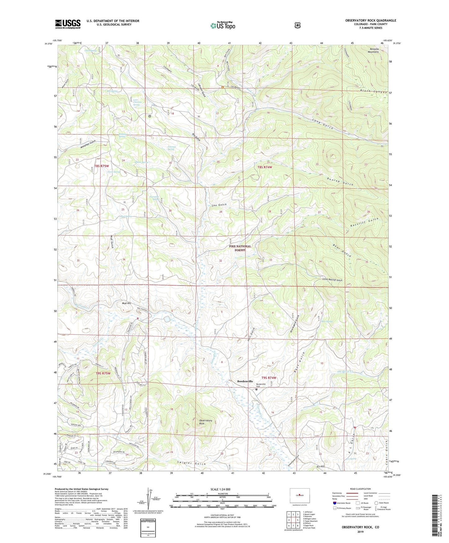
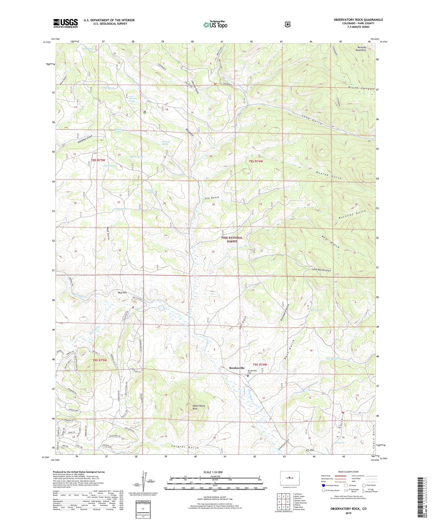
Observatory Rock Colorado US Topo Map
Couldn't load pickup availability
Also explore the Observatory Rock Forest Service Topo of this same quad for updated USFS data
2022 topographic map quadrangle Observatory Rock in the state of Colorado. Scale: 1:24000. Based on the newly updated USGS 7.5' US Topo map series, this map is in the following counties: Park. The map contains contour data, water features, and other items you are used to seeing on USGS maps, but also has updated roads and other features. This is the next generation of topographic maps. Printed on high-quality waterproof paper with UV fade-resistant inks.
Quads adjacent to this one:
West: Milligan Lakes
Northwest: Jefferson
North: Mount Logan
Northeast: Shawnee
East: Topaz Mountain
Southeast: Farnum Peak
South: Eagle Rock
Southwest: Elkhorn
This map covers the same area as the classic USGS quad with code o39105c6.
Contains the following named places: A L Spring, Bear Gulch, Bed Spring, Black Canyon, Bordenville, Bordenville Cemetery, Clark Spring, Coleman Ranch, Coleman Spring, Dixon Spring, Dry Gulch, Dunlap Gulch, Graveyard Gulch, Hall Gulch, Highfill Ranch, Ingram Ranch, Jefferson - Como Fire Protection District Station 3 Stagestop, Jefferson - Como Fire Protection District Station 6, Johnson Gulch, Johnston Ranch, Lee Gulch, Little Ratcliff Gulch, Lone Chimney Spring, Long Gulch, Michigan Creek, Miller Ranch, Mud Gulch, Mud Hill, Mud Spring, Observatory Rock, Old House Creek, Porcupine Spring, Ratcliff Gulch, Rees Gulch, Rees Spring, Robbins Spring, Rock Creek, Rock Creek Cow Camp, Schoolhouse Gulch, Swigler Gulch, Willow Spring