MyTopo
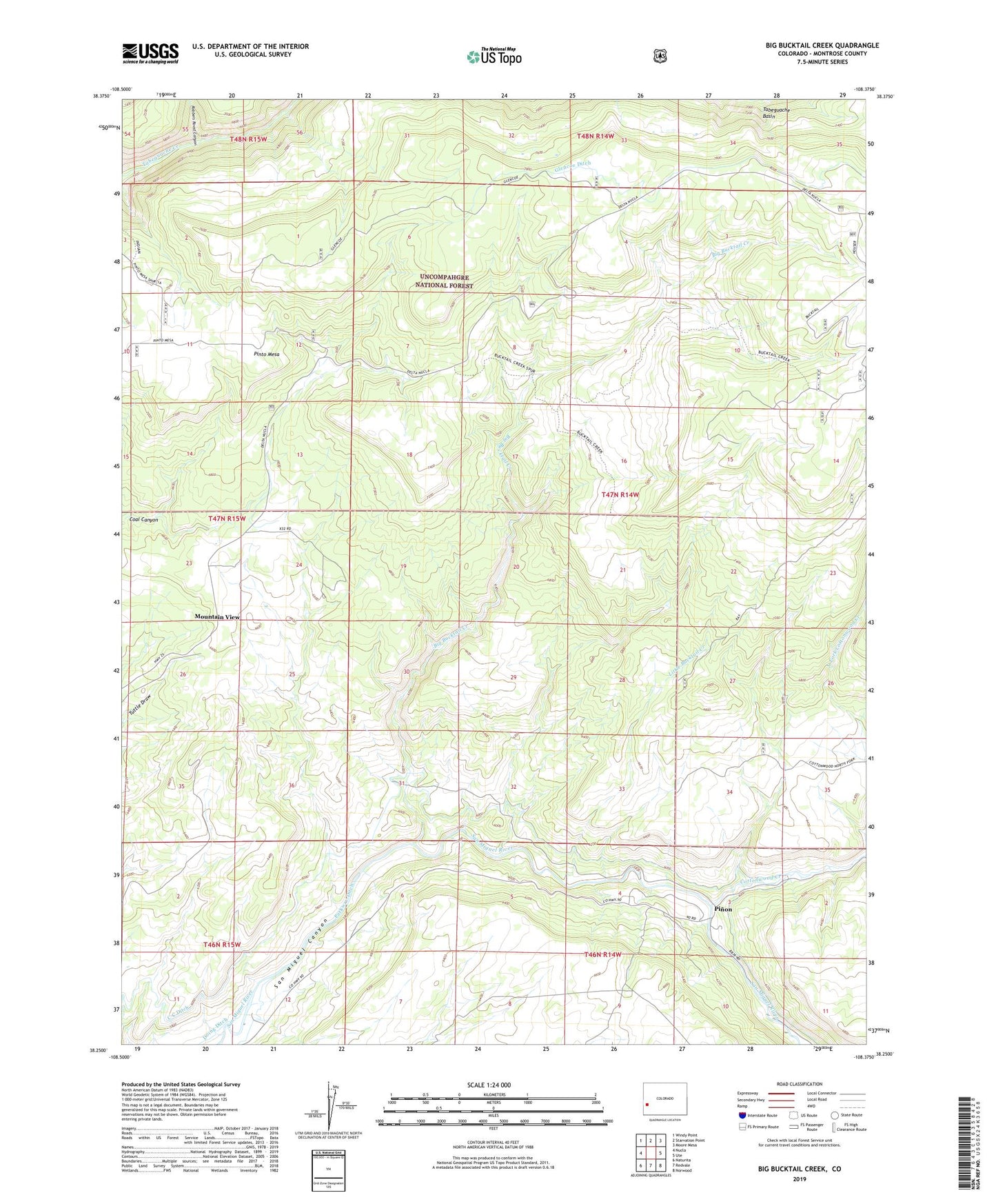
Big Bucktail Creek Colorado US Topo Map
Couldn't load pickup availability
Also explore the Big Bucktail Creek Forest Service Topo of this same quad for updated USFS data
2022 topographic map quadrangle Big Bucktail Creek in the state of Colorado. Scale: 1:24000. Based on the newly updated USGS 7.5' US Topo map series, this map is in the following counties: Montrose. The map contains contour data, water features, and other items you are used to seeing on USGS maps, but also has updated roads and other features. This is the next generation of topographic maps. Printed on high-quality waterproof paper with UV fade-resistant inks.
Quads adjacent to this one:
West: Nucla
Northwest: Windy Point
North: Starvation Point
Northeast: Moore Mesa
East: Ute
Southeast: Norwood
South: Redvale
Southwest: Naturita
This map covers the same area as the classic USGS quad with code o38108c4.
Contains the following named places: Big Bucktail Creek, Cottonwood Creek, Goulding Mine, Hobbs Mine, Little Bucktail Creek, Mountain View, North Fork Cottonwood Creek, Pinon, Pinto Mesa, Ray Trail, Robbers Roost Canyon, San Miguel Canyon, ZIP Code: 81424