MyTopo
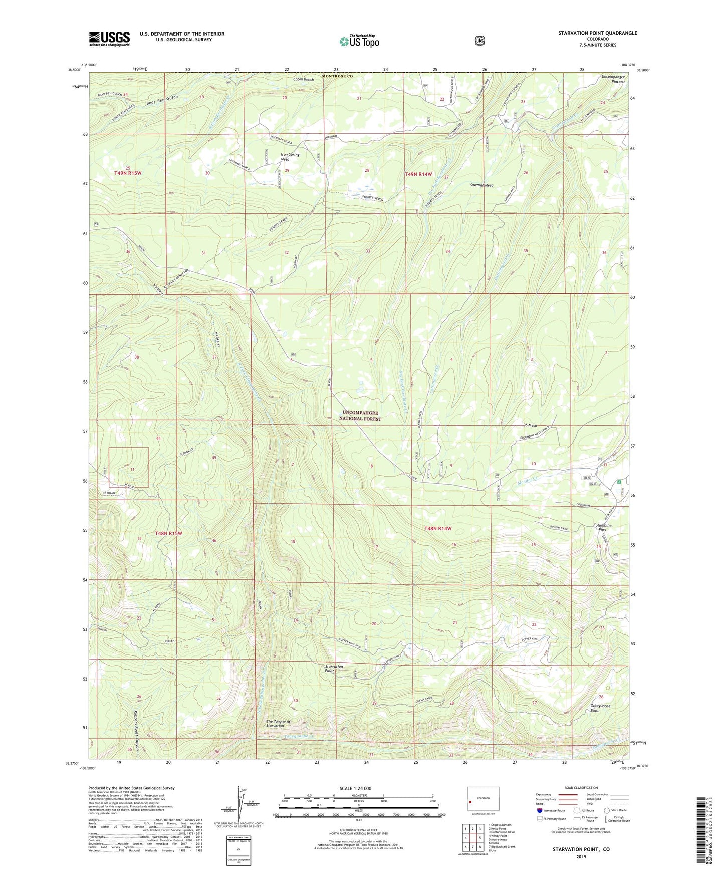
Starvation Point Colorado US Topo Map
Couldn't load pickup availability
Also explore the Starvation Point Forest Service Topo of this same quad for updated USFS data
2022 topographic map quadrangle Starvation Point in the state of Colorado. Scale: 1:24000. Based on the newly updated USGS 7.5' US Topo map series, this map is in the following counties: Montrose, Mesa. The map contains contour data, water features, and other items you are used to seeing on USGS maps, but also has updated roads and other features. This is the next generation of topographic maps. Printed on high-quality waterproof paper with UV fade-resistant inks.
Quads adjacent to this one:
West: Windy Point
Northwest: Snipe Mountain
North: Kelso Point
Northeast: Cottonwood Basin
East: Moore Mesa
Southeast: Ute
South: Big Bucktail Creek
Southwest: Nucla
This map covers the same area as the classic USGS quad with code o38108d4.
Contains the following named places: Bear Pen Gulch, Columbine Campground, Columbine Guard Station, Columbine Pass, Copper King Mine, Davis Cow Camp, Devils Cow Camp, Dillard Cow Camp, Fortyseven Cow Camp, Grassy Lake Trail, Iron Spring Mesa, Lockhart Cow Camp, North Fork Tabeguache Creek, RP Cow Camp, Sawmill Mesa, Smokehouse Campground, Starvation Point, Tabeguache Basin, The Tongue of Starvation, Twentyfive Mesa