MyTopo
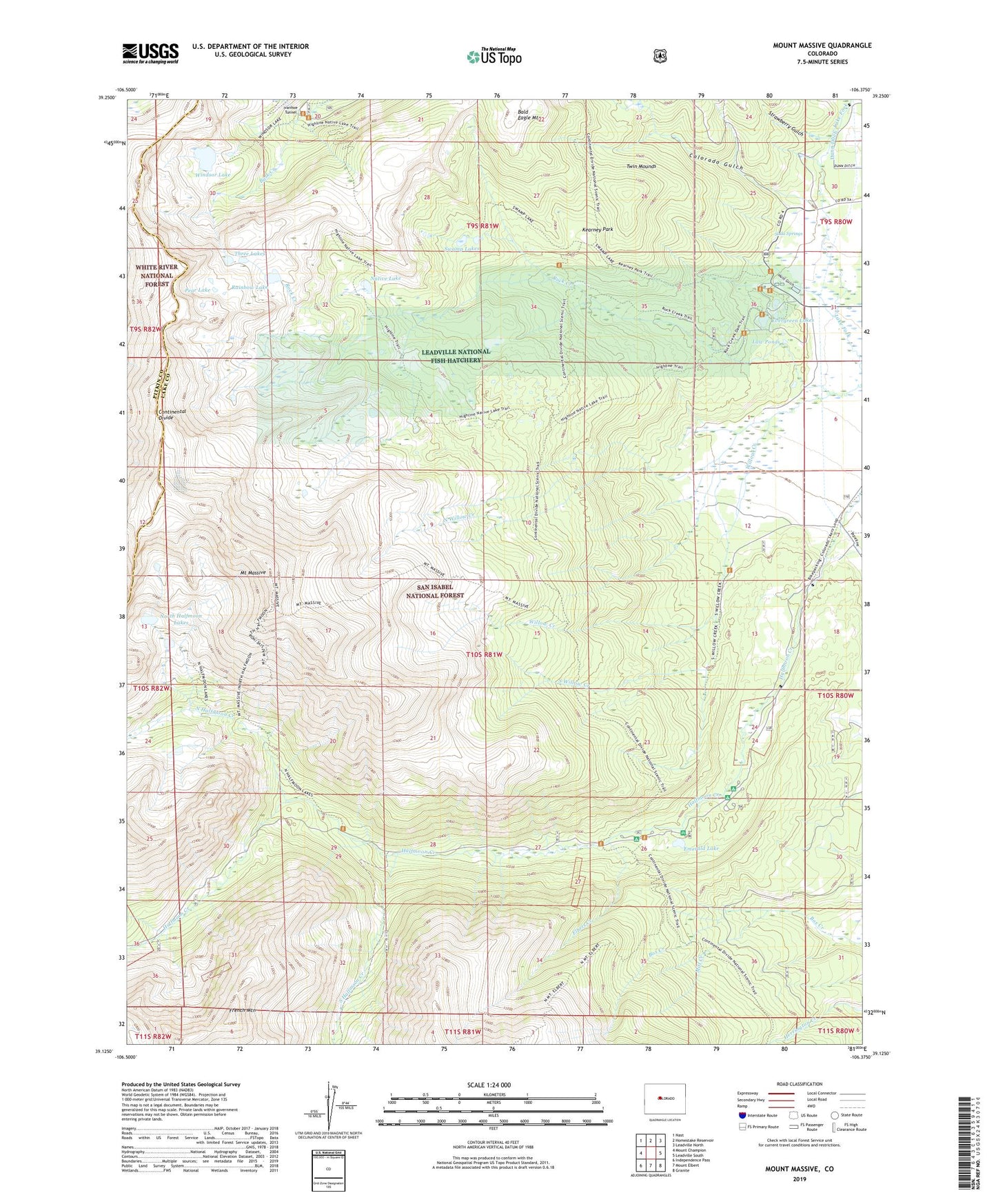
Mount Massive Colorado US Topo Map
Couldn't load pickup availability
Also explore the Mount Massive Forest Service Topo of this same quad for updated USFS data
2022 topographic map quadrangle Mount Massive in the state of Colorado. Scale: 1:24000. Based on the newly updated USGS 7.5' US Topo map series, this map is in the following counties: Lake, Pitkin. The map contains contour data, water features, and other items you are used to seeing on USGS maps, but also has updated roads and other features. This is the next generation of topographic maps. Printed on high-quality waterproof paper with UV fade-resistant inks.
Quads adjacent to this one:
West: Mount Champion
Northwest: Nast
North: Homestake Reservoir
Northeast: Leadville North
East: Leadville South
Southeast: Granite
South: Mount Elbert
Southwest: Independence Pass
This map covers the same area as the classic USGS quad with code o39106b4.
Contains the following named places: Colorado Gulch, Dunn Ditch, Elbert Creek, Elbert Creek Campground, Emerald Lake, Evergreen Lakes, French Mountain, Gannett Peak, Halfmoon Campground, Hidden Lakes, Highline Trail, Hunt Gulch, Kearney Park, Law Ponds, Leadville National Fish Hatchery, Little Keystone Shaft Mine, Little Major Mine, Mexican Mine, Mill Creek, Mount Massive, Mount Massive Placer Mine, Mount Massive Trail, Mount Massive Wilderness, Native Lake, North Halfmoon Creek, North Halfmoon Lakes, North Willow Creek, Notch Lake, Pear Lake, Rainbow Lake, Rock Creek, Siwatch Tunnel, Soda Springs, South Halfmoon Creek, South Willow Creek, Strawberry Gulch, Sugarloaf Gulch, Swamp Lakes, Three Lakes, Twin Mounds, Venture Mine, Venture Shaft, Windsor Lake