MyTopo
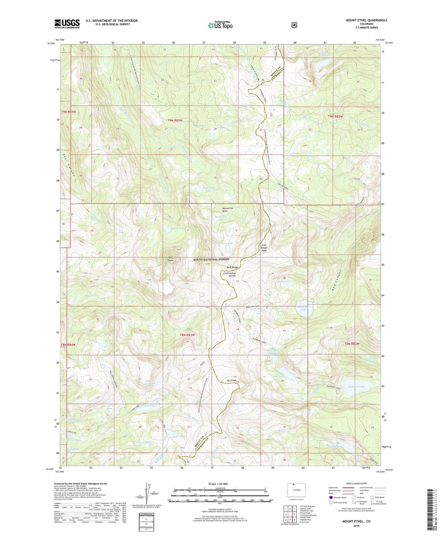
Mount Ethel Colorado US Topo Map
Couldn't load pickup availability
Also explore the Mount Ethel Forest Service Topo of this same quad for updated USFS data
2022 topographic map quadrangle Mount Ethel in the state of Colorado. Scale: 1:24000. Based on the newly updated USGS 7.5' US Topo map series, this map is in the following counties: Routt, Jackson. The map contains contour data, water features, and other items you are used to seeing on USGS maps, but also has updated roads and other features. This is the next generation of topographic maps. Printed on high-quality waterproof paper with UV fade-resistant inks.
Quads adjacent to this one:
West: Floyd Peak
Northwest: Farwell Mountain
North: Mount Zirkel
Northeast: Boettcher Lake
East: Pitchpine Mountain
Southeast: Teal Lake
South: Buffalo Pass
Southwest: Rocky Peak
This map covers the same area as the classic USGS quad with code o40106f6.
Contains the following named places: Agua Fria Lake, Aqua Fria Dam, Aqua Fria Reservoir, Big Creek Lake, Big Creek Lake Trail, Crags Trail, Dome Lake, Lake Elbert, Lake Katherine, Lake of the Crags, Lost Ranger Peak, Lost Ranger Trail, Luna Lake, Mirror Lake, Mount Ethel, North Lake, North Lake Trail, Park Range, Pristine Lake, Ptarmigan Lake, Rainbow Lake, Rainbow Lake Trail, Rosa Lake, Roxy Ann Lake, Slide Lake, Spike Lake, The Dome, Upper Slide Lake, Wolverine Basin, Wolverine Creek, Wolverine Lake, Wyoming Trail