MyTopo
Pitchpine Mountain Colorado US Topo Map
Couldn't load pickup availability
Also explore the Pitchpine Mountain Forest Service Topo of this same quad for updated USFS data
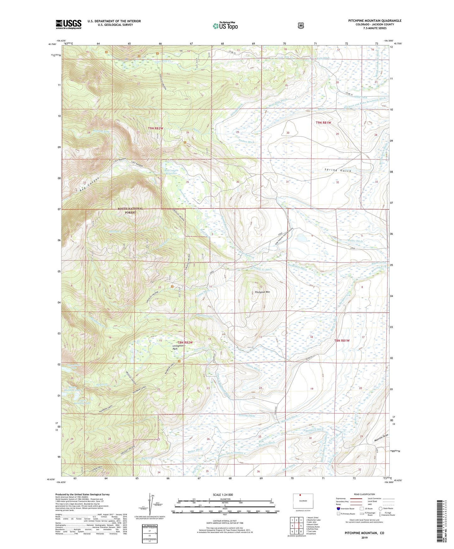
2022 topographic map quadrangle Pitchpine Mountain in the state of Colorado. Scale: 1:24000. Based on the newly updated USGS 7.5' US Topo map series, this map is in the following counties: Jackson. The map contains contour data, water features, and other items you are used to seeing on USGS maps, but also has updated roads and other features. This is the next generation of topographic maps. Printed on high-quality waterproof paper with UV fade-resistant inks.
Quads adjacent to this one:
West: Mount Ethel
Northwest: Mount Zirkel
North: Boettcher Lake
Northeast: Lake John
East: Delaney Butte
Southeast: Coalmont
South: Teal Lake
Southwest: Buffalo Pass
This map covers the same area as the classic USGS quad with code o40106f5.
Contains the following named places: Aspin Ditch, Beaver Ditch, Brands Ranch, Briggs and Bohn Ditch, Butler Creek, Butler Ditch, Butler Ditch Number 2, Butler Ditch Number 3, Butler Ditch Number 4, Butte Creek, Canon Ditch, Carlstrom Brothers Ranch, Ceanothuse Lake, Crystal Mine, Dora Ditch, Earnest Ditch, Emigh Ranch, Erika Ditch, Eriki Ditch, Heineman Ditch, Higho Ditch, Hillside Ditch, Hodgson Ditch, Irvine Ranch, Japanese Davidson Ditch, Joe Mine, Lillie Ditch, Livingston Park, Lone Pine Ditch, Lower Rainbow Lake, Manville Ditch Number 2, Middle Rainbow Lake, Mitchell Ditch, Norrell Ditch, Norris Creek, Norris Ditch, Norris Ranch, Open A Diamond Ditch, Pearl Ditch, Pedad Mine, Pitchpine Mountain, Raspberry Creek, Red Canyon, Red Canyon Reservoir, Roaring Ditch, South Fork Beaver Creek, Spar Mine, Spring Creek, Spring Gulch Ditch, Sunday Creek, Sunday Creek Ditch, Timber Ditch, Wolfer Ditch