MyTopo
Buffalo Pass Colorado US Topo Map
Couldn't load pickup availability
Also explore the Buffalo Pass Forest Service Topo of this same quad for updated USFS data
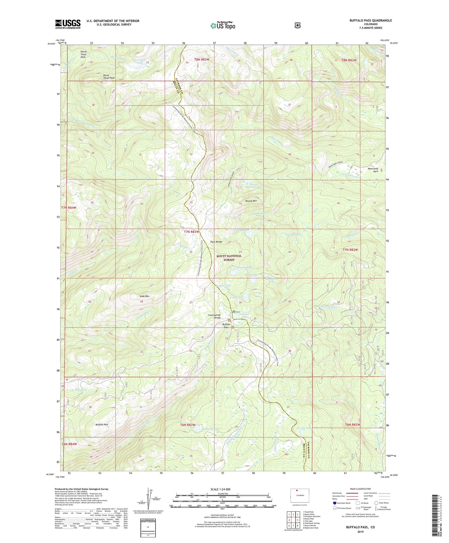
2022 topographic map quadrangle Buffalo Pass in the state of Colorado. Scale: 1:24000. Based on the newly updated USGS 7.5' US Topo map series, this map is in the following counties: Jackson, Routt. The map contains contour data, water features, and other items you are used to seeing on USGS maps, but also has updated roads and other features. This is the next generation of topographic maps. Printed on high-quality waterproof paper with UV fade-resistant inks.
Quads adjacent to this one:
West: Rocky Peak
Northwest: Floyd Peak
North: Mount Ethel
Northeast: Pitchpine Mountain
East: Teal Lake
Southeast: Rabbit Ears Peak
South: Mount Werner
Southwest: Steamboat Springs
This map covers the same area as the classic USGS quad with code o40106e6.
Contains the following named places: Buffalo Mountain, Buffalo Pass, George Lake, Grizzly Lake, Horse Thief Park, Horse Thief Peak, Jonah Lake, Lake Albert, Lake Dinosaur, Martha Lake, Newcomb Creek Trail, Newcomb Park, Porcupine Creek, Porcupine Lake, Round Mountain, Round Mountain Lake, Shoestring Lake, Soda Mountain, Summit Lake, Summit Lake Campground, Summit Lake Guard Station, Victoria Lake, Whale Lake