MyTopo
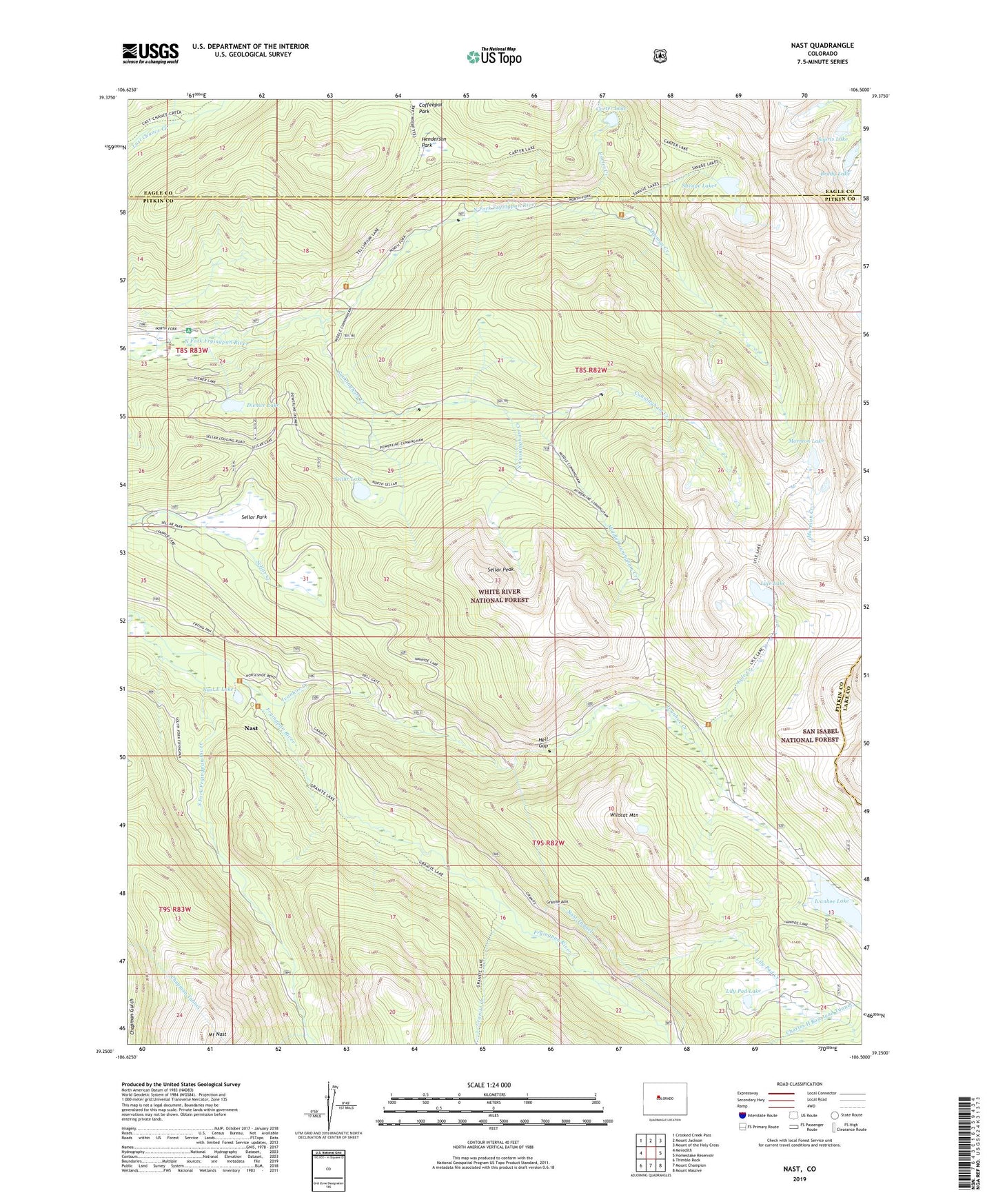
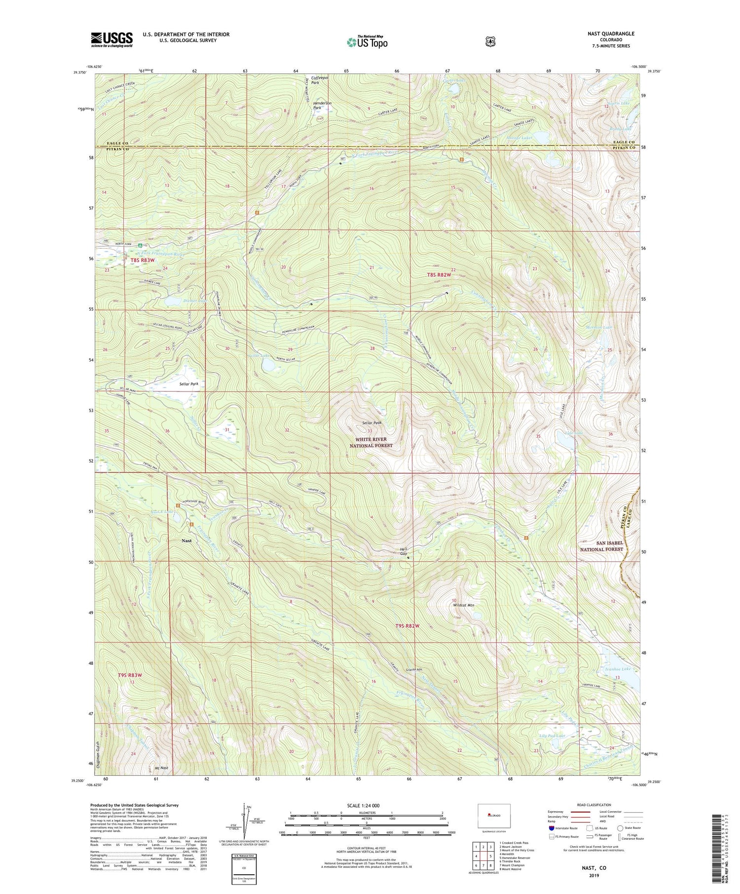
Nast Colorado US Topo Map
Couldn't load pickup availability
Also explore the Nast Forest Service Topo of this same quad for updated USFS data
2022 topographic map quadrangle Nast in the state of Colorado. Scale: 1:24000. Based on the newly updated USGS 7.5' US Topo map series, this map is in the following counties: Pitkin, Eagle, Lake. The map contains contour data, water features, and other items you are used to seeing on USGS maps, but also has updated roads and other features. This is the next generation of topographic maps. Printed on high-quality waterproof paper with UV fade-resistant inks.
Quads adjacent to this one:
West: Meredith
Northwest: Crooked Creek Pass
North: Mount Jackson
Northeast: Mount of the Holy Cross
East: Homestake Reservoir
Southeast: Mount Massive
South: Mount Champion
Southwest: Thimble Rock
This map covers the same area as the classic USGS quad with code o39106c5.
Contains the following named places: Brady Lake, Carter and Moran Tunnels Mine, Carter Creek, Carter Lake, Chapman Tunnel, Coffeepot Park, Cunningham Creek, Cunningham Tunnel Mine, Diemer Lake, Elk Wallow Campground, Fryingpan-Arkansaw North Side Collection System, Granite Adit, Granite Creek, Hell Gap, Henderson Park, Horseshoe Bend Ranch, Ivanhoe Creek, Ivanhoe Dam, Ivanhoe Lake, Last Chance Trail, Lily Pad Creek, Lily Pad Lake, Lyle Creek, Lyle Lake, Middle Cunningham Creek, Mormon Creek, Mormon Lake, Mount Nast, Nast, Nast E Lake, Nast Tunnel, Reed Creek, Savage Lakes, Sellar Lake, Sellar Park, Sellar Peak, Sopris Lake, South Cunningham Creek, South Fork Fryingpan River, Wildcat Mountain