MyTopo
Myers Canyon Colorado US Topo Map
Couldn't load pickup availability
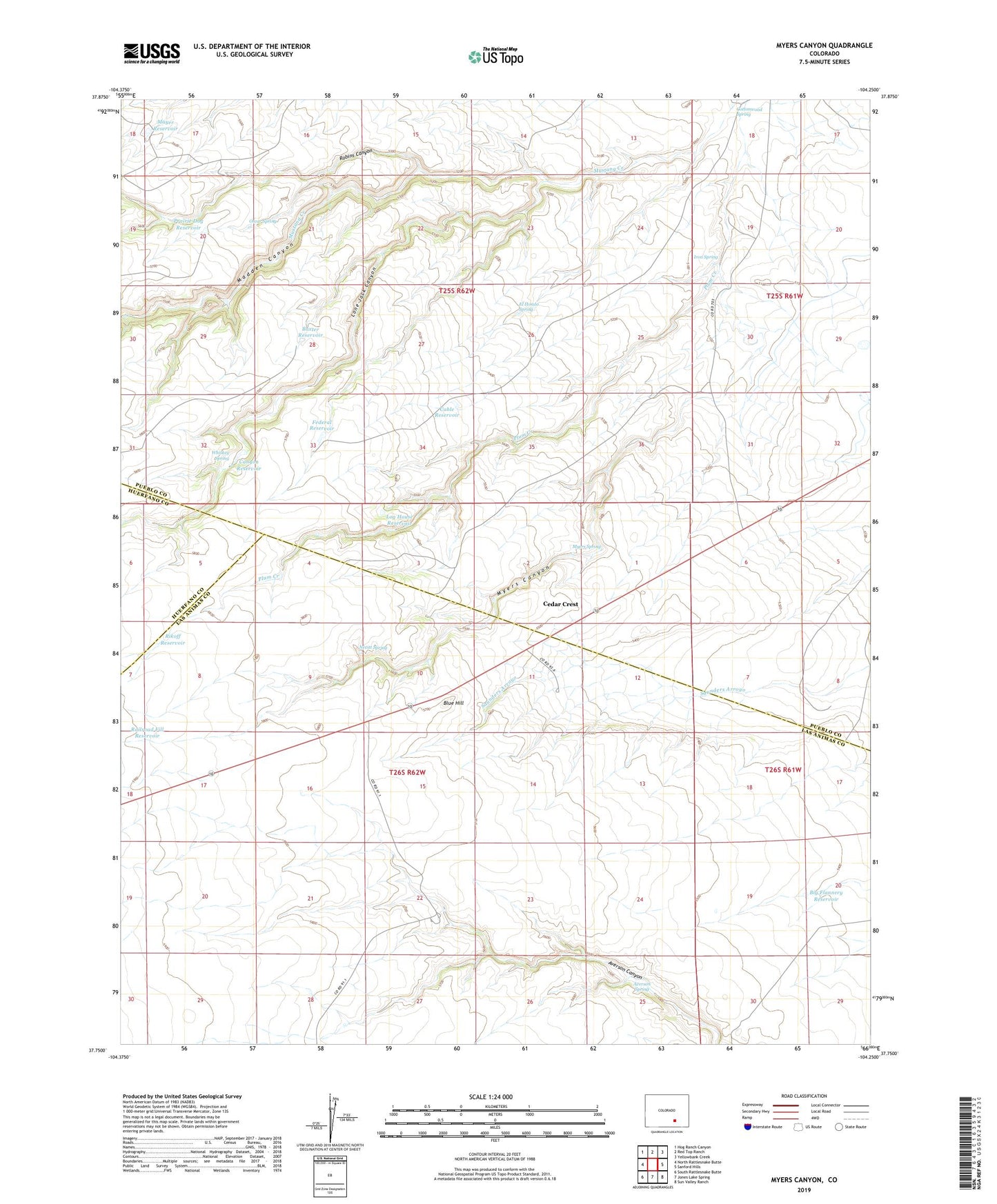
2022 topographic map quadrangle Myers Canyon in the state of Colorado. Scale: 1:24000. Based on the newly updated USGS 7.5' US Topo map series, this map is in the following counties: Pueblo, Las Animas, Huerfano. The map contains contour data, water features, and other items you are used to seeing on USGS maps, but also has updated roads and other features. This is the next generation of topographic maps. Printed on high-quality waterproof paper with UV fade-resistant inks.
Quads adjacent to this one:
West: North Rattlesnake Butte
Northwest: Hog Ranch Canyon
North: Red Top Ranch
Northeast: Yellowbank Creek
East: Sanford Hills
Southeast: Sun Valley Ranch
South: Jones Lake Spring
Southwest: South Rattlesnake Butte
This map covers the same area as the classic USGS quad with code o37104g3.
Contains the following named places: A Bar Ranch, Averson Spring, Baxter Reservoir, Big Flannery Reservoir, Blue Hill, Cable Reservoir, Cactus Flat Windmill, Canyon Reservoir, Cedar Crest, Cottonwood Spring, El Hondo Spring, Federal Reservoir, Flannery Windmill, Iron Spring, Knowlton Ranch, Log House Reservoir, Lone Jack Canyon, Madden Canyon, Mayer Reservoir, Myers Camp, Myers Spring, Nevitt Spring, Oscar Spring, Prairie Dog Reservoir, Railroad Fill Reservoir, Rikoff Reservoir, Robins Canyon, Spurlock Ranch, Whiskey Spring