
MyTopo
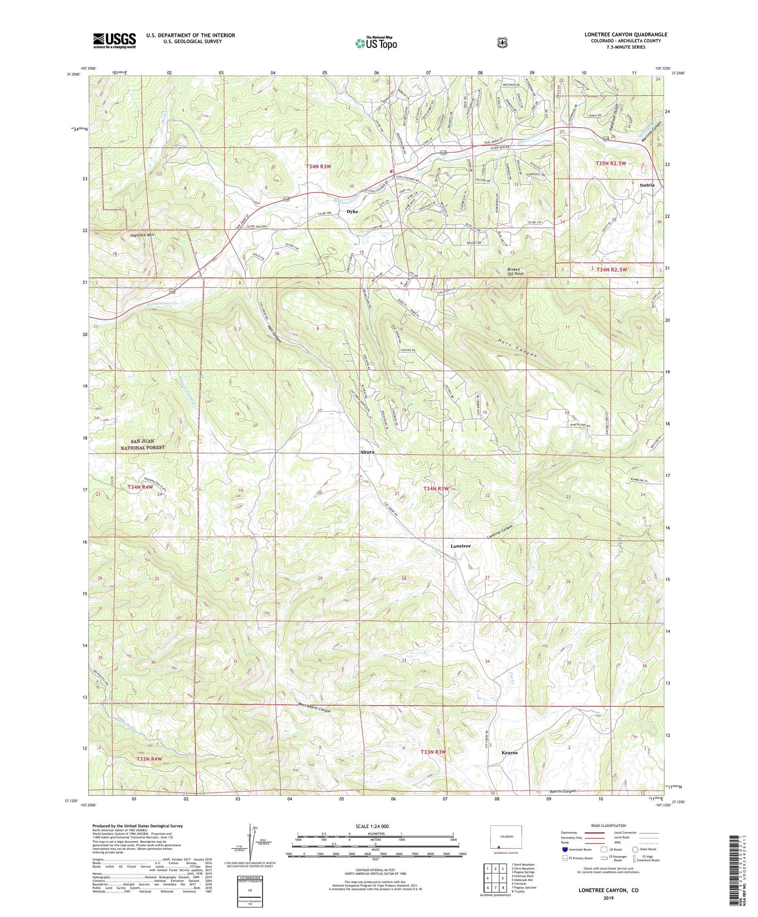
Lonetree Canyon Colorado US Topo Map
Couldn't load pickup availability
Also explore the Lonetree Canyon Forest Service Topo of this same quad for updated USFS data
2022 topographic map quadrangle Lonetree Canyon in the state of Colorado. Scale: 1:24000. Based on the newly updated USGS 7.5' US Topo map series, this map is in the following counties: Archuleta. The map contains contour data, water features, and other items you are used to seeing on USGS maps, but also has updated roads and other features. This is the next generation of topographic maps. Printed on high-quality waterproof paper with UV fade-resistant inks.
Quads adjacent to this one:
West: Chimney Rock
Northwest: Devil Mountain
North: Chris Mountain
Northeast: Pagosa Springs
East: Oakbrush Hill
Southeast: Trujillo
South: Pagosa Junction
Southwest: Carracas
This map covers the same area as the classic USGS quad with code o37107b2.
Contains the following named places: Altura, Broken Off Point, Dyke, Hall Canyon, Haystack Mountain, Hurt Canyon, Kearns, Kearns Canyon, Lonetree, Lonetree Canyon, Martinez Canyon, Martinez Creek, Nutria, Pagosa Fire Protection District Station 5 Aspen Springs, Peterson Gulch, Vega la Juana Creek, West Kearns Canyon


