MyTopo
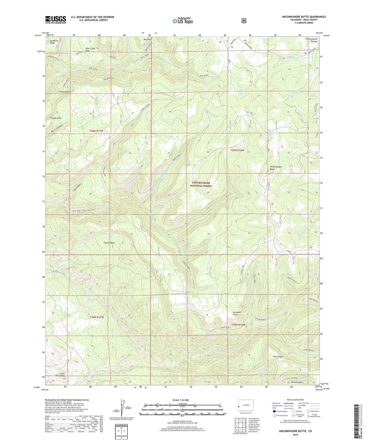
Uncompahgre Butte Colorado US Topo Map
Couldn't load pickup availability
Also explore the Uncompahgre Butte Forest Service Topo of this same quad for updated USFS data
2022 topographic map quadrangle Uncompahgre Butte in the state of Colorado. Scale: 1:24000. Based on the newly updated USGS 7.5' US Topo map series, this map is in the following counties: Mesa. The map contains contour data, water features, and other items you are used to seeing on USGS maps, but also has updated roads and other features. This is the next generation of topographic maps. Printed on high-quality waterproof paper with UV fade-resistant inks.
Quads adjacent to this one:
West: Calamity Mesa
Northwest: Pine Mountain
North: Casto Reservoir
Northeast: Keith Creek
East: Snipe Mountain
Southeast: Windy Point
South: Atkinson Creek
Southwest: Red Canyon
This map covers the same area as the classic USGS quad with code o38108e6.
Contains the following named places: Barklay Creek, Beaver Dam Branch North Fork Mesa Creek, Beaver Dam Trail, Blue Creek Park, Blue Creek Trail, Bunch Ground Branch Blue Creek, California Spring, Campbell Lake, Campbell Point, Coal Creek, Colcord Camp, Coyote Basin, Deep Canyon, Franks Bench, Franks Bench Trail, Garvey Branch, Johnson Basin, Little Round Mountain, Long Canyon, Lower Bench Trail, Mailbox Branch Blue Creek, Mailbox Trail, Massey Branch, Triangle Mesa, Truck Stop Placer, U C Creek, Uncompahgre Butte, Upper Bench Trail, Willow Creek