MyTopo
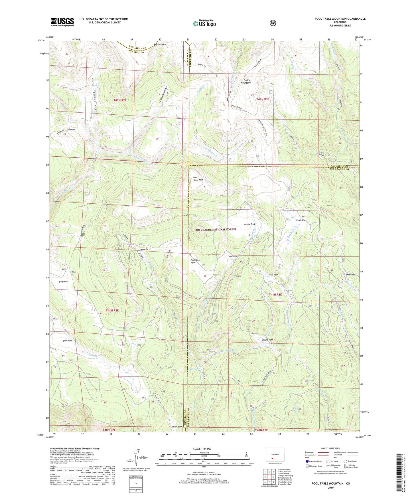
Pool Table Mountain Colorado US Topo Map
Couldn't load pickup availability
Also explore the Pool Table Mountain Forest Service Topo of this same quad for updated USFS data
2022 topographic map quadrangle Pool Table Mountain in the state of Colorado. Scale: 1:24000. Based on the newly updated USGS 7.5' US Topo map series, this map is in the following counties: Mineral, Rio Grande, Saguache. The map contains contour data, water features, and other items you are used to seeing on USGS maps, but also has updated roads and other features. This is the next generation of topographic maps. Printed on high-quality waterproof paper with UV fade-resistant inks.
Quads adjacent to this one:
West: Wagon Wheel Gap
Northwest: Halfmoon Pass
North: Mesa Mountain
Northeast: Bowers Peak
East: Pine Cone Knob
Southeast: South Fork East
South: South Fork West
Southwest: Lake Humphreys
This map covers the same area as the classic USGS quad with code o37106g6.
Contains the following named places: Alder Stock Driveway, Blue Park, Canon Fernandez, Canon Nieve, Corral Park, Deer Park, Difficult Creek, Divide Park, Dyers Park, East Fork Alder Creek, Fish Park, Fremonts Camp, Hansons Mill, Long Gulch, Long Park, Middle Park, Pool Table Mountain, Pool Table Park, Raven Park, Rincon Creek, Round Park, Trujillo Creek, Viers Creek, Viers Park