
MyTopo
Mesa Mountain Colorado US Topo Map
Couldn't load pickup availability
Also explore the Mesa Mountain Forest Service Topo of this same quad for updated USFS data
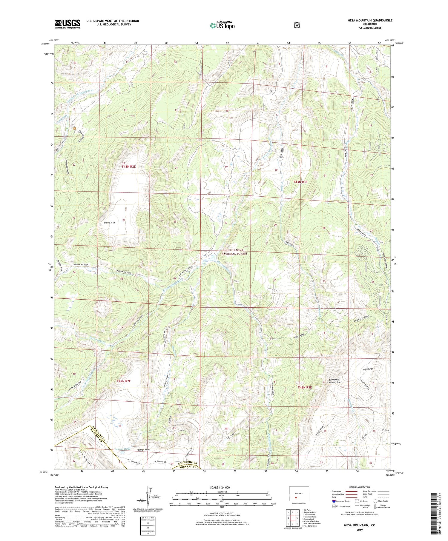
2022 topographic map quadrangle Mesa Mountain in the state of Colorado. Scale: 1:24000. Based on the newly updated USGS 7.5' US Topo map series, this map is in the following counties: Saguache, Mineral. The map contains contour data, water features, and other items you are used to seeing on USGS maps, but also has updated roads and other features. This is the next generation of topographic maps. Printed on high-quality waterproof paper with UV fade-resistant inks.
Quads adjacent to this one:
West: Halfmoon Pass
Northwest: Elk Park
North: Saguache Park
Northeast: Grouse Creek
East: Bowers Peak
Southeast: Pine Cone Knob
South: Pool Table Mountain
Southwest: Wagon Wheel Gap
This map covers the same area as the classic USGS quad with code o37106h6.
Contains the following named places: Bear Creek, Deep Creek, Laguna Hilda, Lake Fork, Lake Fork Saguache Creek, Mesa Mountain, Palmer Mesa, Sheep Mountain, Sky City Mine, Twin Peaks Creek, Wannamaker Creek, Whale Creek


