MyTopo
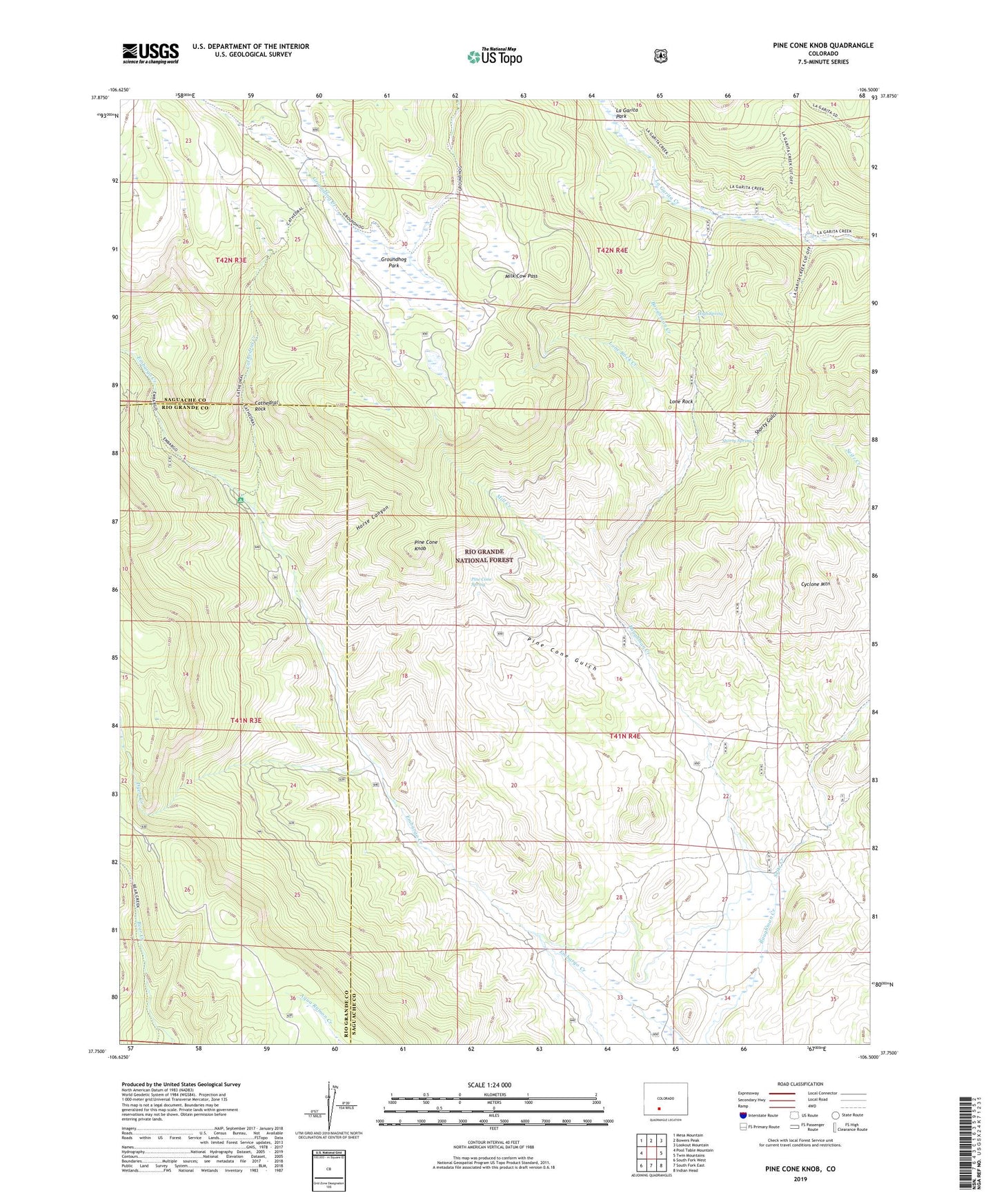
Pine Cone Knob Colorado US Topo Map
Couldn't load pickup availability
Also explore the Pine Cone Knob Forest Service Topo of this same quad for updated USFS data
2022 topographic map quadrangle Pine Cone Knob in the state of Colorado. Scale: 1:24000. Based on the newly updated USGS 7.5' US Topo map series, this map is in the following counties: Saguache, Rio Grande. The map contains contour data, water features, and other items you are used to seeing on USGS maps, but also has updated roads and other features. This is the next generation of topographic maps. Printed on high-quality waterproof paper with UV fade-resistant inks.
Quads adjacent to this one:
West: Pool Table Mountain
Northwest: Mesa Mountain
North: Bowers Peak
Northeast: Lookout Mountain
East: Twin Mountains
Southeast: Indian Head
South: South Fork East
Southwest: South Fork West
This map covers the same area as the classic USGS quad with code o37106g5.
Contains the following named places: Cathedral Campground, Cathedral Creek, Cathedral Rock, Cyclone Mountain, Dyers Creek, Embargo, Groundhog Park, High Spring, Horse Canyon, La Garita Cow Camp, Lone Rock, Lone Rock Creek, Milk Cow Pass, Mill Creek, Pine Cone Gulch, Pine Cone Knob, Pine Cone Spring, Seitz Creek, Shorty Gulch, Shorty Spring