MyTopo
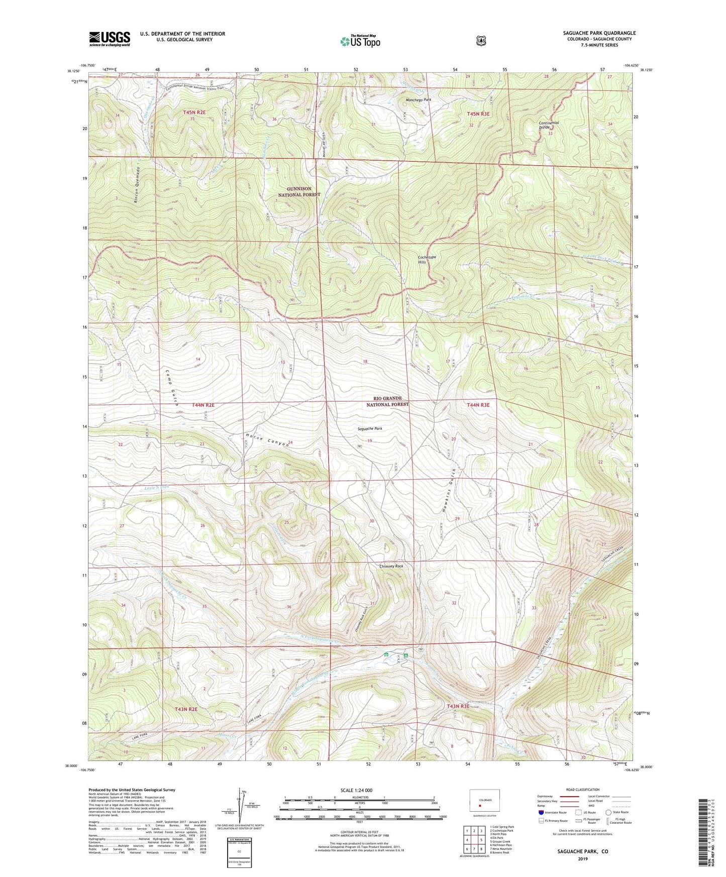
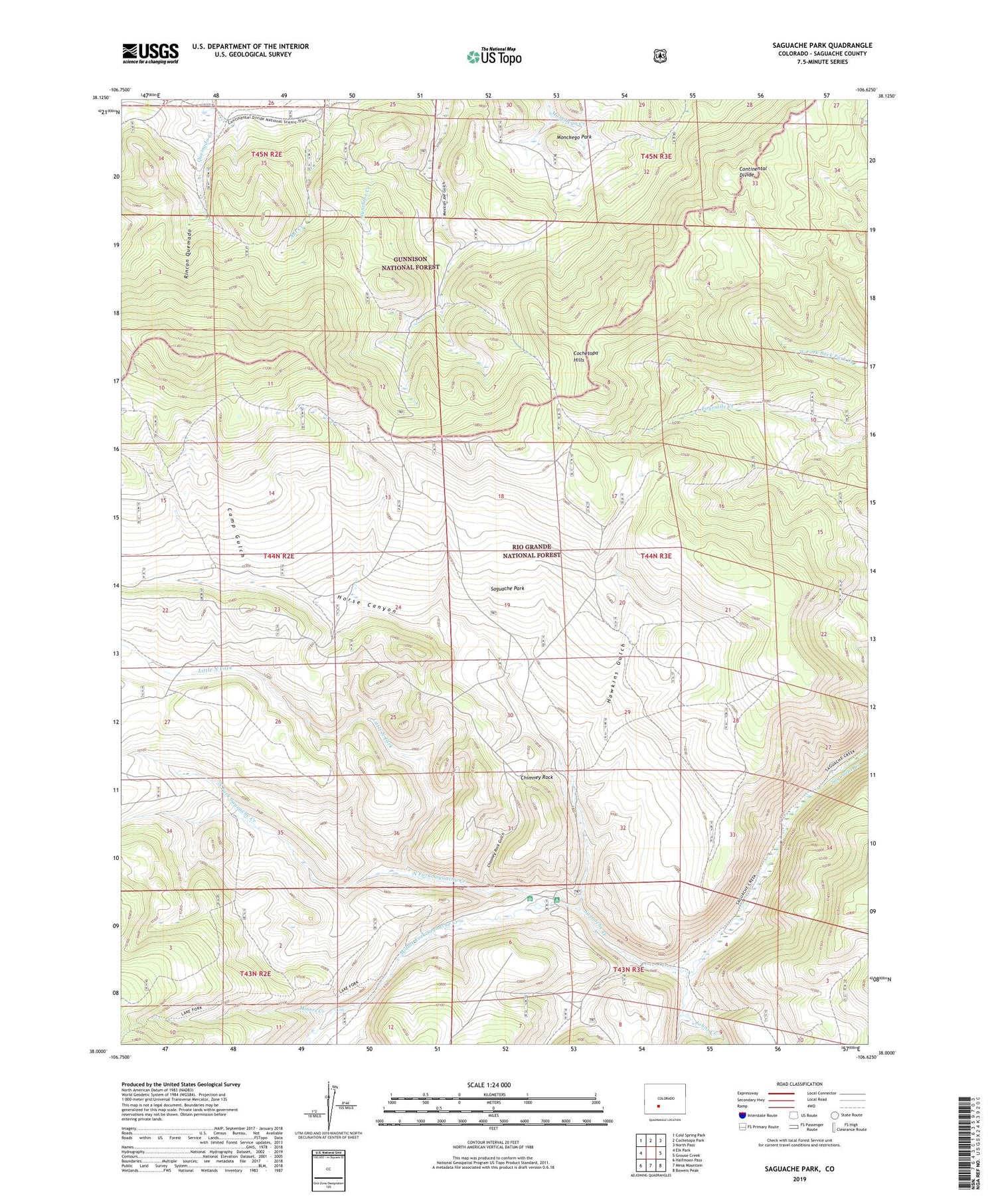
Saguache Park Colorado US Topo Map
Couldn't load pickup availability
Also explore the Saguache Park Forest Service Topo of this same quad for updated USFS data
2022 topographic map quadrangle Saguache Park in the state of Colorado. Scale: 1:24000. Based on the newly updated USGS 7.5' US Topo map series, this map is in the following counties: Saguache. The map contains contour data, water features, and other items you are used to seeing on USGS maps, but also has updated roads and other features. This is the next generation of topographic maps. Printed on high-quality waterproof paper with UV fade-resistant inks.
Quads adjacent to this one:
West: Elk Park
Northwest: Cold Spring Park
North: Cochetopa Park
Northeast: North Pass
East: Grouse Creek
Southeast: Bowers Peak
South: Mesa Mountain
Southwest: Halfmoon Pass
This map covers the same area as the classic USGS quad with code o38106a6.
Contains the following named places: Camp Gulch, Chimney Rock, Chimney Rock Gulch, Hawkins Gulch, Horse Canyon, Johns Creek, Little North Fork, Middle Fork Saguache Creek, Miners Creek, Monchego Park, North Fork Saguache Creek, Rincon Quemado, Saguache Park, South Fork Saguache Creek, Stone Cellar Campground, Stone Cellar Guard Station