
MyTopo
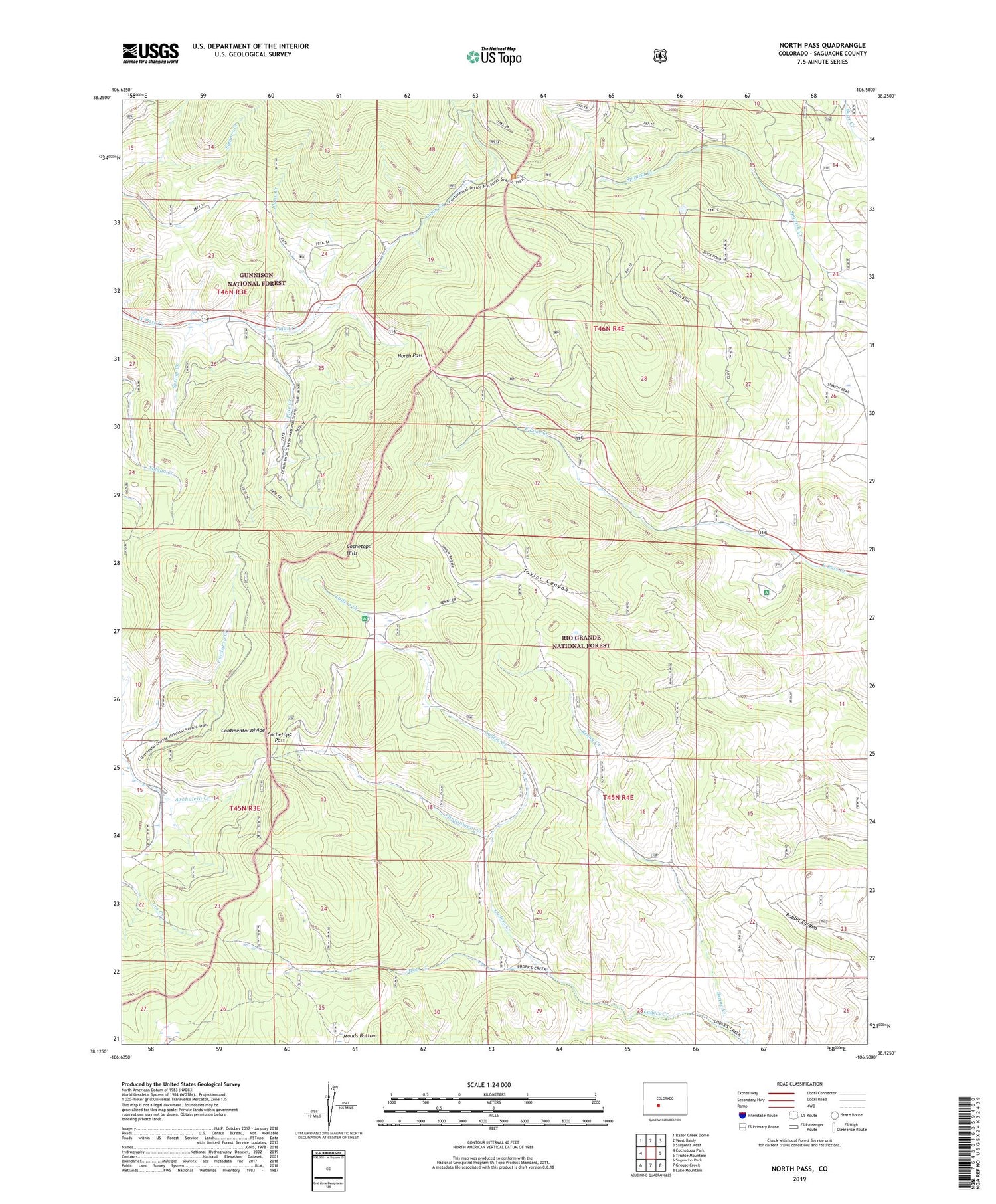
North Pass Colorado US Topo Map
Couldn't load pickup availability
Also explore the North Pass Forest Service Topo of this same quad for updated USFS data
2022 topographic map quadrangle North Pass in the state of Colorado. Scale: 1:24000. Based on the newly updated USGS 7.5' US Topo map series, this map is in the following counties: Saguache. The map contains contour data, water features, and other items you are used to seeing on USGS maps, but also has updated roads and other features. This is the next generation of topographic maps. Printed on high-quality waterproof paper with UV fade-resistant inks.
Quads adjacent to this one:
West: Cochetopa Park
Northwest: Razor Creek Dome
North: West Baldy
Northeast: Sargents Mesa
East: Trickle Mountain
Southeast: Lake Mountain
South: Grouse Creek
Southwest: Saguache Park
This map covers the same area as the classic USGS quad with code o38106b5.
Contains the following named places: Benny Creek, Buffalo Pass Campground, Cantonment Creek, Cochetopa Hills, Cochetopa Pass, Jakes Creek, Luders Creek Campground, Lujan Creek, North Pass, Pine Creek, Slane Creek, Spring Creek


