
MyTopo
Grouse Creek Colorado US Topo Map
Couldn't load pickup availability
Also explore the Grouse Creek Forest Service Topo of this same quad for updated USFS data
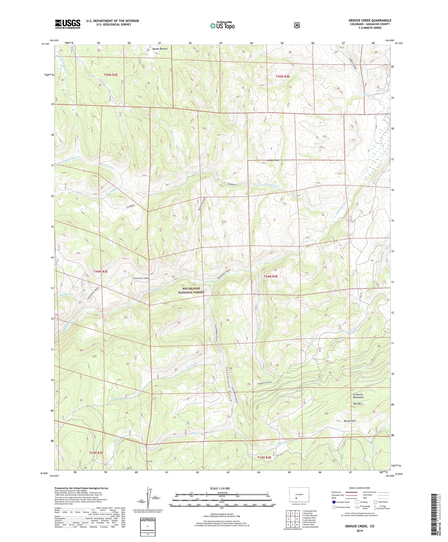
2022 topographic map quadrangle Grouse Creek in the state of Colorado. Scale: 1:24000. Based on the newly updated USGS 7.5' US Topo map series, this map is in the following counties: Saguache. The map contains contour data, water features, and other items you are used to seeing on USGS maps, but also has updated roads and other features. This is the next generation of topographic maps. Printed on high-quality waterproof paper with UV fade-resistant inks.
Quads adjacent to this one:
West: Saguache Park
Northwest: Cochetopa Park
North: North Pass
Northeast: Trickle Mountain
East: Lake Mountain
Southeast: Lookout Mountain
South: Bowers Peak
Southwest: Mesa Mountain
This map covers the same area as the classic USGS quad with code o38106a5.
Contains the following named places: Allen Creek, Andys Hole, Buck Park Creek, California Gulch, Duckfoot Creek, East Fork Buck Park Creek, Elk Creek, Fourmile Creek, Grouse Creek, Hat Mountain, Hat Springs, Moon Creek, Mouds Bottom, Round Park, Trough Creek, West Fork Buck Park Creek, West Park Creek


