
MyTopo
Stewart Peak Colorado US Topo Map
Couldn't load pickup availability
Also explore the Stewart Peak Forest Service Topo of this same quad for updated USFS data
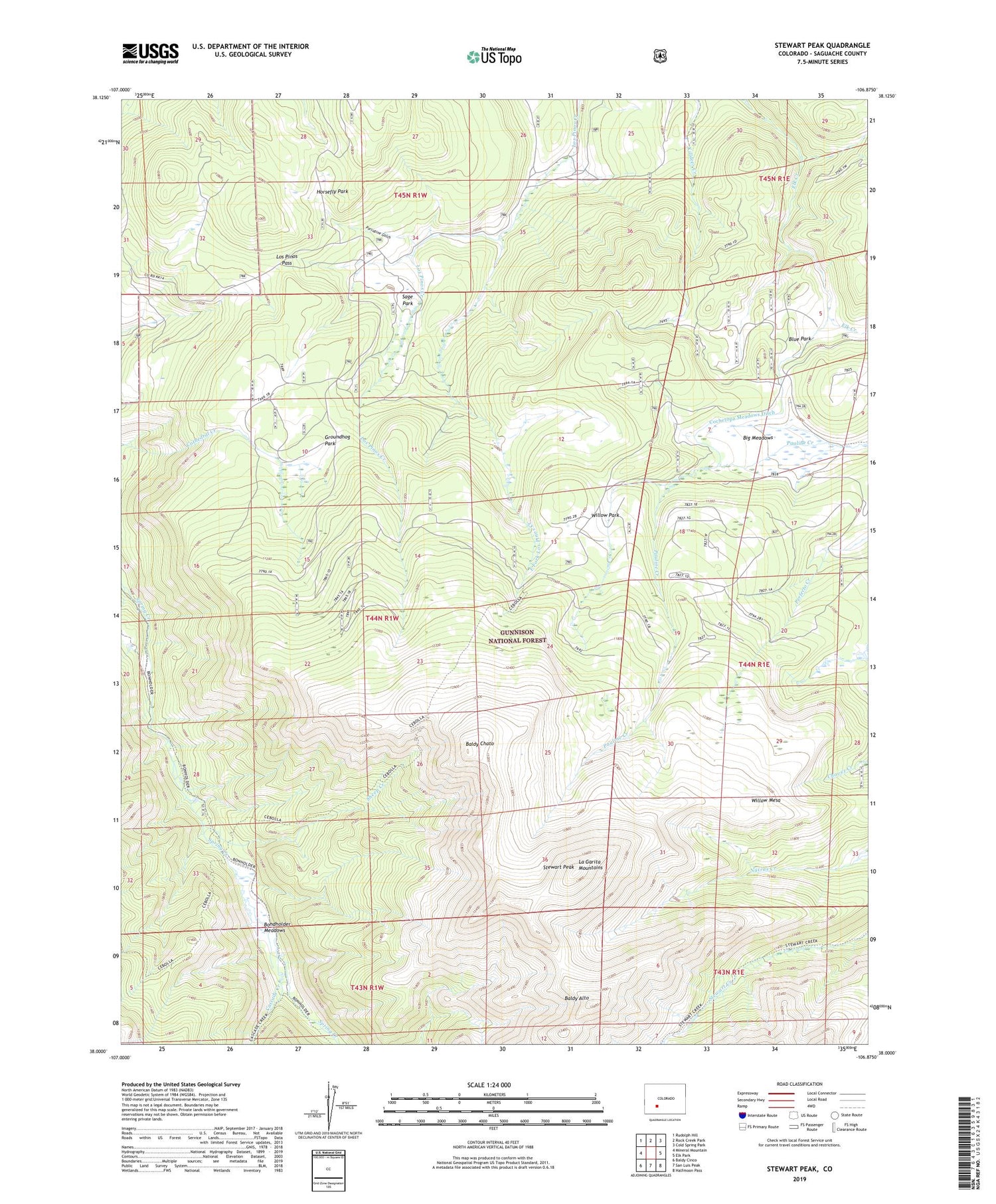
2022 topographic map quadrangle Stewart Peak in the state of Colorado. Scale: 1:24000. Based on the newly updated USGS 7.5' US Topo map series, this map is in the following counties: Saguache. The map contains contour data, water features, and other items you are used to seeing on USGS maps, but also has updated roads and other features. This is the next generation of topographic maps. Printed on high-quality waterproof paper with UV fade-resistant inks.
Quads adjacent to this one:
West: Mineral Mountain
Northwest: Rudolph Hill
North: Rock Creek Park
Northeast: Cold Spring Park
East: Elk Park
Southeast: Halfmoon Pass
South: San Luis Peak
Southwest: Baldy Cinco
This map covers the same area as the classic USGS quad with code o38106a8.
Contains the following named places: Baldy Alto, Baldy Chato, Big Meadows, Blue Park, Bondholder Meadows, Bondholder Trail, Cascade Creek, Cebolla Stock Driveway, Cochetopa Meadows Ditch, East Fork Los Pinos Creek, Groundhog Park, Horsefly Park, La Garita Mountains, La Garita Wilderness, Los Pinos Pass, Porcupine Gulch, Sage Park, Sheep Creek, Stewart Creek Trail, Stewart Peak, Willow Mesa, Willow Park


