MyTopo
The Wall New Mexico US Topo Map
Couldn't load pickup availability
Also explore the The Wall Forest Service Topo of this same quad for updated USFS data
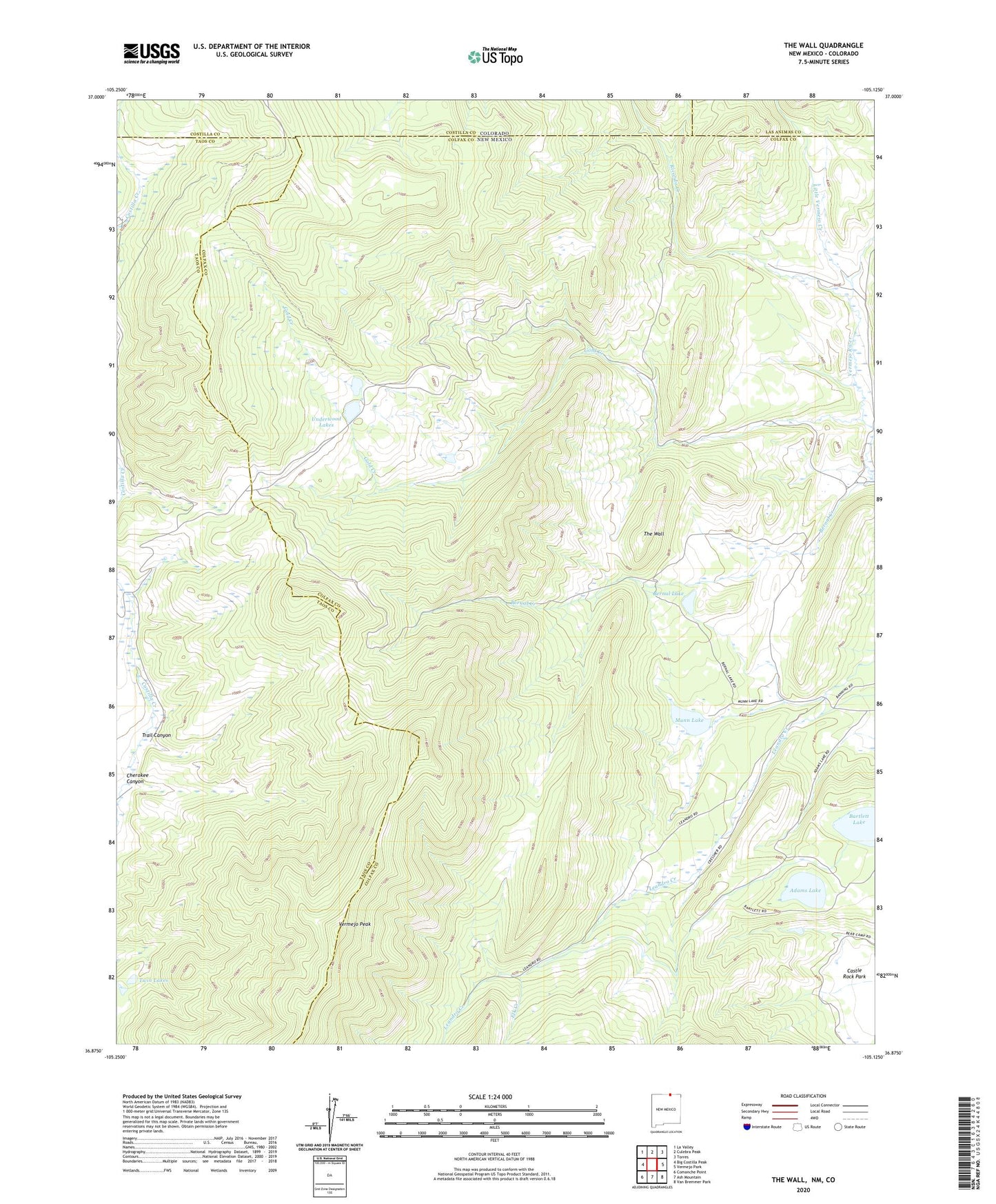
2023 topographic map quadrangle The Wall in the state of New Mexico. Scale: 1:24000. Based on the newly updated USGS 7.5' US Topo map series, this map is in the following counties: Colfax, Taos, Costilla, Las Animas. The map contains contour data, water features, and other items you are used to seeing on USGS maps, but also has updated roads and other features. This is the next generation of topographic maps. Printed on high-quality waterproof paper with UV fade-resistant inks.
Quads adjacent to this one:
West: Big Costilla Peak
Northwest: La Valley
North: Culebra Peak
Northeast: Torres
East: Vermejo Park
Southeast: Van Bremmer Park
South: Ash Mountain
Southwest: Comanche Point
This map covers the same area as the classic USGS quad with code o36105h2.
Contains the following named places: Adams Lake, Banning Place, Bartlett Lake, Bernal Cabin, Bernal Lake, Bernal Trail, Cherokee Canyon, Cressmer Lodge, Elk Creek, Gold Creek, Little Vermejo Creek, Munn Lake, North Fork Vermejo River, Number One Camp, Penaflor Ruins, Ricardo Creek, The Wall, Trail Canyon, Twin Lakes, Underwood Lakes, Van Lint Mine, Vermejo Peak