MyTopo
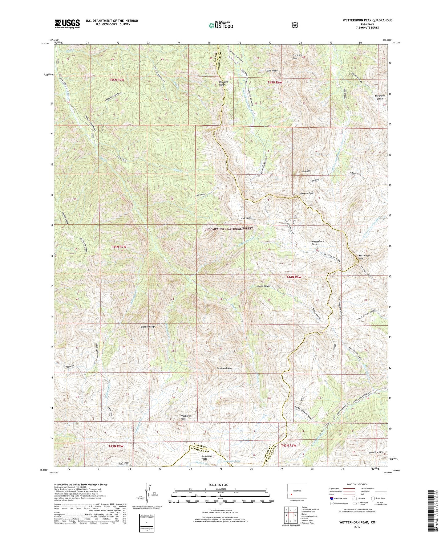
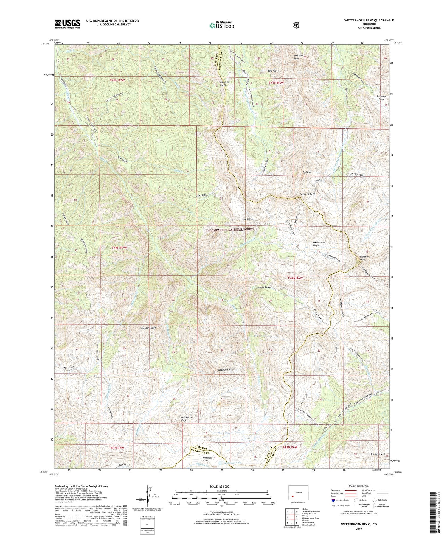
Wetterhorn Peak Colorado US Topo Map
Couldn't load pickup availability
Also explore the Wetterhorn Peak Forest Service Topo of this same quad for updated USFS data
2022 topographic map quadrangle Wetterhorn Peak in the state of Colorado. Scale: 1:24000. Based on the newly updated USGS 7.5' US Topo map series, this map is in the following counties: Ouray, Hinsdale. The map contains contour data, water features, and other items you are used to seeing on USGS maps, but also has updated roads and other features. This is the next generation of topographic maps. Printed on high-quality waterproof paper with UV fade-resistant inks.
Quads adjacent to this one:
West: Ouray
Northwest: Dallas
North: Courthouse Mountain
Northeast: Sheep Mountain
East: Uncompahgre Peak
Southeast: Redcloud Peak
South: Handies Peak
Southwest: Ironton
This map covers the same area as the classic USGS quad with code o38107a5.
Contains the following named places: American Lake, Bighorn Ridge, Blackwall Mountain, Chord Mine, Cow Creek Trail, Coxcomb Peak, Difficulty Creek, Dike Ridge, Green Mountain Trail, Mary Alice Creek, Middle Canyon, Oben Creek, Porphyry Basin, Precipice Peak, Redcliff, Ridge Stock Driveway, Sunshine Mountain, West Fork Trail, Wetterhorn Basin, Wetterhorn Creek, Wetterhorn Peak, Wildhorse Creek, Wildhorse Peak, ZIP Code: 81427