MyTopo
Hampton Connecticut US Topo Map
Couldn't load pickup availability
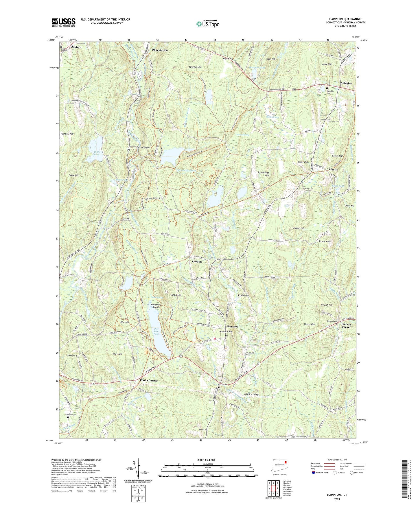
2024 topographic map quadrangle Hampton in the state of Connecticut. Scale: 1:24000. Based on the newly updated USGS 7.5' US Topo map series, this map is in the following counties: Windham. The map contains contour data, water features, and other items you are used to seeing on USGS maps, but also has updated roads and other features. This is the next generation of topographic maps. Printed on high-quality waterproof paper with UV fade-resistant inks.
Quads adjacent to this one:
West: Spring Hill
Northwest: Westford
North: Eastford
Northeast: Putnam
East: Danielson
Southeast: Plainfield
South: Scotland
Southwest: Willimantic
This map covers the same area as the classic USGS quad with code o41072g1.
Contains the following named places: Abington, Abington Cemetery, Abington Congregational Church, Abington Social Library, Allen Hill, Alworth Hill, Ashford, Ashford Academy, Babcock Cemetery, Baker Pond, Bear Hill, Beaupres Pond, Beaupres Pond Dam, Beaverdam Brook, Benson Cemetery, Bigelow Brook, Black Spruce Pond, Black Spruce Pond Dam, Burnham-Hibbard House, Catden Swamp, Cedar Swamp, Cedar Swamp Brook, Cherry Hill, Chewink Cemetery, Clark Cemetery, Clark Hill, Clarks Corner, Easter Hill, Elliotts, Elliotts Brook, Elliotts School, Fernow Birdge, Fletcher Memorial Library, Frog Rock, Frog Rock Roadside Park, Fuller Brook, Gathering in Christ Church, Goodwin Brook, Governors Island, Grow Cemetery, Grow Hill, Halls Pond, Halls Pond North Dam, Halls Pond South Dike, Hampton, Hampton Brook, Hampton Chaplin Ambulance Corporation, Hampton Congregational Church, Hampton Elementary School, Hampton Fire Company, Hampton Hill, Hampton Hill Historic District, Hampton Post Office, Hampton Reservoir, Hampton Reservoir Dam, Hampton Station, Hamptonville, Holt Brook, Howard Valley, James L Goodwin Conservation Center, James L Goodwin State Forest, Kimball Hill, Litchfield Cemetery, Lyon Hill, Maple Swamp, Murphy Brook, Natchaug, Nathaniel Lyon Memorial Park, Nickerson Park, North Cemetery, Old Ashford Cemetery, Our Lady of Lourdes Church, Paine Hill, Peppertree Campground, Pine Acres Lake, Pine Acres Lake Dam, Pumpkin Hill, Rawson, Reeds Pond, Sharpe Hill, Sharpe Hill Vineyard, Shaw Hill, Silvermine Brook, Slovik Brook, Snow Hill, South Cemetery, Sprague Hill, Spring Brook, Stepping Stone Ministries, Stetson Cemetery, Stetson Corner, Still River, Stones Brook, Sunset Hill, Town of Hampton, Trowbridge Hill, Turner Brook, Wade Brook, Whitman Brook, ZIP Code: 06247