MyTopo
Spring Hill Connecticut US Topo Map
Couldn't load pickup availability
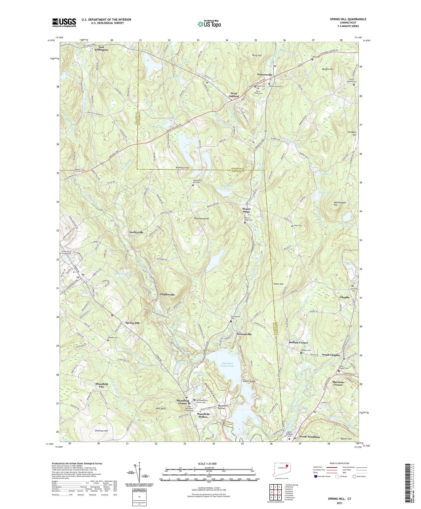
2024 topographic map quadrangle Spring Hill in the state of Connecticut. Scale: 1:24000. Based on the newly updated USGS 7.5' US Topo map series, this map is in the following counties: Tolland, Windham. The map contains contour data, water features, and other items you are used to seeing on USGS maps, but also has updated roads and other features. This is the next generation of topographic maps. Printed on high-quality waterproof paper with UV fade-resistant inks.
Quads adjacent to this one:
West: Coventry
Northwest: Stafford Springs
North: Westford
Northeast: Eastford
East: Hampton
Southeast: Scotland
South: Willimantic
Southwest: Columbia
This map covers the same area as the classic USGS quad with code o41072g2.
Contains the following named places: Ames Brook, Ashford Post Office, Ashford Volunteer Fire Department Station 20, Atwoodville, Atwoodville Cemetery, Babcock Library, Bassett Bridge, Bebbington Brook, Bedlam Cemetery, Bedlam Corner, Bucket Hill, Buttonball Brook, Byles Brook, Camp Connri, Chaffeeville, Chapins Pond, Chaplin, Chaplin Cemetery, Chaplin Elementary School, Chaplin Historic District, Chaplin Museum, Chaplin Post Office, Chaplin Town Hall, Chaplin Volunteer Fire Department Station 9, Chestnut Hill, Church Farm Homestead, Colts Pond, Darling Pond, Earl W Smith Senior Center, East Branch Stonehouse Brook, East Willington, Echo Lake, Eldredge Brook, Fenton River, Fishers Brook, Fox Swamp, Gardner Brook, Goss Brook, Gurleyville, Hanks Hill, Hanks Hill Pond, Hansens Pond, Hansens Pond Dam, Happy Acres Dam, Happy Acres Pond, Hillside Cemetery, Josias Byles Sanctuary, Knowlton Brook, Knowlton Hill, Knowlton Pond, Leander Pond, Lipps Brook, Lowry Brook, Lynch Pond, Mansfield Center, Mansfield Center Census Designated Place, Mansfield Center Post Office, Mansfield City, Mansfield Fire Department Station 307, Mansfield Fire Marshal's Office, Mansfield Hollow, Mansfield Hollow Dam, Mansfield Hollow Lake, Mansfield Recreation Pond, Mansfield Recreation Pond Dam, Mansure Pond, Mason Brook, McLaughlin Pond, McLaughlin Pond Dam, Mirror Lake, Moritz Brook, Moritz Pond, Mount Hope, Mount Hope Cemetery, Mount Hope River, New Mansfield Center Cemetery, Nipmuck Trail, North Windham Cemetery, North Windham Post Office, Olde Mansfield Center Cemetery, Perry Hill, Pompey Hollow Park, Rattlesnake Hill, Russ Cemetery, Rychlings Pond, Saint Philip Cemetery, Saint Philip-Apostle Church, Schoolhouse Brook, Sherman Corner, Snow Cemetery, South Ashford Cemetery, South Chaplin, South Chaplin Cemetery, Spring Hill, Squaw Hollow Brook, Stonehouse Brook, Storrs, Storrs Mansfield Post Office, Storrs Resident State Trooper Office, Tift Pond, Tower Hill, Town of Chaplin, Town of Mansfield, Tucker Pond, Turnip Meadow, Upson Lake, Upton Pond, Varga Pond, Ward Cemetery, Warrenville, Warrenville Cemetery, Warrenville Post Office, Warrenville School, West Ashford, Wild Life Marsh Reservoir, Wildlife Marsh Dam, William Ross Public Library, Wolf Rock, Wormwood Hill, Wormwood Hill Cemetery, ZIP Codes: 06235, 06250, 06268


