MyTopo
Alford Florida US Topo Map
Couldn't load pickup availability
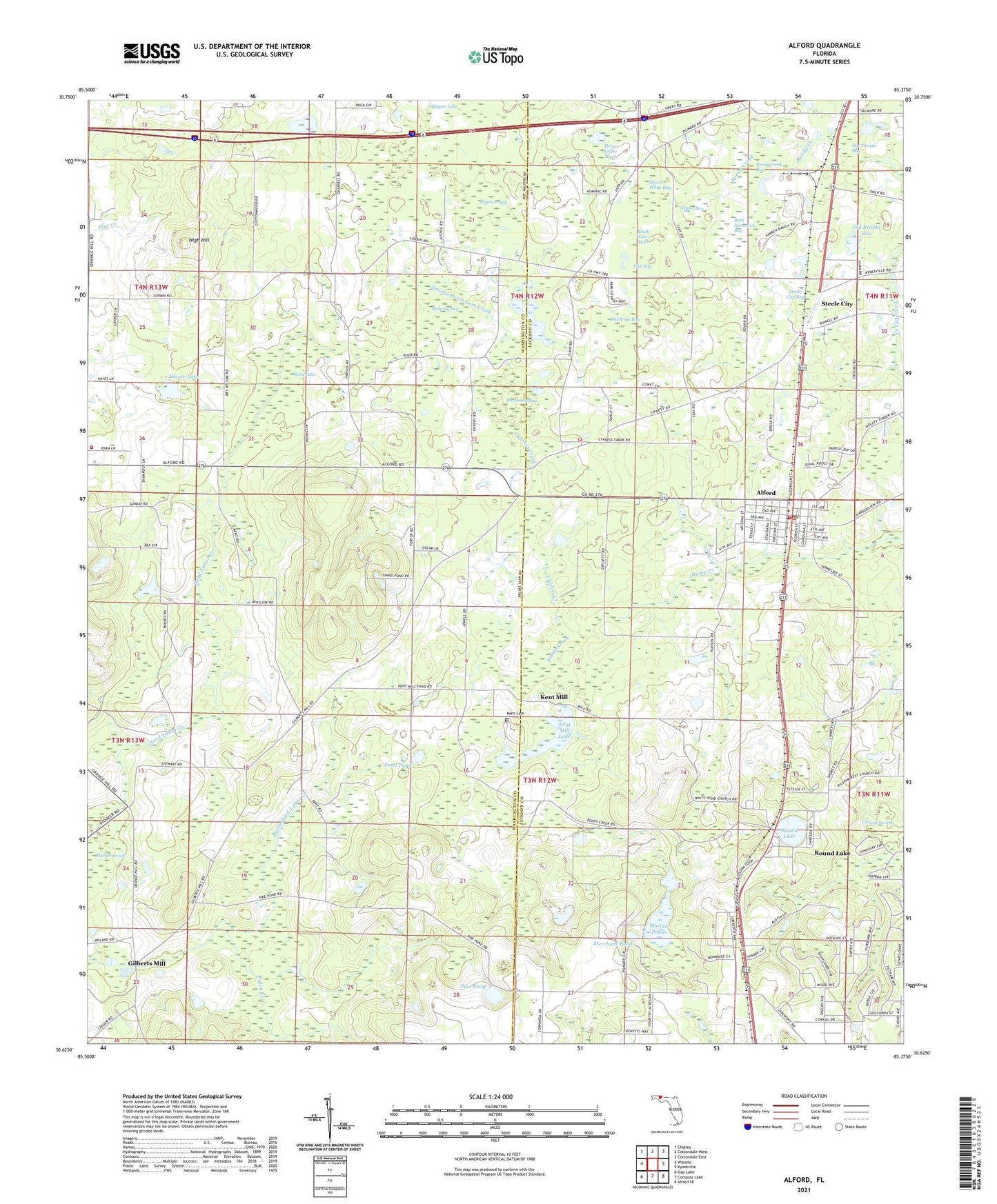
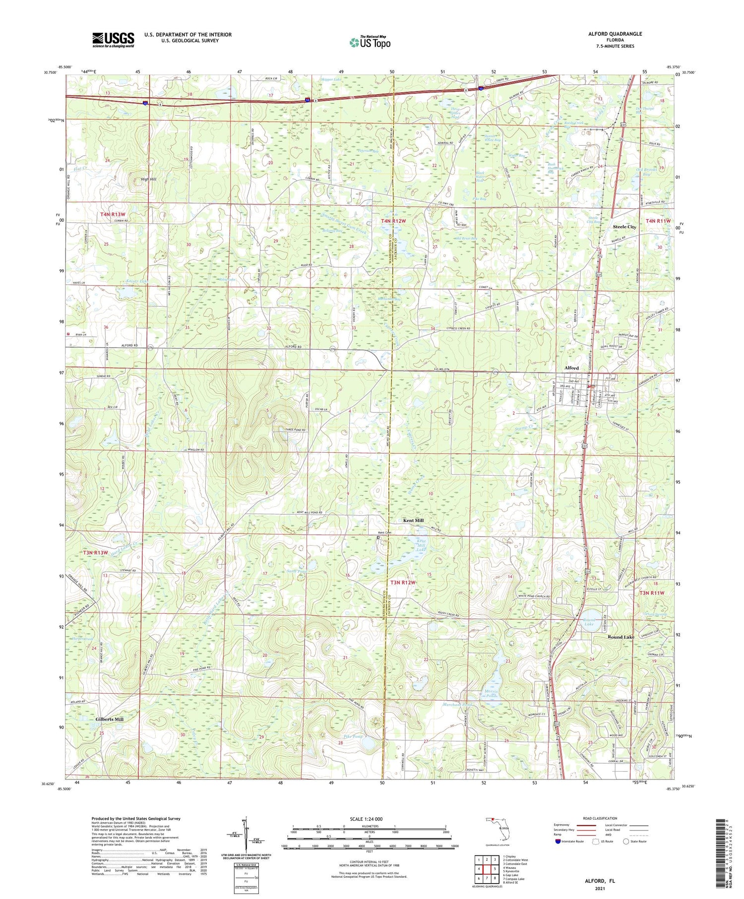
2024 topographic map quadrangle Alford in the state of Florida. Scale: 1:24000. Based on the newly updated USGS 7.5' US Topo map series, this map is in the following counties: Washington, Jackson. The map contains contour data, water features, and other items you are used to seeing on USGS maps, but also has updated roads and other features. This is the next generation of topographic maps. Printed on high-quality waterproof paper with UV fade-resistant inks.
Quads adjacent to this one:
West: Wausau
Northwest: Chipley
North: Cottondale West
Northeast: Cottondale East
East: Kynesville
Southeast: Alford SE
South: Compass Lake
Southwest: Gap Lake
This map covers the same area as the classic USGS quad with code o30085f4.
Contains the following named places: Alford, Alford Elementary School, Alford Post Office, Bellamy Bay, Black Water Hole, Bonnet Pond, Buchanan Bay, Bush Hammock Bay, Cypress Creek, Cypress Creek Church, Doc Tharpe Bay, Gilberts Mill, High Hill, Jackson County Fire and Rescue, Kaiser Lake, Kent Cemetery, Kent Mill, Kent Mill Lake, Macedonia Church, Merchant Pond, Morris Pond, New Orange Church, Oakie Ridge School, Old Briar Bay, Old Brooks Bay, Orange Hill Volunteer Fire Department, Peterson Bay, Pike Bay, Pike Pond, Poley Creek, Reedy Creek, Reedy Creek Bay, Ridgetop Railroad Station, Riley Lake, Rocky Mount School, Round Lake, Salem Church, Sand Hill School, Sand Pond, Sapp Church, Smutty Sweet Gum Creek, Steele City, Steele City Bay, Three Sisters Pond, Town of Alford, Water Bay, White Pond Church, Zannie White Bay, ZIP Code: 32420