MyTopo
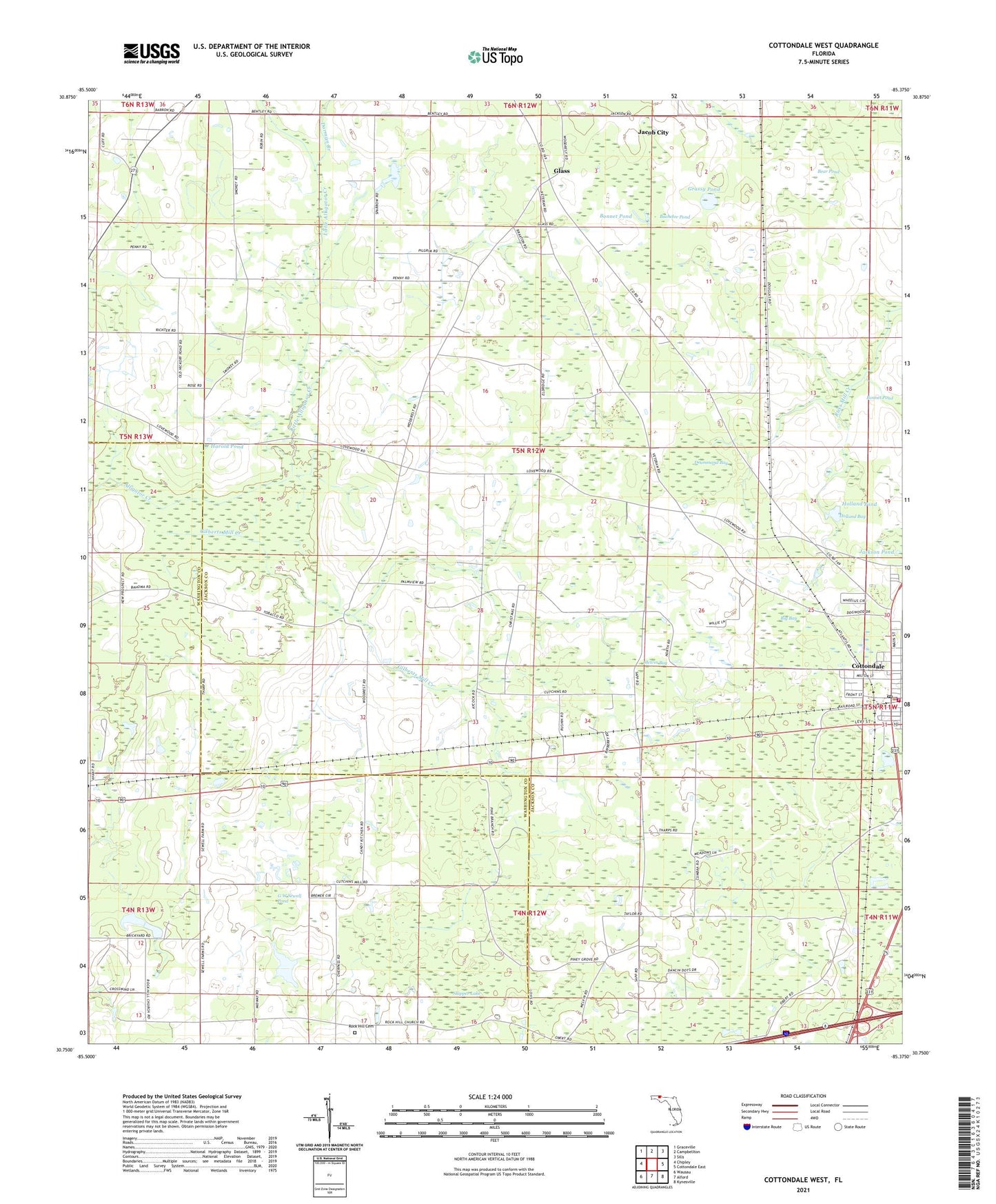
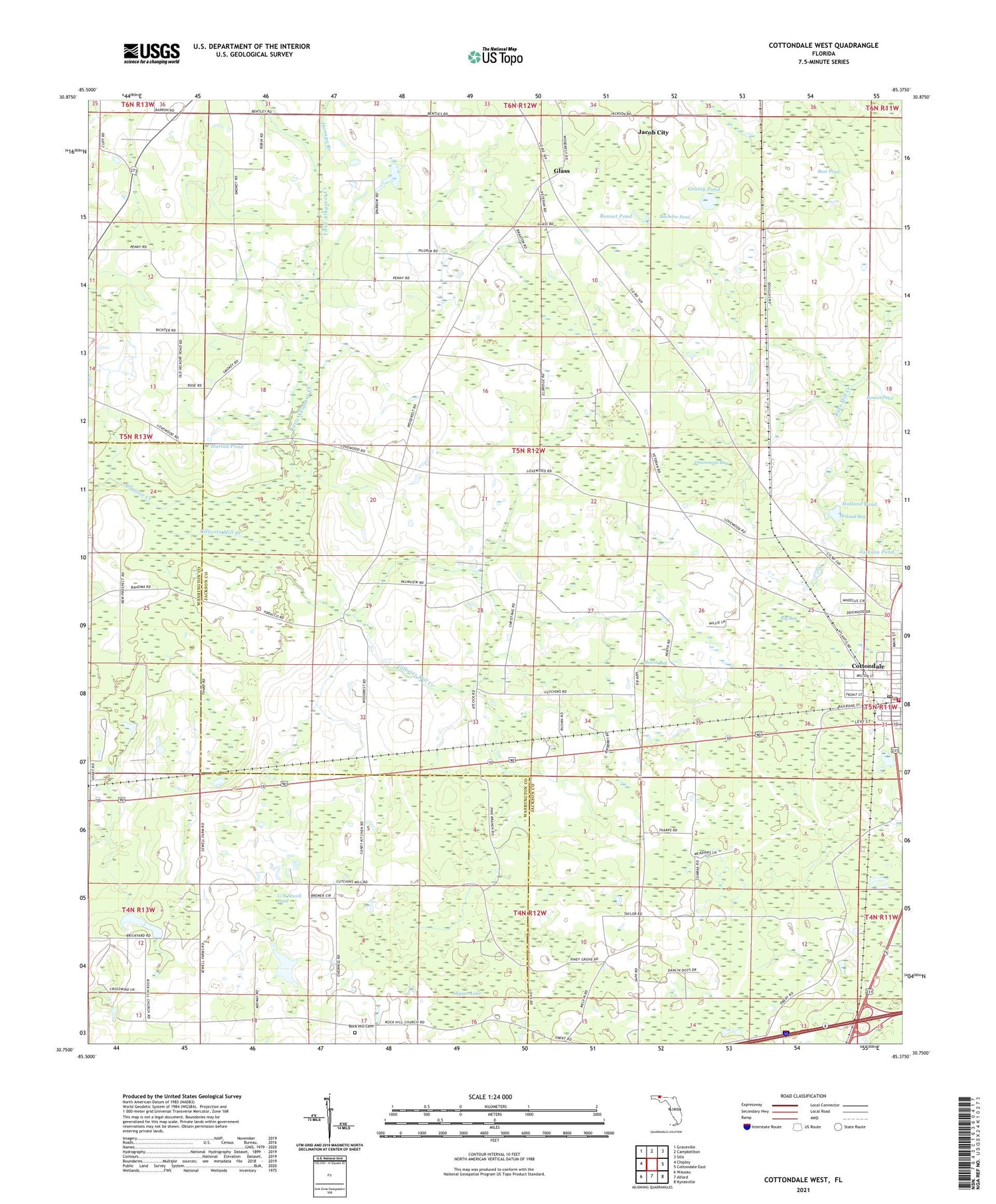
Cottondale West Florida US Topo Map
Couldn't load pickup availability
2024 topographic map quadrangle Cottondale West in the state of Florida. Scale: 1:24000. Based on the newly updated USGS 7.5' US Topo map series, this map is in the following counties: Jackson, Washington. The map contains contour data, water features, and other items you are used to seeing on USGS maps, but also has updated roads and other features. This is the next generation of topographic maps. Printed on high-quality waterproof paper with UV fade-resistant inks.
Quads adjacent to this one:
West: Chipley
Northwest: Graceville
North: Campbellton
Northeast: Sills
East: Cottondale East
Southeast: Kynesville
South: Alford
Southwest: Wausau
This map covers the same area as the classic USGS quad with code o30085g4.
Contains the following named places: Bachelor Pond, Bear Pond, Big Bay, Big Bay Pond, Bonnet Pond, Cottondale, Cottondale Airport, Cottondale Division, Cottondale Police Department, Cottondale Post Office, Cottondale Volunteer Fire Department, Dorman Branch, Drummond Bay, Friendship Church, G W Sewell Pond, Gilberts Mill Creek, Glass, Glass Church, Grassy Pond, Harold Pond, Holland Bay, Holland Pond, Jackson Pond, Little Alligator Creek, Lovewood Church, Lovewood School, Melvin Bay, New Prospect Church, Pilgrim Rest Church, Piney Grove Church, Rock Hill Church, Skipper Lake, ZIP Code: 32431