
MyTopo
Altha East Florida US Topo Map
Couldn't load pickup availability
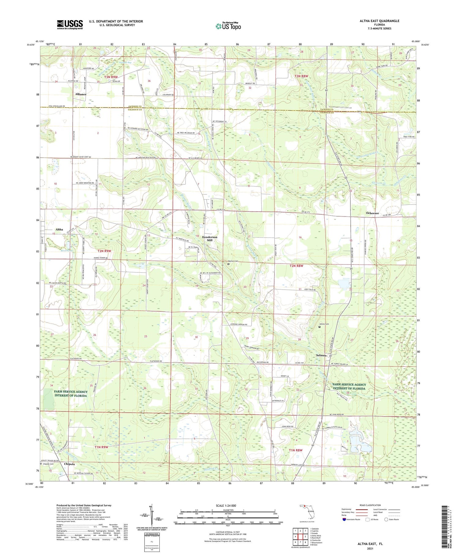
2024 topographic map quadrangle Altha East in the state of Florida. Scale: 1:24000. Based on the newly updated USGS 7.5' US Topo map series, this map is in the following counties: Calhoun, Jackson. The map contains contour data, water features, and other items you are used to seeing on USGS maps, but also has updated roads and other features. This is the next generation of topographic maps. Printed on high-quality waterproof paper with UV fade-resistant inks.
Quads adjacent to this one:
West: Altha West
Northwest: Oakdale
North: Cypress
Northeast: Sneads
East: Rock Bluff
Southeast: Bristol
South: Blountstown
Southwest: Clarksville
This map covers the same area as the classic USGS quad with code o30085e1.
Contains the following named places: Alliance, Altha Division, Altha International Airport, Atkins Cemetery, Barton Cemetery, Bird Pond, Carpenter Sink Creek, Chipola, Chipola Cemetery, Corinth Church, County Line Airstrip, Durham Bay, Eufala, Flowers Creek, Fox Creek, Henderson Mill, Macedonia, Macedonia Church, Mount Olive Church, New Zion Church, Ocheesee, Selman, Smokehouse Creek, Sunny Hill Church, Thomas Mill Creek, Wilson Mill Creek


