MyTopo
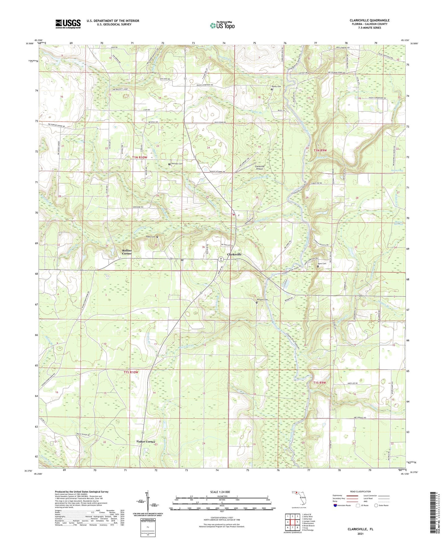
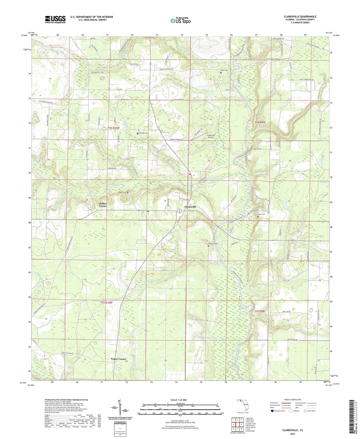
Clarksville Florida US Topo Map
Couldn't load pickup availability
2024 topographic map quadrangle Clarksville in the state of Florida. Scale: 1:24000. Based on the newly updated USGS 7.5' US Topo map series, this map is in the following counties: Calhoun. The map contains contour data, water features, and other items you are used to seeing on USGS maps, but also has updated roads and other features. This is the next generation of topographic maps. Printed on high-quality waterproof paper with UV fade-resistant inks.
Quads adjacent to this one:
West: Juniper Creek
Northwest: Alford SE
North: Altha West
Northeast: Altha East
East: Blountstown
Southeast: Estiffanulga
South: Frink
Southwest: Broad Branch
This map covers the same area as the classic USGS quad with code o30085d2.
Contains the following named places: Abe Spring Church, Ayers Cemetery, Bailey Cemetery, Big Brook, Calhoun County, Carr, Carr Church, Carr School, Clarksville, Clarksville - Carr Volunteer Fire Department, Clarksville Airport, Clarksville Post Office, Commander Creek, Crossroads School, Davis Mill Creek, Farley Creek, Fisher Corner, Fourmile Creek, Fox Creek, Griffin Branch, Herndon Cemetery, Hewett Head, Hogpen Branch, Magnolia Church, New Home Church, Otter Creek, Palmetto Branch, Palmetto Head, Pippin Cemetery, Poplar Head, Poplar Head Church, Red Oak Church, Rollins Corner, Suggs Head, Taylor Branch, Tenmile Creek, Toolchest Branch, Travelers Rest Church, Turtle Lake Branch, Wildcat Creek, Williams Cemetery, ZIP Code: 32430