MyTopo
Blountstown Florida US Topo Map
Couldn't load pickup availability
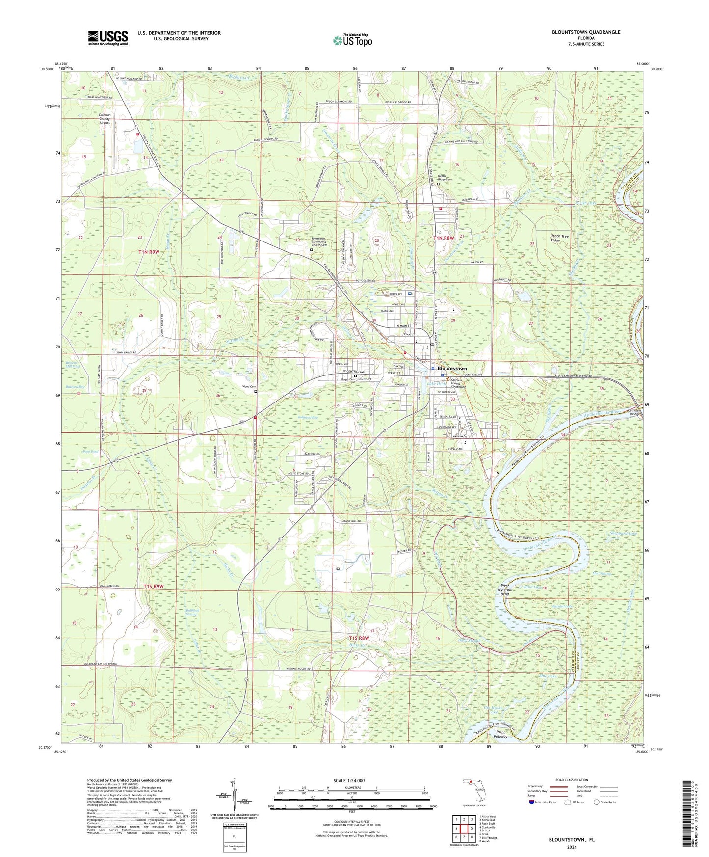
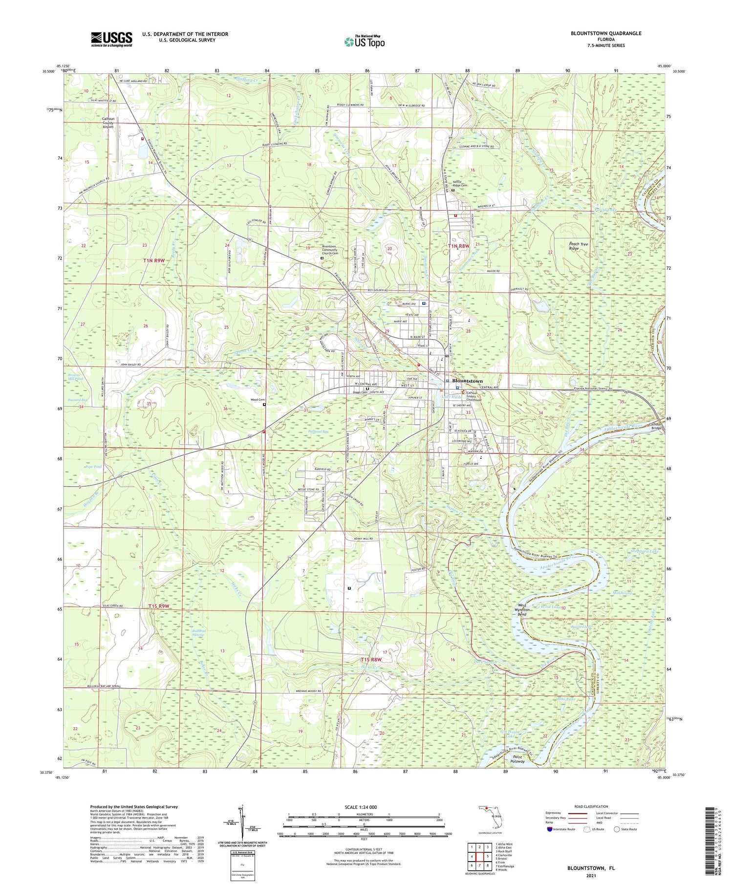
2024 topographic map quadrangle Blountstown in the state of Florida. Scale: 1:24000. Based on the newly updated USGS 7.5' US Topo map series, this map is in the following counties: Calhoun, Liberty. The map contains contour data, water features, and other items you are used to seeing on USGS maps, but also has updated roads and other features. This is the next generation of topographic maps. Printed on high-quality waterproof paper with UV fade-resistant inks.
Quads adjacent to this one:
West: Clarksville
Northwest: Altha West
North: Altha East
Northeast: Rock Bluff
East: Bristol
Southeast: Woods
South: Estiffanulga
Southwest: Frink
This map covers the same area as the classic USGS quad with code o30085d1.
Contains the following named places: Bethel Christian School, Bethel Church, Blountstown, Blountstown Airport, Blountstown Elementary School, Blountstown Fire Department, Blountstown Middle School, Blountstown Police Department, Blountstown Post Office, Blountstown Senior High School, Blue Lake, Boggs Cemetery, Browns Mill Pond, Bullhead Bay, Bullhead Swamp, Buzzard Bay, Buzzard Lake, Calhoun Bridge, Calhoun Correctional Institution, Calhoun County Airport, Calhoun County Education Center, Calhoun County Sheriff's Office, Calhoun Liberty Ambulance, Calhoun Liberty Hospital, Choconickla, Christian Home Church, City of Blountstown, Coon Creek, Duck Slough, Durham, Flowers Still, Gin House Lake, Hicks Creek, Hollis Landing, Lake Hilda, Leonards, Leonards Siding, Magnolia Volunteer Fire Department, McNeal, Neal Landing, Nettle Ridge Cemetery, Nettle Ridge Volunteer Fire Department, North Florida Child Development Mayhaw Center, Ocheeseulga, Old River, Parish Lake, Peach Tree Ridge, Pear-Azalea Park, Pine Grove Church, Pine Island, Point Poloway, Pope Pond, Reedy Creek, Rivertown Community Church Cemetery, Sam Atkins Park, Sheppard Lake, Sheppards Landing, Simmons Creek, Stafford Creek, Sutton Creek, The Bayou, W T Neal Civic Center, West Wynnton Bend, Westside Volunteer Fire Department, Wind Lake, Wood Cemetery, WPHK-FM (Blountstown), WYBT-AM (Blountstown)