MyTopo
Baywood Florida US Topo Map
Couldn't load pickup availability
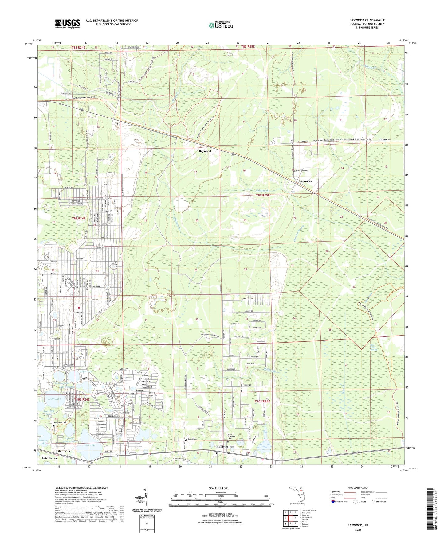
2024 topographic map quadrangle Baywood in the state of Florida. Scale: 1:24000. Based on the newly updated USGS 7.5' US Topo map series, this map is in the following counties: Putnam. The map contains contour data, water features, and other items you are used to seeing on USGS maps, but also has updated roads and other features. This is the next generation of topographic maps. Printed on high-quality waterproof paper with UV fade-resistant inks.
Quads adjacent to this one:
West: Putnam Hall
Northwest: Gold Head Branch
North: Rice Creek
Northeast: Bostwick
East: Palatka
Southeast: Satsuma
South: Rodman
Southwest: Keuka
This map covers the same area as the classic USGS quad with code o29081f7.
Contains the following named places: Baywood, Boll Green Lake, Carraway, Church Lake, First Baptist Church, Hickory Branch, Hollister Forestry Station, Hollister Post Office, Hollister Volunteer Fire Department, Interlachen Lake Estates Volunteer Fire Department Station 17, Interlachen-Florahome Division, Jewel Lake, Lake Ida, Lake Virginia, Macedonia Missionary Baptist Church, Mannville, Manville Substation Clay Electric Co-op, Mary Elizabeth Cemetery, Mary Elizabeth Church, Mei - Wun Cemetery, Mirror Lake, Naomi Cemetery, Naomi Church, Oldtown Branch, Palmetto Branch, Pine Lawn Cemetery, Q I Roberts Middle School, Rice Creek Swamp, Sand Hill Pond, Seventh Day Adventist Church, Up and Down Lake, Violet Lake, William Panton Grant