MyTopo
Rice Creek Florida US Topo Map
Couldn't load pickup availability
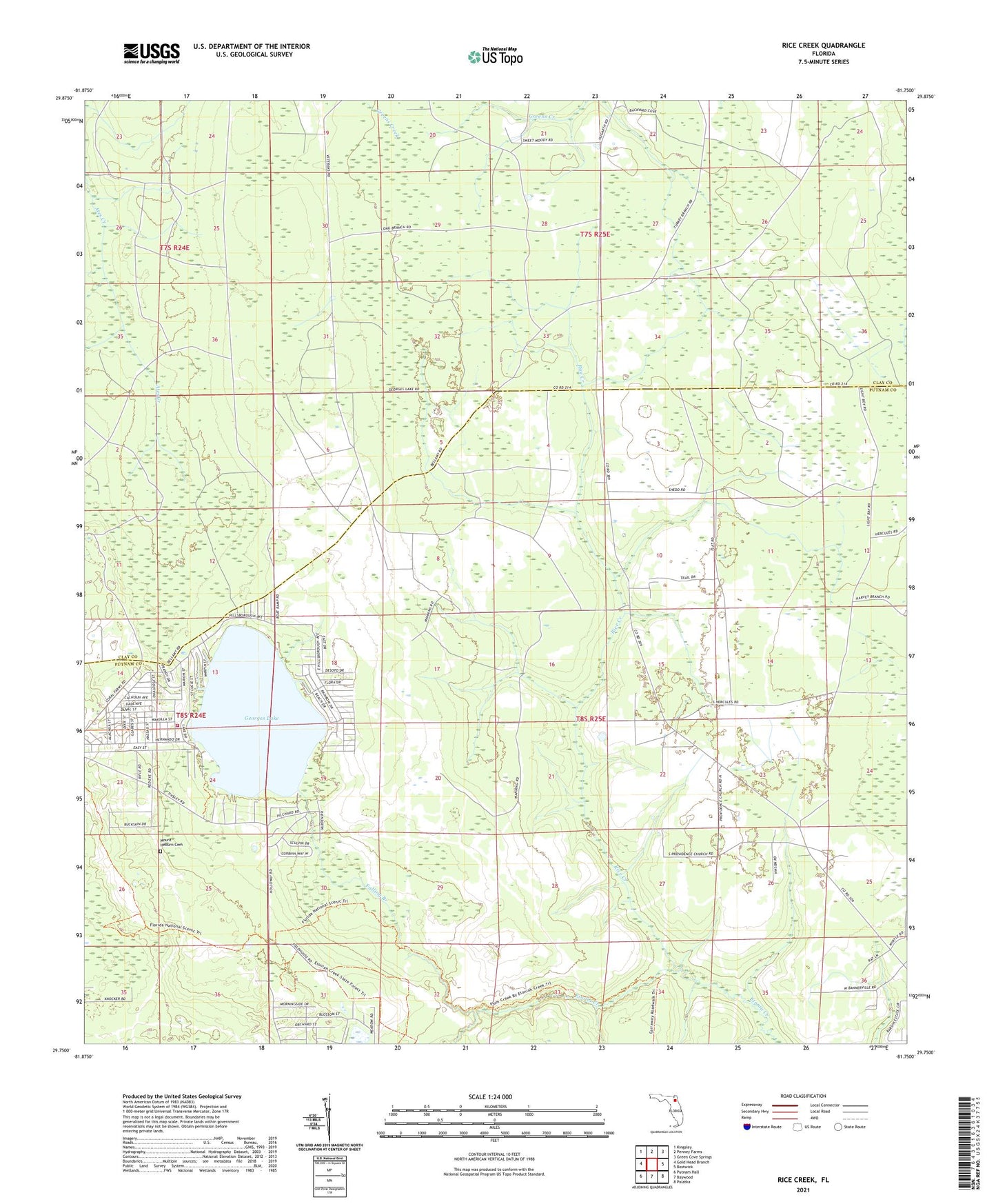
2024 topographic map quadrangle Rice Creek in the state of Florida. Scale: 1:24000. Based on the newly updated USGS 7.5' US Topo map series, this map is in the following counties: Putnam, Clay. The map contains contour data, water features, and other items you are used to seeing on USGS maps, but also has updated roads and other features. This is the next generation of topographic maps. Printed on high-quality waterproof paper with UV fade-resistant inks.
Quads adjacent to this one:
West: Gold Head Branch
Northwest: Kingsley
North: Penney Farms
Northeast: Green Cove Springs
East: Bostwick
Southeast: Palatka
South: Baywood
Southwest: Putnam Hall
This map covers the same area as the classic USGS quad with code o29081g7.
Contains the following named places: Devils Den Creek, Falling Branch, Georges Lake, Georges Lake Area Volunteer Fire Department Station 16, Harlem, Mount Heburn Cemetery, Providence Church, Rice Creek, ZIP Code: 32140