MyTopo
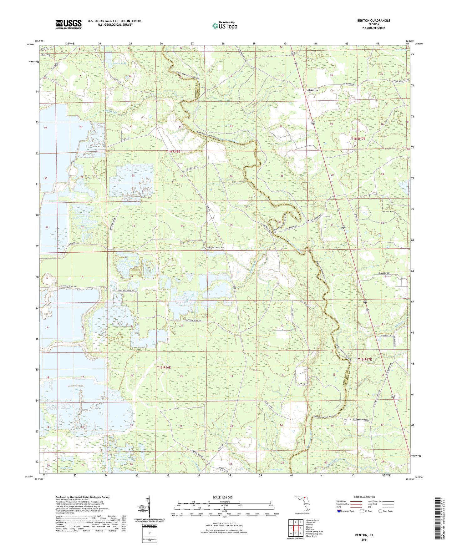
Benton Florida US Topo Map
Couldn't load pickup availability
Also explore the Benton Forest Service Topo of this same quad for updated USFS data
2024 topographic map quadrangle Benton in the state of Florida. Scale: 1:24000. Based on the newly updated USGS 7.5' US Topo map series, this map is in the following counties: Hamilton, Columbia. The map contains contour data, water features, and other items you are used to seeing on USGS maps, but also has updated roads and other features. This is the next generation of topographic maps. Printed on high-quality waterproof paper with UV fade-resistant inks.
Quads adjacent to this one:
West: Genoa
Northwest: Cypress Creek
North: Fargo SW
Northeast: Council
East: Fairview
Southeast: Deep Creek
South: White Springs East
Southwest: White Springs West
This map covers the same area as the classic USGS quad with code o30082d6.
Contains the following named places: Bay Creek, Benton, Benton Tower, Brown Lake, Deep Creek Adventist Church, Hogans Branch, Hooker Bay, Hunter Creek, Little Creek, Oak Grove Church, Prospect Church, Roaring Creek, White Springs Division