MyTopo
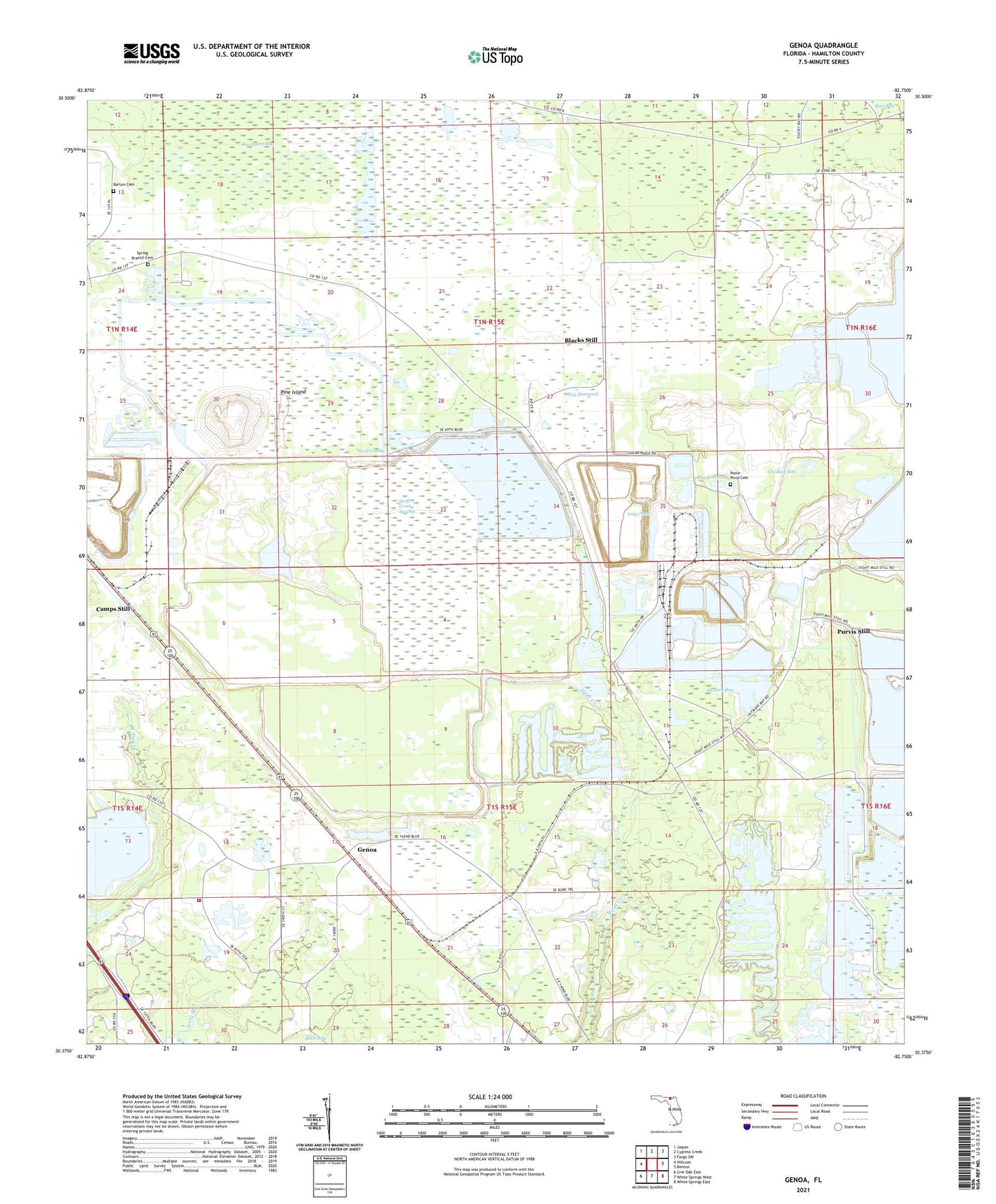
Genoa Florida US Topo Map
Couldn't load pickup availability
2024 topographic map quadrangle Genoa in the state of Florida. Scale: 1:24000. Based on the newly updated USGS 7.5' US Topo map series, this map is in the following counties: Hamilton. The map contains contour data, water features, and other items you are used to seeing on USGS maps, but also has updated roads and other features. This is the next generation of topographic maps. Printed on high-quality waterproof paper with UV fade-resistant inks.
Quads adjacent to this one:
West: Hillcoat
Northwest: Jasper
North: Cypress Creek
Northeast: Fargo SW
East: Benton
Southeast: White Springs East
South: White Springs West
Southwest: Live Oak East
This map covers the same area as the classic USGS quad with code o30082d7.
Contains the following named places: Altmans Bay, Barton Cemetery, Belmont, Blacks Still, Camp Branch Church, Camps Still, Cheshire Bay, Christie Lookout Tower, Friendship Church, Genoa, Hamilton County Fire and Rescue Department Genoa Station, Hog Hammock, Long Pond, Occidental Railroad Station, Occidental Wildlife Management Area, Pine Island, Poole Pond, Poole Pond Cemetery, Purvis Still, Smith Creek Church, Spring Branch Cemetery, Spring Branch Church, Swift Creek, Swift Creek Swamp