
MyTopo
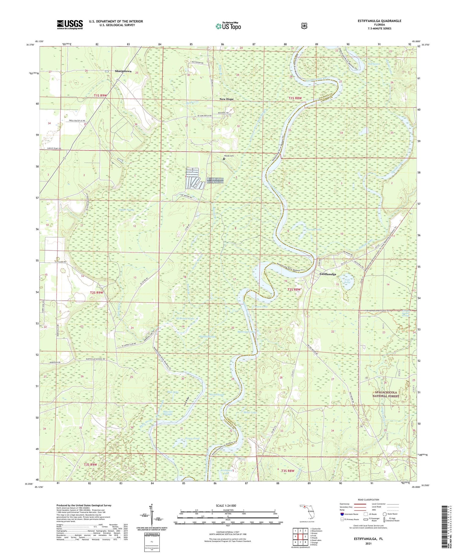
Estiffanulga Florida US Topo Map
Couldn't load pickup availability
Also explore the Estiffanulga Forest Service Topo of this same quad for updated USFS data
2024 topographic map quadrangle Estiffanulga in the state of Florida. Scale: 1:24000. Based on the newly updated USGS 7.5' US Topo map series, this map is in the following counties: Calhoun, Liberty. The map contains contour data, water features, and other items you are used to seeing on USGS maps, but also has updated roads and other features. This is the next generation of topographic maps. Printed on high-quality waterproof paper with UV fade-resistant inks.
Quads adjacent to this one:
West: Frink
Northwest: Clarksville
North: Blountstown
Northeast: Bristol
East: Woods
Southeast: Wilma
South: Orange
Southwest: Dead Lakes
This map covers the same area as the classic USGS quad with code o30085c1.
Contains the following named places: Acorn Lake, Ammonia Camp, Ammonia River Sand Slough, Apalachicola Work Center, Baker Branch, Blountstown Division, Boggy Branch, Brickyard Lake, Estiffanulga, Fish Lake, Fish Pond, Gunn Landing, Honey Pond, Hughes Creek, Humility Church, Iamonia Lake, Johnson Branch, Juniper Swamp, Landy Lake, Little Gully Creek, Long Ridge, Lots Mill Creek, Mary Slough, Marysville, McDougal Lake, Middle Slough, Miller Lake, Mosquito Landing, Mud Swamp, Muscogee Lake, Muscogee Landing, New Hope, Outside Lake, Power Landing, Raccoon Slough, Rudy Slough, Sharpstown, Shingle Landing, Woods Branch, Woods Cemetery, ZIP Code: 32424


