MyTopo
Branford Florida US Topo Map
Couldn't load pickup availability
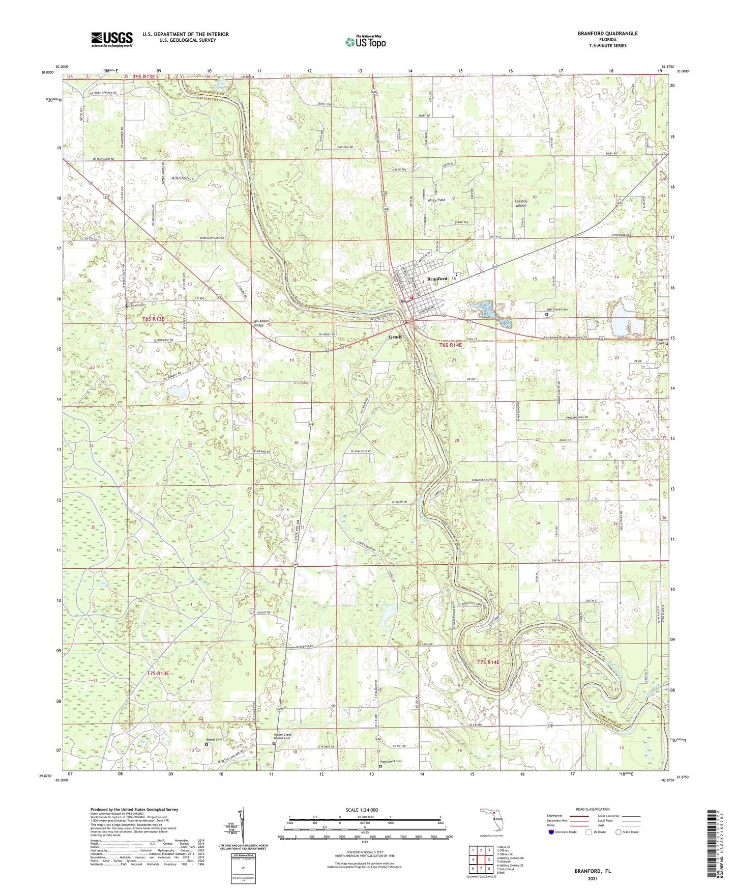
2024 topographic map quadrangle Branford in the state of Florida. Scale: 1:24000. Based on the newly updated USGS 7.5' US Topo map series, this map is in the following counties: Lafayette, Suwannee, Gilchrist. The map contains contour data, water features, and other items you are used to seeing on USGS maps, but also has updated roads and other features. This is the next generation of topographic maps. Printed on high-quality waterproof paper with UV fade-resistant inks.
Quads adjacent to this one:
West: Mallory Swamp NE
Northwest: Mayo SE
East: Hildreth
Southeast: Bell
South: Hatchbend
Southwest: Mallory Swamp SE
This map covers the same area as the classic USGS quad with code o29082h8.
Contains the following named places: Bethel Cemetery, Branford, Branford Church of God, Branford Church of God by Faith, Branford High School, Branford High School Stadium, Branford Post Office, Branford Presbyterian Church, Branford Public Library, Branford Town Hall, Branford United Methodist Church, Branford Volunteer Fire Department, Byrd Cemetery, Byrd Church, Ephesus Advent Christian Church, First Baptist Church of Branford, Grady, Hal Adams Bridge, Hall Farm Airport, Hatch Park, Hatchbend Apostolic Church, Hatchbend Cemetery, Hunts Cemetery, Lazyboy Airport, Little River Springs, Living Springs Family Worship Center, Macedonia Baptist Purity Church, Mount Paran Baptist Church, Oak Grove Cemetery, Peace Baptist Church, San Juan Catholic Mission, Santa Fe River, Suwannee Point Ranch Airport, Town of Branford, Vineyard of Grace Ministries, Wachitokha, Walker Creek Baptist Cemetery, Walker Creek Bethel Baptist Church, Wanamake, White Field, ZIP Code: 32008