MyTopo
Hildreth Florida US Topo Map
Couldn't load pickup availability
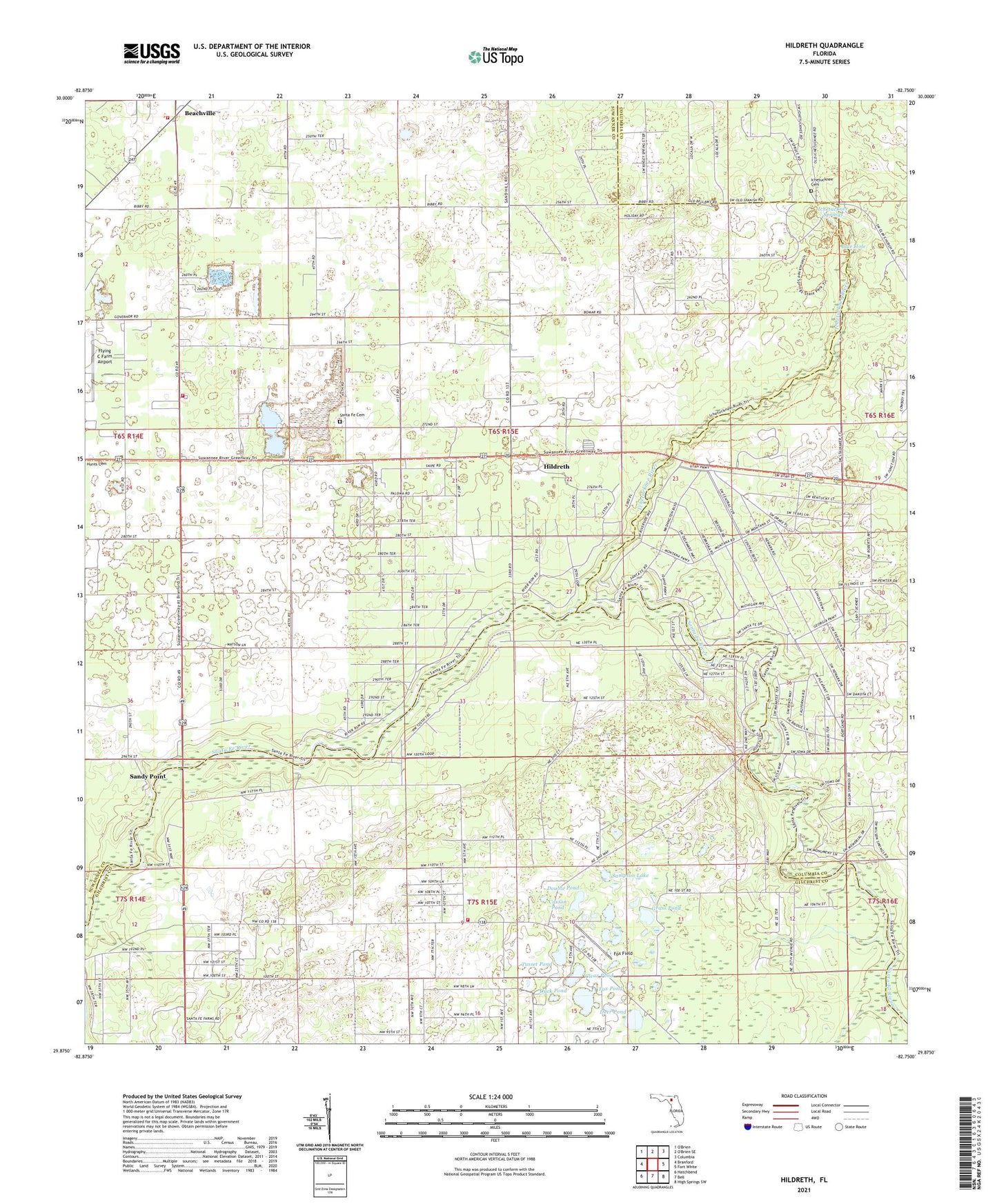
2024 topographic map quadrangle Hildreth in the state of Florida. Scale: 1:24000. Based on the newly updated USGS 7.5' US Topo map series, this map is in the following counties: Suwannee, Gilchrist, Columbia. The map contains contour data, water features, and other items you are used to seeing on USGS maps, but also has updated roads and other features. This is the next generation of topographic maps. Printed on high-quality waterproof paper with UV fade-resistant inks.
Quads adjacent to this one:
West: Branford
Northeast: Columbia
East: Fort White
Southeast: High Springs SW
South: Bell
Southwest: Hatchbend
This map covers the same area as the classic USGS quad with code o29082h7.
Contains the following named places: Beachville, Beachville Advent Christian Church, Beachville Fire Tower, Blue Hole, Burlington Santa Fe Church of Christ, Casson Pond, Clear Pond, Deer Pond, Double Pond, Duck Pond, Flying C Farm Airport, Fort White, Fort White Library, Fort White Progress Energy Radio Tower, Fort White Progress Energy Substation, Fox Field, Fox Pond, Gilchrist County Fire and Rescue Station 2, Grass Pond, Hildreth, Icheetucknee River Baptist Church, Ichetucknee Cemetery, Ichetucknee River, Ichetucknee Springs, Ichetucknee Springs State Park, Landmark Baptist Church, Lanier Railroad Station, Lebanon Baptist Church, Magnolia Church, New Grove Church, Pleasant Grove Church, Ranchette Volunteer Fire Department, River Run Campground, Sampson Lake, Sandy Point, Sandy Point Trailer Park, Santa Fe Cemetery, Suwannee County Fire Rescue Station 3, Suwannee Valley Electric Cooperative Walker Substation, Thompson Airfield, True Life Apostolic Church, Tusset Pond