MyTopo
Hatchbend Florida US Topo Map
Couldn't load pickup availability
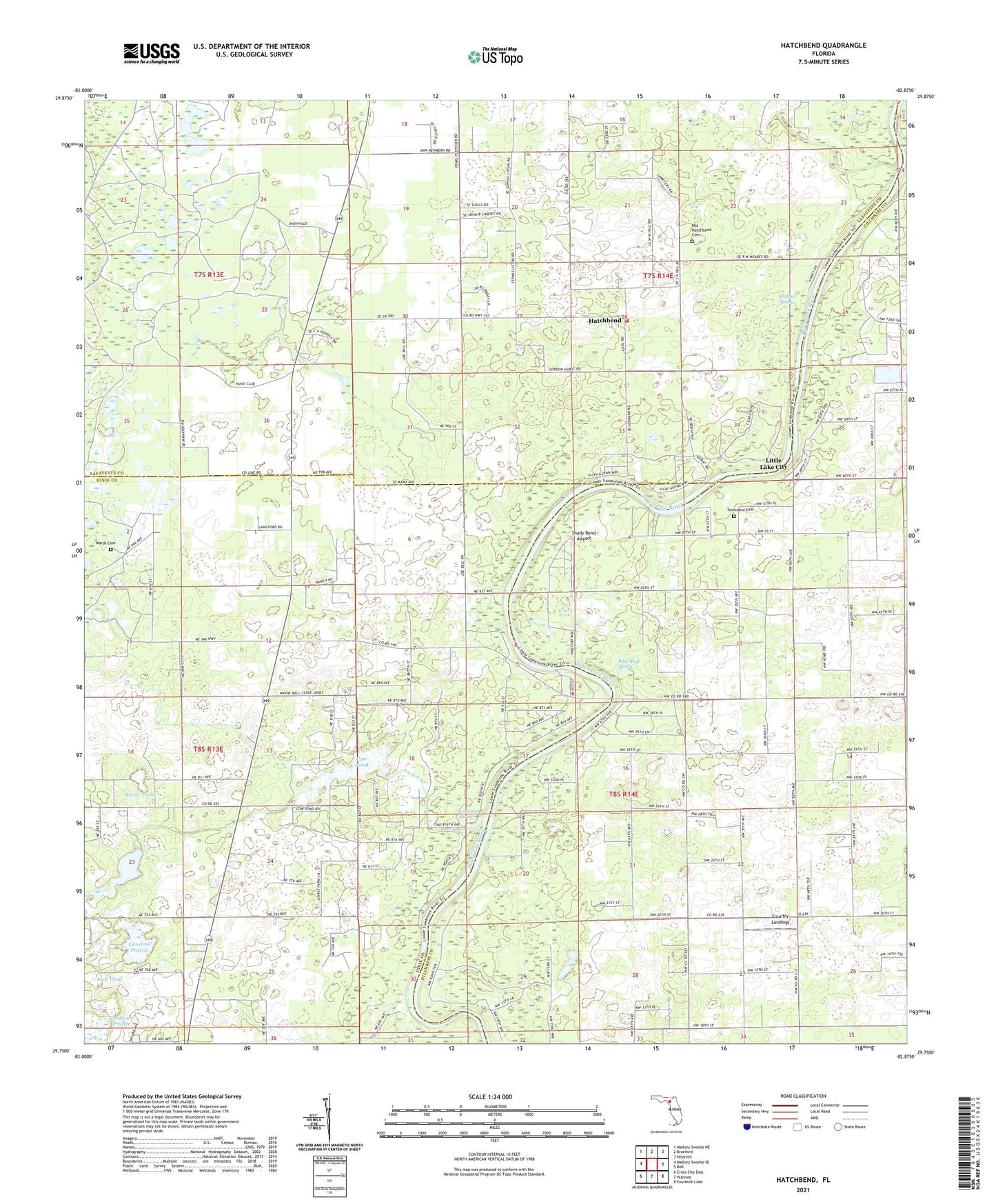
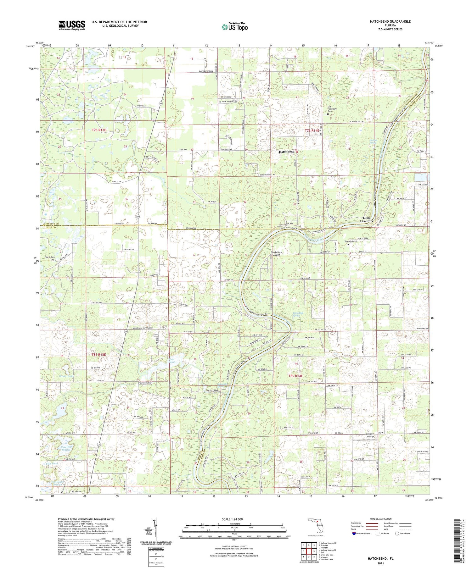
2024 topographic map quadrangle Hatchbend in the state of Florida. Scale: 1:24000. Based on the newly updated USGS 7.5' US Topo map series, this map is in the following counties: Lafayette, Gilchrist, Dixie. The map contains contour data, water features, and other items you are used to seeing on USGS maps, but also has updated roads and other features. This is the next generation of topographic maps. Printed on high-quality waterproof paper with UV fade-resistant inks.
Quads adjacent to this one:
West: Mallory Swamp SE
Northwest: Mallory Swamp NE
North: Branford
Northeast: Hildreth
East: Bell
Southeast: Fourmile Lake
South: Wannee
Southwest: Cross City East
This map covers the same area as the classic USGS quad with code o29082g8.
Contains the following named places: Careless Prairie, Country Landings, Cow Pond, Darrah Air Park, Fletcher Spring, Guaranto Spring, Hatch Bend Volunteer Fire Department, Hatchbend, Little Lake City, McCalls Chapel, Mount Nebo Church, New Hope Church, Old Hatchbend Cemetery, Rock Bluff Landing, Rock Bluff Spring, Rock Sink Church, Shady Bend Airport, Simms Landing, Suwannee River Research Educational Center, Tomlinson Prairie, Townsend Cemetery, Wards Cemetery, Water Pond, Wayfair Church, Williams Lake