MyTopo
Broad Branch Florida US Topo Map
Couldn't load pickup availability
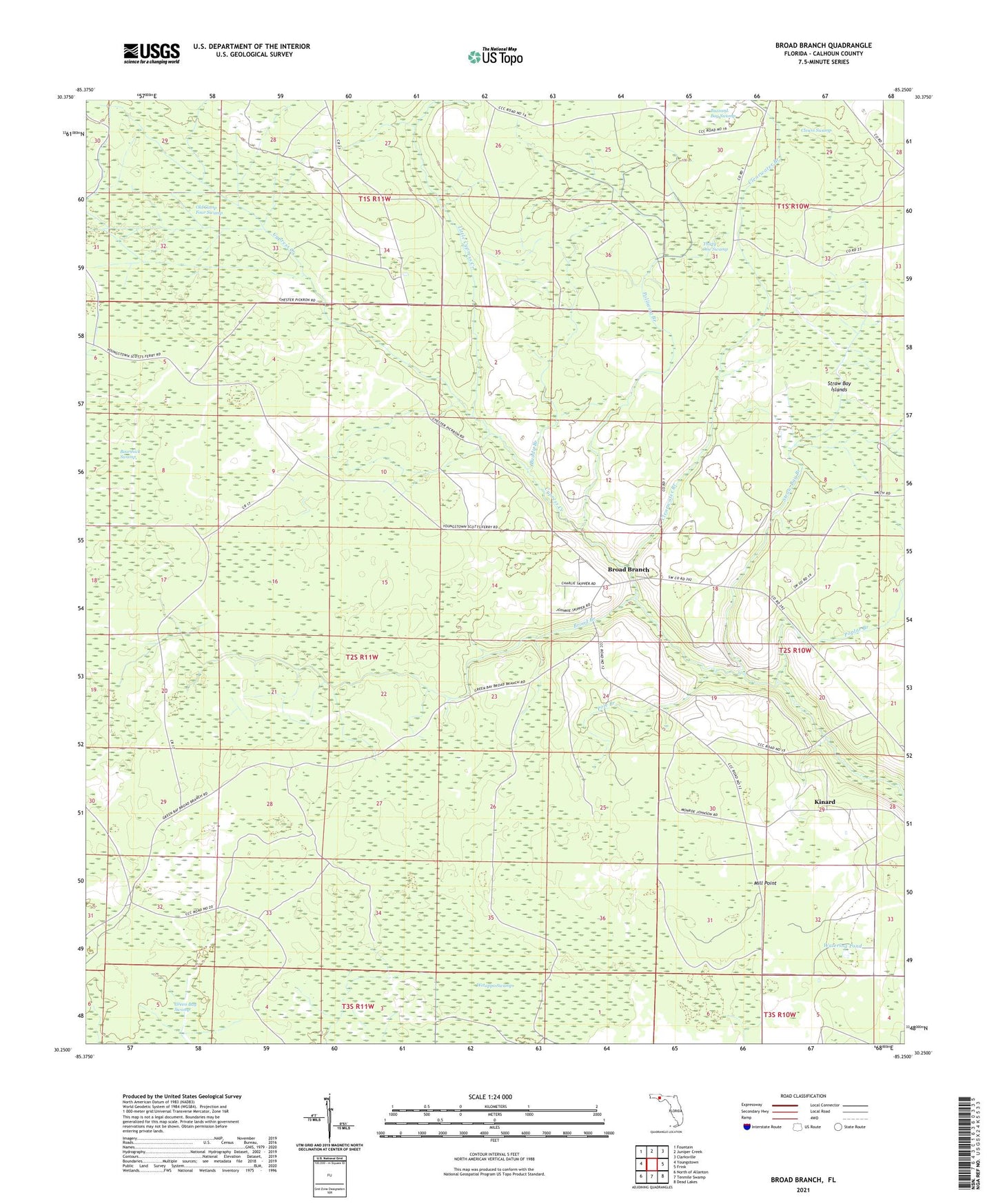
2024 topographic map quadrangle Broad Branch in the state of Florida. Scale: 1:24000. Based on the newly updated USGS 7.5' US Topo map series, this map is in the following counties: Calhoun. The map contains contour data, water features, and other items you are used to seeing on USGS maps, but also has updated roads and other features. This is the next generation of topographic maps. Printed on high-quality waterproof paper with UV fade-resistant inks.
Quads adjacent to this one:
West: Youngstown
Northwest: Fountain
North: Juniper Creek
Northeast: Clarksville
East: Frink
Southeast: Dead Lakes
South: Tenmile Swamp
Southwest: North of Allanton
This map covers the same area as the classic USGS quad with code o30085c3.
Contains the following named places: Broad Branch, Buddy Branch, Buzzard Bay Swamp, Clearwater Branch, Clearwater Pond, Clewis Swamp, Cypress Creek, Kinard, Little Cypress Creek, Mill Point, Old Camp Four Swamp, Pole Branch, Polliwog Branch, Poplar Branch, Straw Bay Branch, Straw Bay Islands, Thirty One Swamp, Watering Pond, Wetappo Swamp