MyTopo
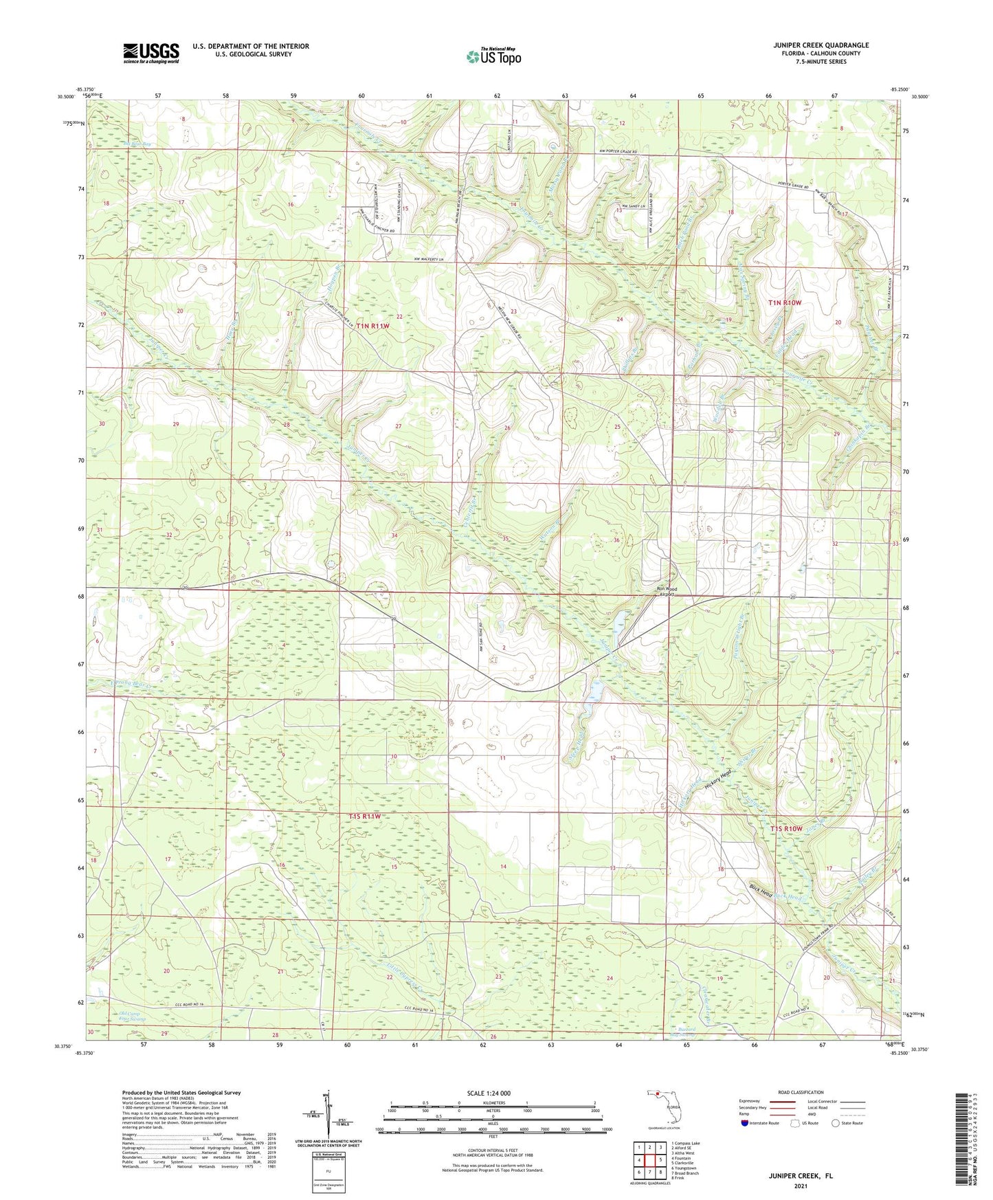
Juniper Creek Florida US Topo Map
Couldn't load pickup availability
2024 topographic map quadrangle Juniper Creek in the state of Florida. Scale: 1:24000. Based on the newly updated USGS 7.5' US Topo map series, this map is in the following counties: Calhoun. The map contains contour data, water features, and other items you are used to seeing on USGS maps, but also has updated roads and other features. This is the next generation of topographic maps. Printed on high-quality waterproof paper with UV fade-resistant inks.
Quads adjacent to this one:
West: Fountain
Northwest: Compass Lake
North: Alford SE
Northeast: Altha West
East: Clarksville
Southeast: Frink
South: Broad Branch
Southwest: Youngstown
This map covers the same area as the classic USGS quad with code o30085d3.
Contains the following named places: Bailey Branch, Big Bear Bay, Buck Head, Calder Head, Centerfit Branch, Chinkapin Branch, Ditch Pond Branch, Hickory Head, Hogpen Branch, Huey Branch, Jones Branch, Josey Branch, Max Spring Branch, Mossy Pond Branch, Panther Branch, Parham Branch, Parson Wright Branch, Phillips Branch, Rock Head, Ron Wood Airport, Shirer Branch, Steep Head, Steep Head Farm Airport, Taylor Branch, Watson Branch, West Calhoun Division, Woodell Branch