MyTopo
Hilliard Florida US Topo Map
Couldn't load pickup availability
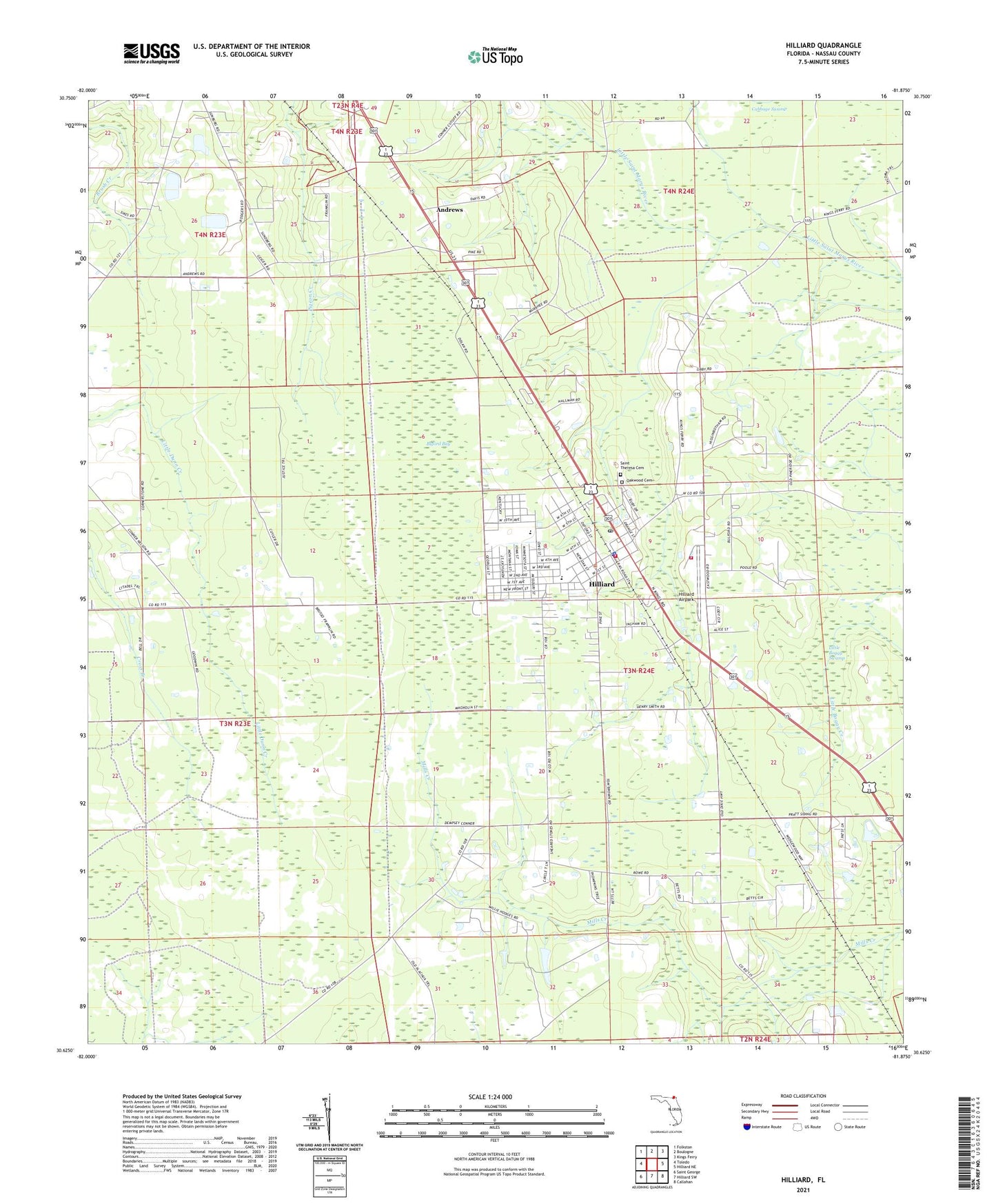
2024 topographic map quadrangle Hilliard in the state of Florida. Scale: 1:24000. Based on the newly updated USGS 7.5' US Topo map series, this map is in the following counties: Nassau. The map contains contour data, water features, and other items you are used to seeing on USGS maps, but also has updated roads and other features. This is the next generation of topographic maps. Printed on high-quality waterproof paper with UV fade-resistant inks.
Quads adjacent to this one:
West: Toledo
Northwest: Folkston
North: Boulogne
Northeast: Kings Ferry
East: Hilliard NE
Southeast: Callahan
South: Hilliard SW
Southwest: Saint George
This map covers the same area as the classic USGS quad with code o30081f8.
Contains the following named places: Andrews, Bethel Church, Buford Bay, Buford Grove Church, Hilliard, Hilliard Airpark, Hilliard Elementary School, Hilliard Middle - Senior High School, Hilliard Post Office, Hilliard Volunteer Fire Department, Little Boggy Swamp, Nassau County Fire and Rescue Station 4, Nassau County Fire and Rescue Station 40, Nassua County Sheriff's Office Hilliard Substation, Oakwood Cemetery, Saint Theresa Cemetery, Town of Hilliard, ZIP Code: 32046