MyTopo
Hilliard NE Florida US Topo Map
Couldn't load pickup availability
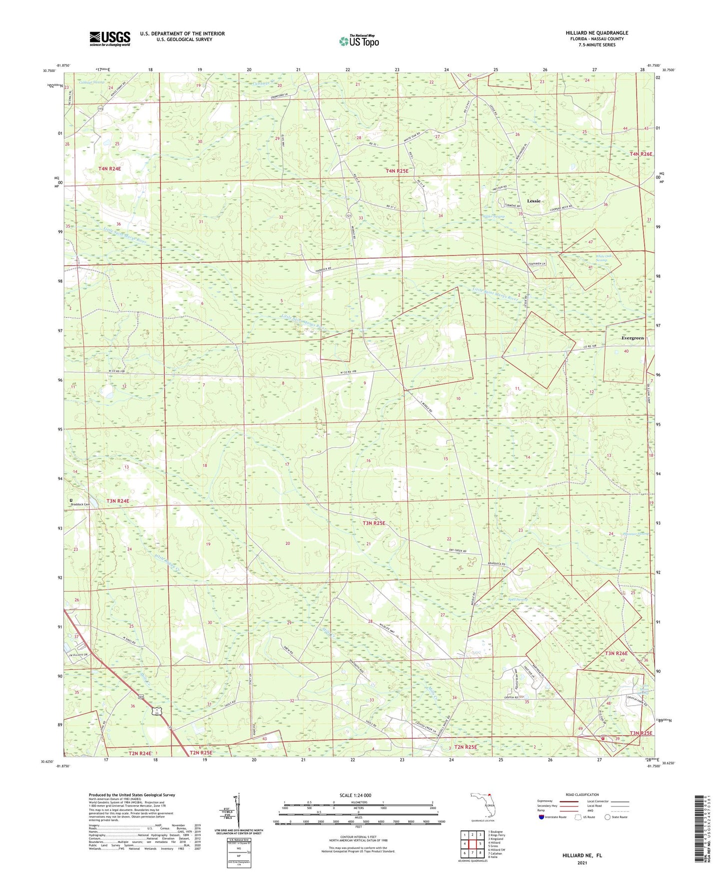
2024 topographic map quadrangle Hilliard NE in the state of Florida. Scale: 1:24000. Based on the newly updated USGS 7.5' US Topo map series, this map is in the following counties: Nassau. The map contains contour data, water features, and other items you are used to seeing on USGS maps, but also has updated roads and other features. This is the next generation of topographic maps. Printed on high-quality waterproof paper with UV fade-resistant inks.
Quads adjacent to this one:
West: Hilliard
Northwest: Boulogne
North: Kings Ferry
Northeast: Kingsland
East: Gross
Southeast: Italia
South: Callahan
Southwest: Hilliard SW
This map covers the same area as the classic USGS quad with code o30081f7.
Contains the following named places: Braddock Cemetery, Cabbage Swamp, Ephesus Church, Evergreen, Lessie, Little Boggy Creek, Mount Horeb Baptist Church, Nassau Oak Volunteer Fire Department Station 11, Nassau Wildlife Management Area, Spell Swamp, Wilder Swamp