MyTopo
Mayo Florida US Topo Map
Couldn't load pickup availability
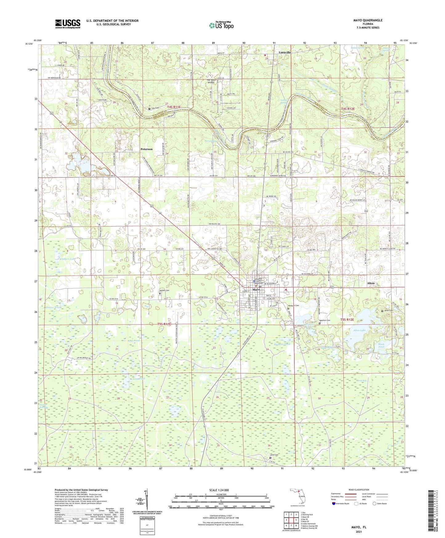
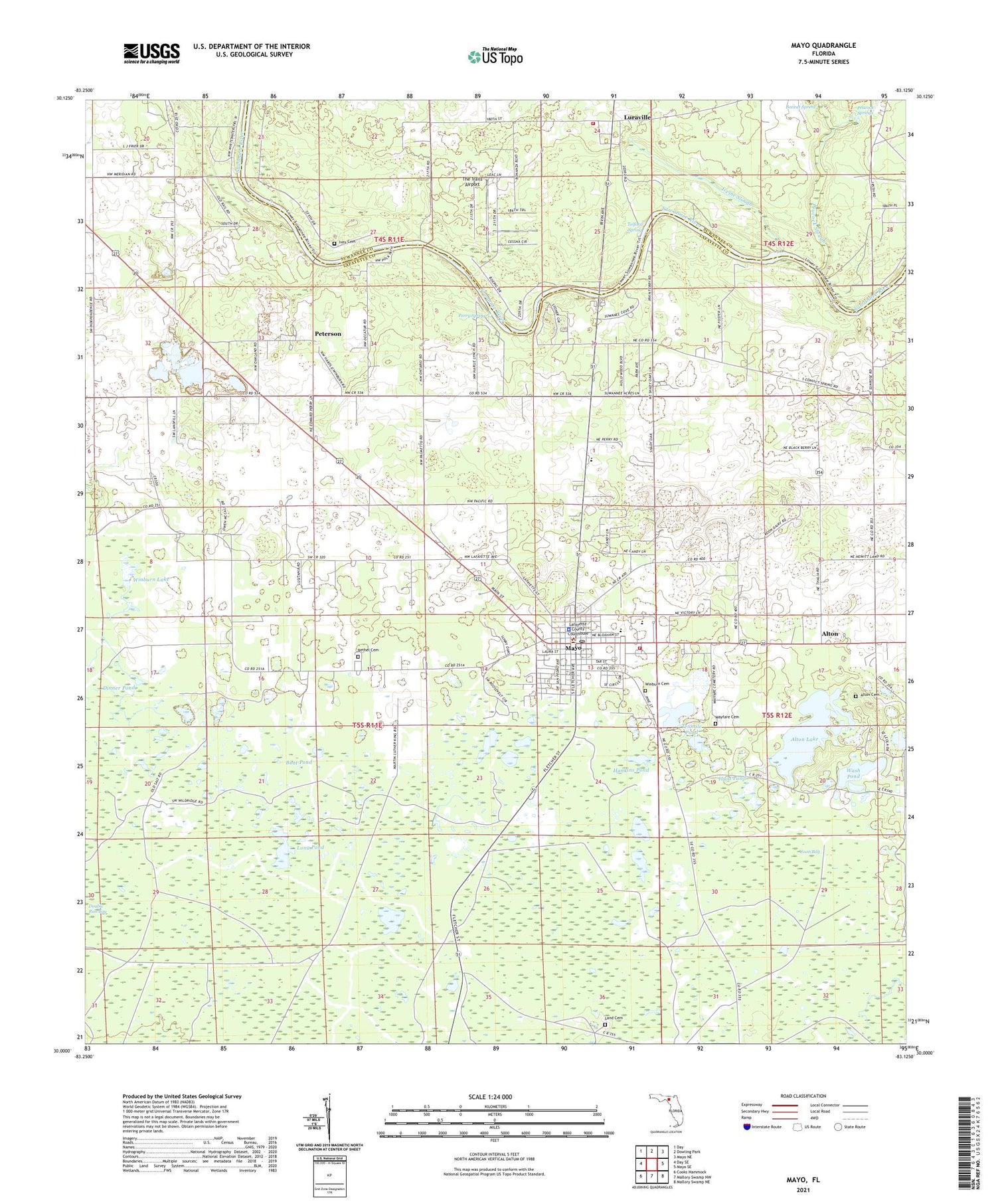
2024 topographic map quadrangle Mayo in the state of Florida. Scale: 1:24000. Based on the newly updated USGS 7.5' US Topo map series, this map is in the following counties: Lafayette, Suwannee. The map contains contour data, water features, and other items you are used to seeing on USGS maps, but also has updated roads and other features. This is the next generation of topographic maps. Printed on high-quality waterproof paper with UV fade-resistant inks.
Quads adjacent to this one:
West: Day SE
Northwest: Day
North: Dowling Park
Northeast: Mayo NE
East: Mayo SE
Southeast: Mallory Swamp NE
South: Mallory Swamp NW
Southwest: Cooks Hammock
This map covers the same area as the classic USGS quad with code o30083a2.
Contains the following named places: Alton, Alton Cemetery, Alton Dairy, Alton Lake, Bethel Cemetery, Boat Pond, Bonnet Spring, Camp Osceola, Coon Bay, Dinner Pond, Double Run Bay, Hankins Pond, Hunt Pond, Irvine Slough, Ivey Cemetery, Kerbys Dairy, Lafayette County Sheriff's Office, Lafayette Elementary School, Lafayette High School, Land Cemetery, Long Pond, Luraville, Luraville Baptist Church, Luraville Volunteer Fire Department, May Volunteer Fire Department, Mayo, Mayo Lookout Tower, Mayo Mine, Mayo Post Office, Mayo Volunteer Fire Department, New Hope Church, Our Lady of Guadalupe Church, Peacock Slough, Peacock Springs, Perry Spring, Peterson, San Pedro Junction, Telford Spring, Tenmile Pond, The Trails Airport, Three Rivers Library System Lafayette County Public Library, Town of Mayo, Wash Pond, Wayfare Cemetery, WGSG-FM (Mayo), Winburn Cemetery, Winburn Lake, Winburn Pond, ZIP Code: 32066