
MyTopo
Day SE Florida US Topo Map
Couldn't load pickup availability
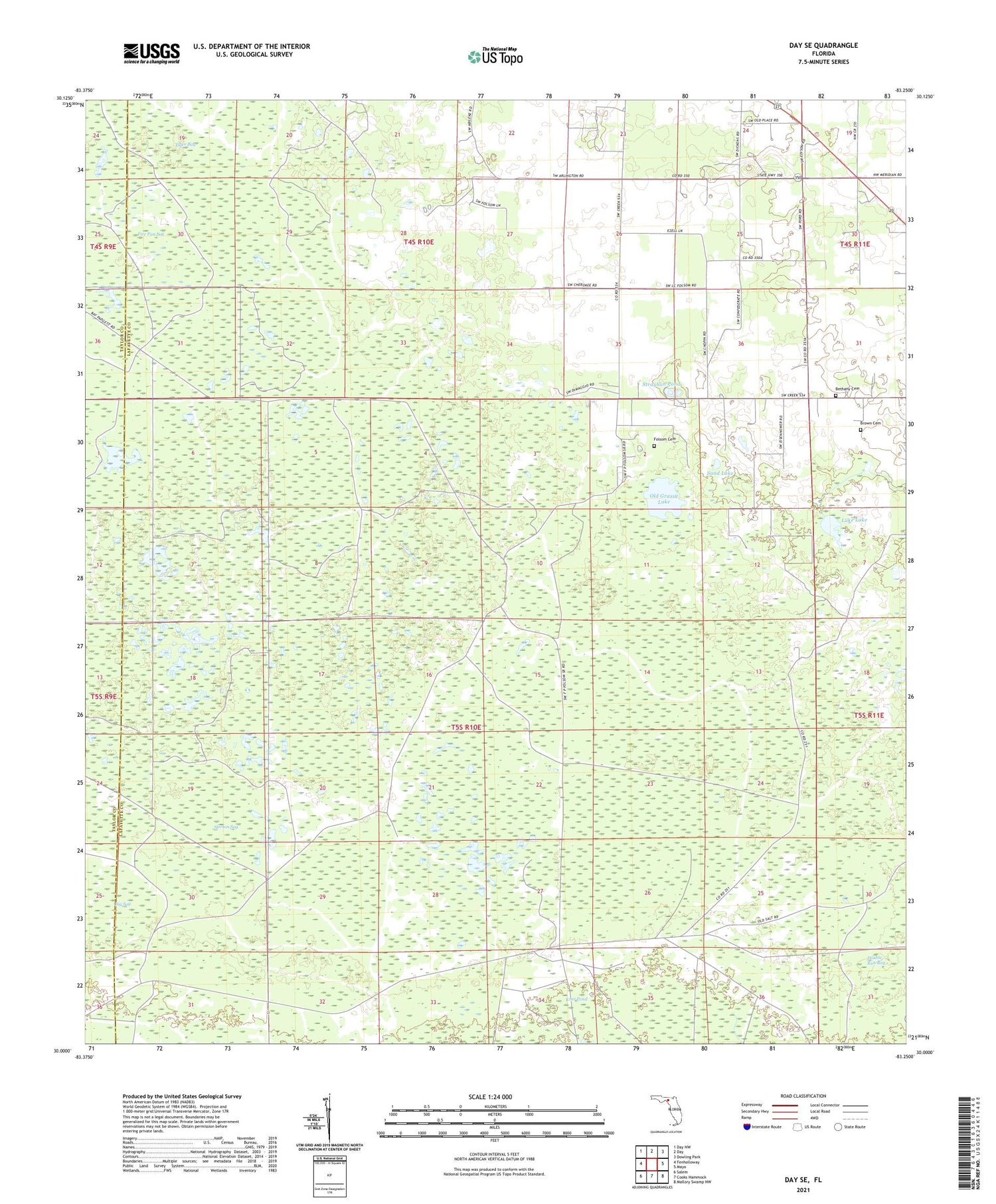
2024 topographic map quadrangle Day SE in the state of Florida. Scale: 1:24000. Based on the newly updated USGS 7.5' US Topo map series, this map is in the following counties: Lafayette, Taylor. The map contains contour data, water features, and other items you are used to seeing on USGS maps, but also has updated roads and other features. This is the next generation of topographic maps. Printed on high-quality waterproof paper with UV fade-resistant inks.
Quads adjacent to this one:
West: Fenholloway
Northwest: Day NW
North: Day
Northeast: Dowling Park
East: Mayo
Southeast: Mallory Swamp NW
South: Cooks Hammock
Southwest: Salem
This map covers the same area as the classic USGS quad with code o30083a3.
Contains the following named places: Ainsley Lookout Tower, Bethany Cemetery, Brown Cemetery, Brumley Camp, Folsom Cemetery, Horton Sog, Luke Lake, Old Grassy Lake, Paremore Camp, Pleasant Grove Church, Sand Lake, Strayhan Pond, Tiger Bay


