MyTopo
Cotton Plant Florida US Topo Map
Couldn't load pickup availability
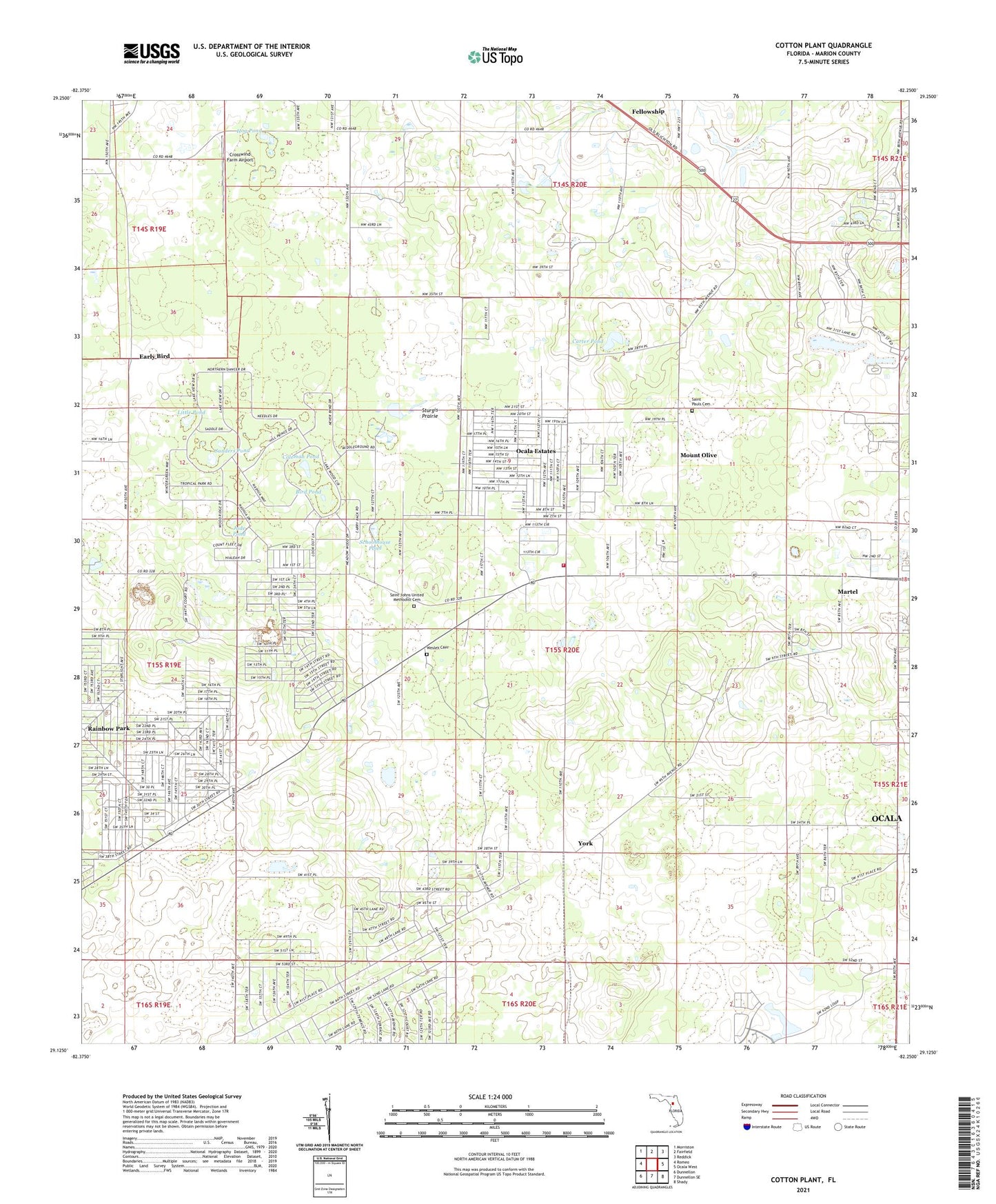
2024 topographic map quadrangle Cotton Plant in the state of Florida. Scale: 1:24000. Based on the newly updated USGS 7.5' US Topo map series, this map is in the following counties: Marion. The map contains contour data, water features, and other items you are used to seeing on USGS maps, but also has updated roads and other features. This is the next generation of topographic maps. Printed on high-quality waterproof paper with UV fade-resistant inks.
Quads adjacent to this one:
West: Romeo
Northwest: Morriston
North: Fairfield
Northeast: Reddick
East: Ocala West
Southeast: Shady
South: Dunnellon SE
Southwest: Dunnellon
This map covers the same area as the classic USGS quad with code o29082b3.
Contains the following named places: Alltel Cellular Phone Tower, Bird Pond, Blessed Trinity Catholic Church, Carter Pond, Classic Mile Race Track, Coleman Pond, Cotton Plant, Countryside Baptist Church, Crosswind Farm Airport, Early Bird, Fellowship, Fellowship Baptist Church, Fellowship Division, Friendship Church, Gospel Fellowship Outreach Church, Hog Pond, Jude Pond, Kingdom Hall of Jehovah's Witnesses, Leroy, Little Pond, Marion County Fire Rescue Station 12, Mars Hill Missionary Baptist Church, Minehead Station, Mount Olive, New Jerusalem Missionary Baptist Church, Ocala Estates, Ocala Estates Census Designated Place, Ocala Pentecostal Church of God in Christ, Our Lady of Guadalupe Catholic Church, Rainbow Park, Rainbow Park Census Designated Place, Saint Johns United Methodist Cemetery, Saint Johns United Methodist Church, Saint Pauls Cemetery, Saint Pauls Church, Sanders Pond, Schoolhouse Pond, Sherman Oaks, Siloam Baptist Church, Sonshine Baptist Church, Sturgis Prairie, Wesley Cemetery, Wesley Chapel, West Marion Baptist Church, York, ZIP Codes: 34481, 34482