MyTopo
Morriston Florida US Topo Map
Couldn't load pickup availability
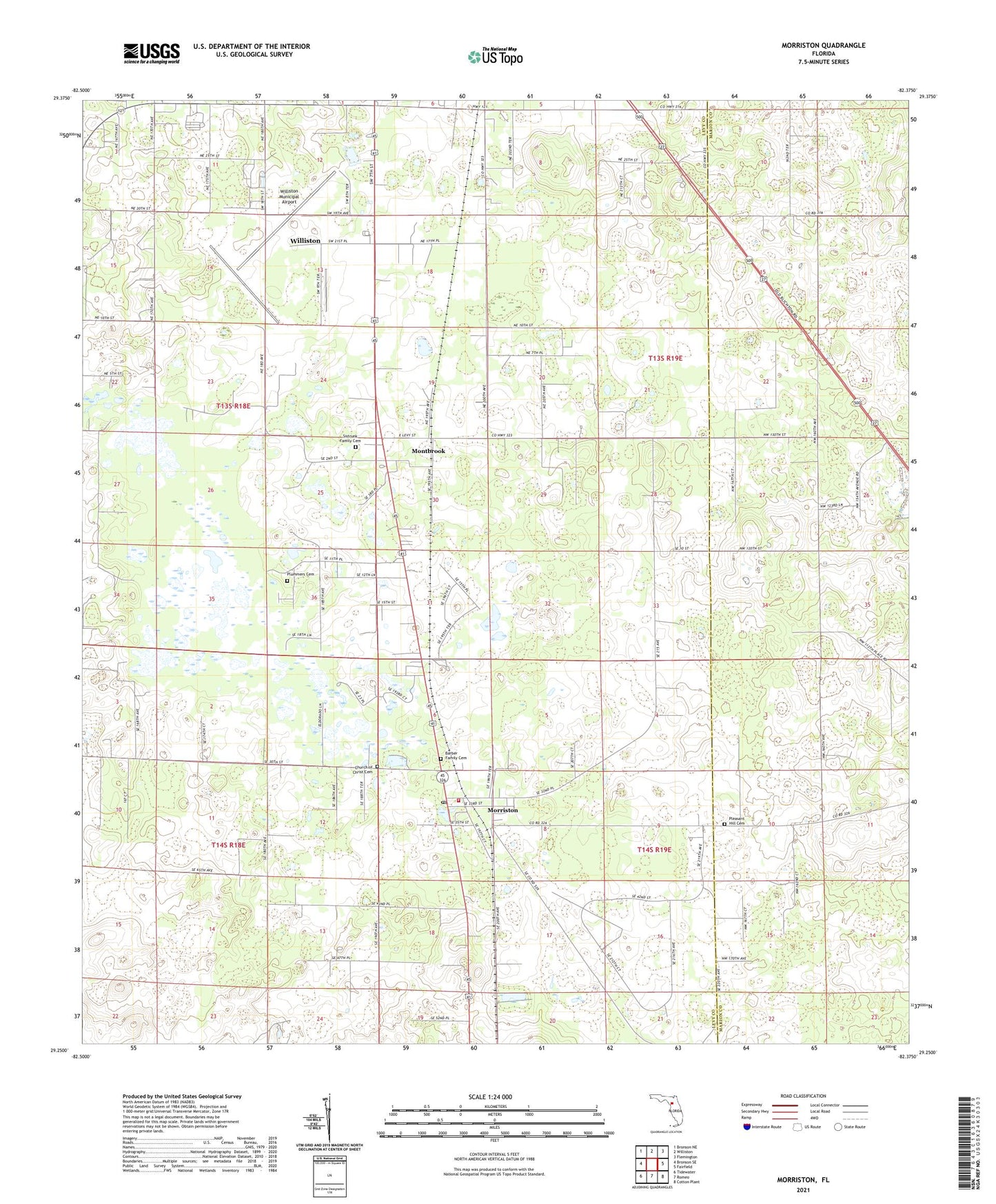
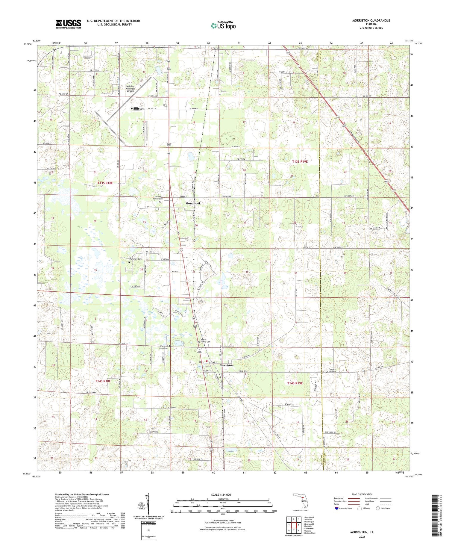
2024 topographic map quadrangle Morriston in the state of Florida. Scale: 1:24000. Based on the newly updated USGS 7.5' US Topo map series, this map is in the following counties: Levy, Marion. The map contains contour data, water features, and other items you are used to seeing on USGS maps, but also has updated roads and other features. This is the next generation of topographic maps. Printed on high-quality waterproof paper with UV fade-resistant inks.
Quads adjacent to this one:
West: Bronson SE
Northwest: Bronson NE
North: Williston
Northeast: Flemington
East: Fairfield
Southeast: Cotton Plant
South: Romeo
Southwest: Tidewater
This map covers the same area as the classic USGS quad with code o29082c4.
Contains the following named places: Barber Family Cemetery, Church of Christ, Church of Christ Cemetery, Lake Stafford, Montbrook, Montbrook Army Air Field, Morriston, Morriston Baptist Church, Morriston Census Designated Place, Morriston Montbrook Volunteer Fire Department Station 1, Morriston Post Office, Pleasant Hill Cemetery, Plummers Cemetery, Saint James Missionary Baptist Church, Sistrunk Family Cemetery, Unity Temple of Deliverance, Williston Municipal Airport, ZIP Code: 32668