MyTopo
Darlington Florida US Topo Map
Couldn't load pickup availability
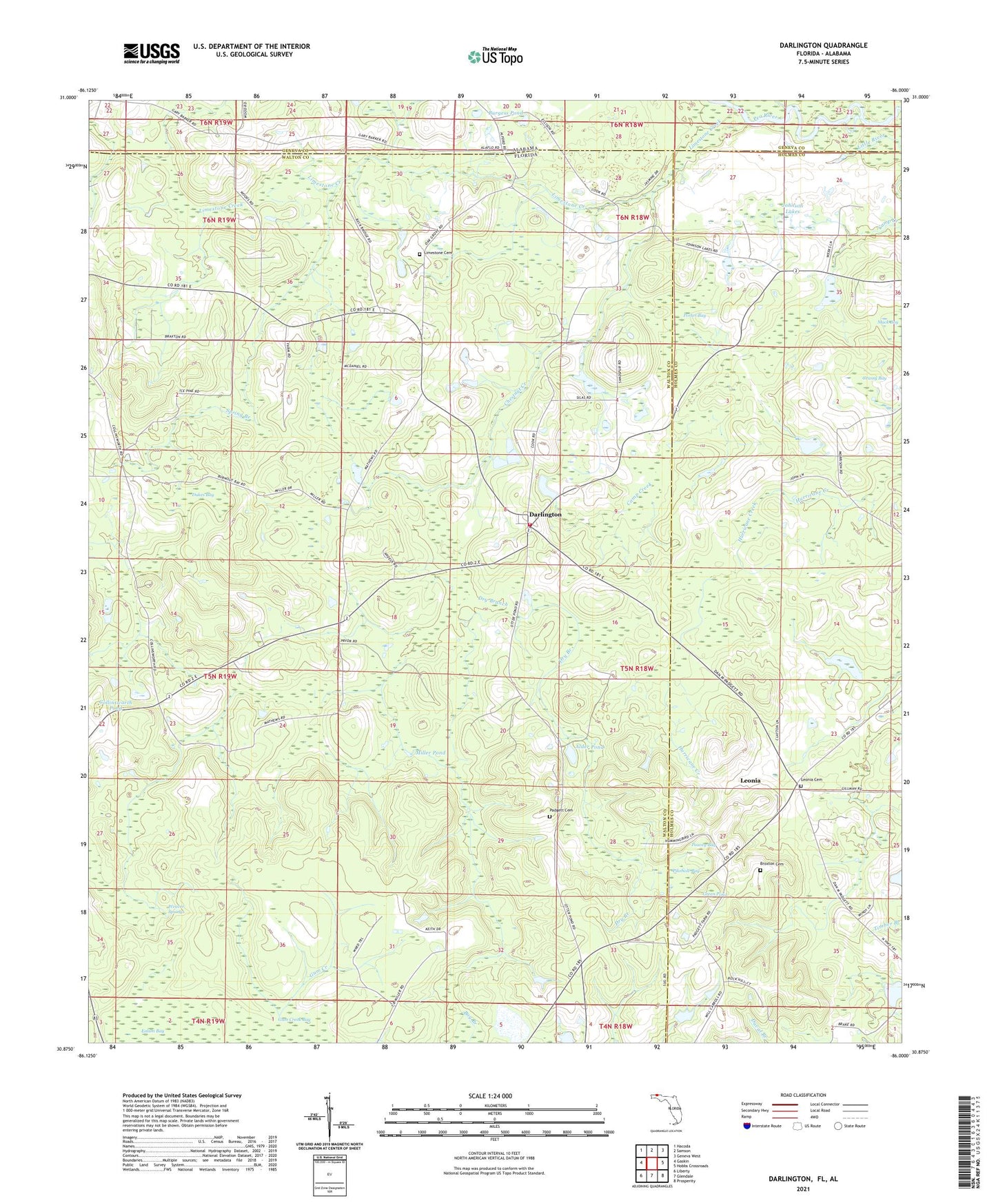
2024 topographic map quadrangle Darlington in the states of Florida, Alabama. Scale: 1:24000. Based on the newly updated USGS 7.5' US Topo map series, this map is in the following counties: Walton, Holmes, Geneva. The map contains contour data, water features, and other items you are used to seeing on USGS maps, but also has updated roads and other features. This is the next generation of topographic maps. Printed on high-quality waterproof paper with UV fade-resistant inks.
Quads adjacent to this one:
West: Gaskin
Northwest: Hacoda
North: Samson
Northeast: Geneva West
East: Hobbs Crossroads
Southeast: Prosperity
South: Glendale
Southwest: Liberty
This map covers the same area as the classic USGS quad with code o30086h1.
Contains the following named places: Alder Pond, Broxton Cemetery, Burgess Pond, Burgess School, Camp Creek Church, Chestnut Creek, Collinsworth Pond, Cook Pond, Darlington, Darlington Gascon Fire Station, Dry Branch, Dukes Bay, Ealum Bay, Grassy Bay, Green Pond, Johnson Lakes, Leonia, Leonia Baptist Church, Leonia Cemetery, Limestone Cemetery, Limestone Church, Limestone Creek, Mack Bay, Miller Pond, Oak Grove Church, Padgett Cemetery, Peavey Bay, Pikehole Bay, Porter Bay, Spring Branch, Weaver Springs