MyTopo
Day Florida US Topo Map
Couldn't load pickup availability
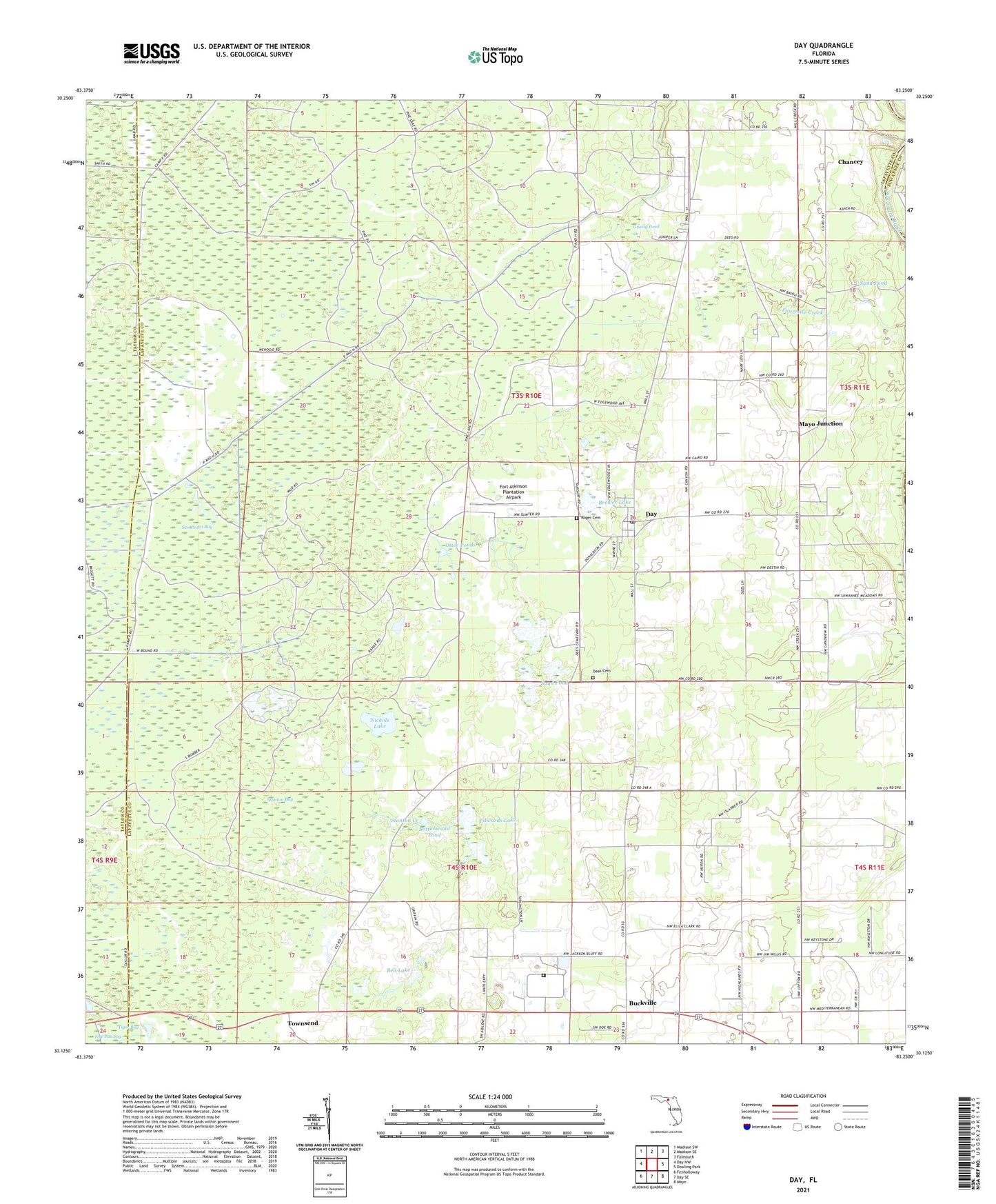
2024 topographic map quadrangle Day in the state of Florida. Scale: 1:24000. Based on the newly updated USGS 7.5' US Topo map series, this map is in the following counties: Lafayette, Taylor, Suwannee. The map contains contour data, water features, and other items you are used to seeing on USGS maps, but also has updated roads and other features. This is the next generation of topographic maps. Printed on high-quality waterproof paper with UV fade-resistant inks.
Quads adjacent to this one:
West: Day NW
Northwest: Madison SW
North: Madison SE
Northeast: Falmouth
East: Dowling Park
Southeast: Mayo
South: Day SE
Southwest: Fenholloway
This map covers the same area as the classic USGS quad with code o30083b3.
Contains the following named places: Bell Lake, Bottonwood Pond, Brewer Lake, Brewer Lake Baptist Church, Buckville, Chancey, Day, Day Census Designated Place, Day Division, Day Post Office, Dees Cemetery, Edwards Lake, Fort Atkinson Lake, Fort Atkinson Plantation Airpark, Fourmile Creek, Grassy Pond, Magnolia Church, Mayo Correctional Institution Annex, Mayo Junction, Nichols Lake, Otter Ponds, Riverside Church, Roger Cemetery, Sand Pond, Stanton Bay, Stanton Creek, Townsend