MyTopo
Daytona Beach SW Florida US Topo Map
Couldn't load pickup availability
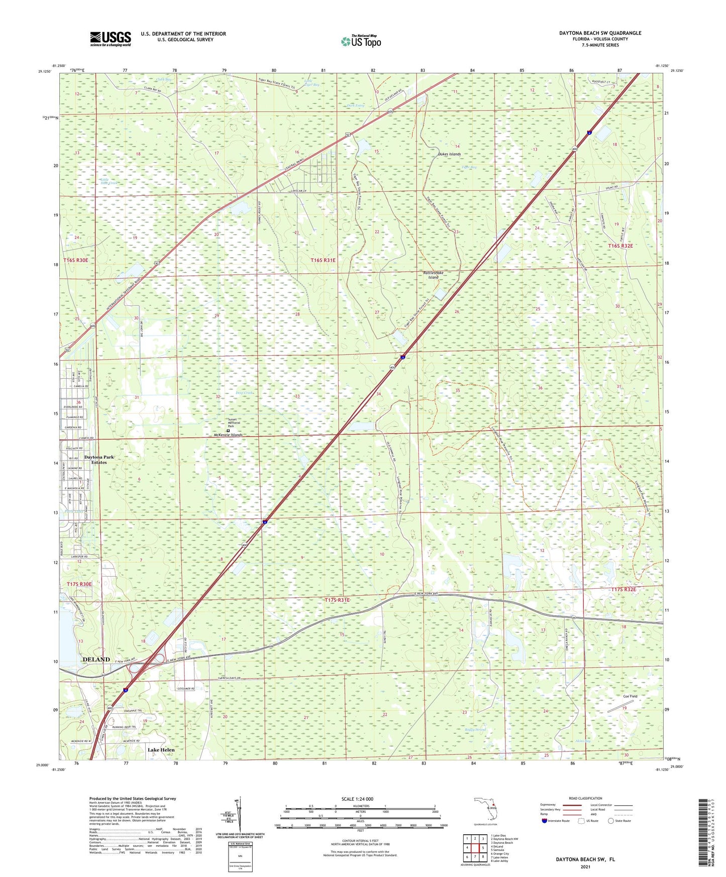
2024 topographic map quadrangle Daytona Beach SW in the state of Florida. Scale: 1:24000. Based on the newly updated USGS 7.5' US Topo map series, this map is in the following counties: Volusia. The map contains contour data, water features, and other items you are used to seeing on USGS maps, but also has updated roads and other features. This is the next generation of topographic maps. Printed on high-quality waterproof paper with UV fade-resistant inks.
Quads adjacent to this one:
West: DeLand
Northwest: Lake Dias
North: Daytona Beach NW
Northeast: Daytona Beach
East: Samsula
Southeast: Lake Ashby
South: Lake Helen
Southwest: Orange City
This map covers the same area as the classic USGS quad with code o29081a2.
Contains the following named places: Akins Bay, Boggy Strand, Coe Field, Dark Entry, Daytona Park Estates, Deep Creek, Dukes Islands, Little Haw Creek, McKenzie Islands, Rattlesnake Island, Spruce Creek Senior High School, Sunset Memorial Park, Tomoka Wildlife Management Area Volusia Recharge Tract, Volusia County, ZIP Code: 32724