
MyTopo
Lake Dias Florida US Topo Map
Couldn't load pickup availability
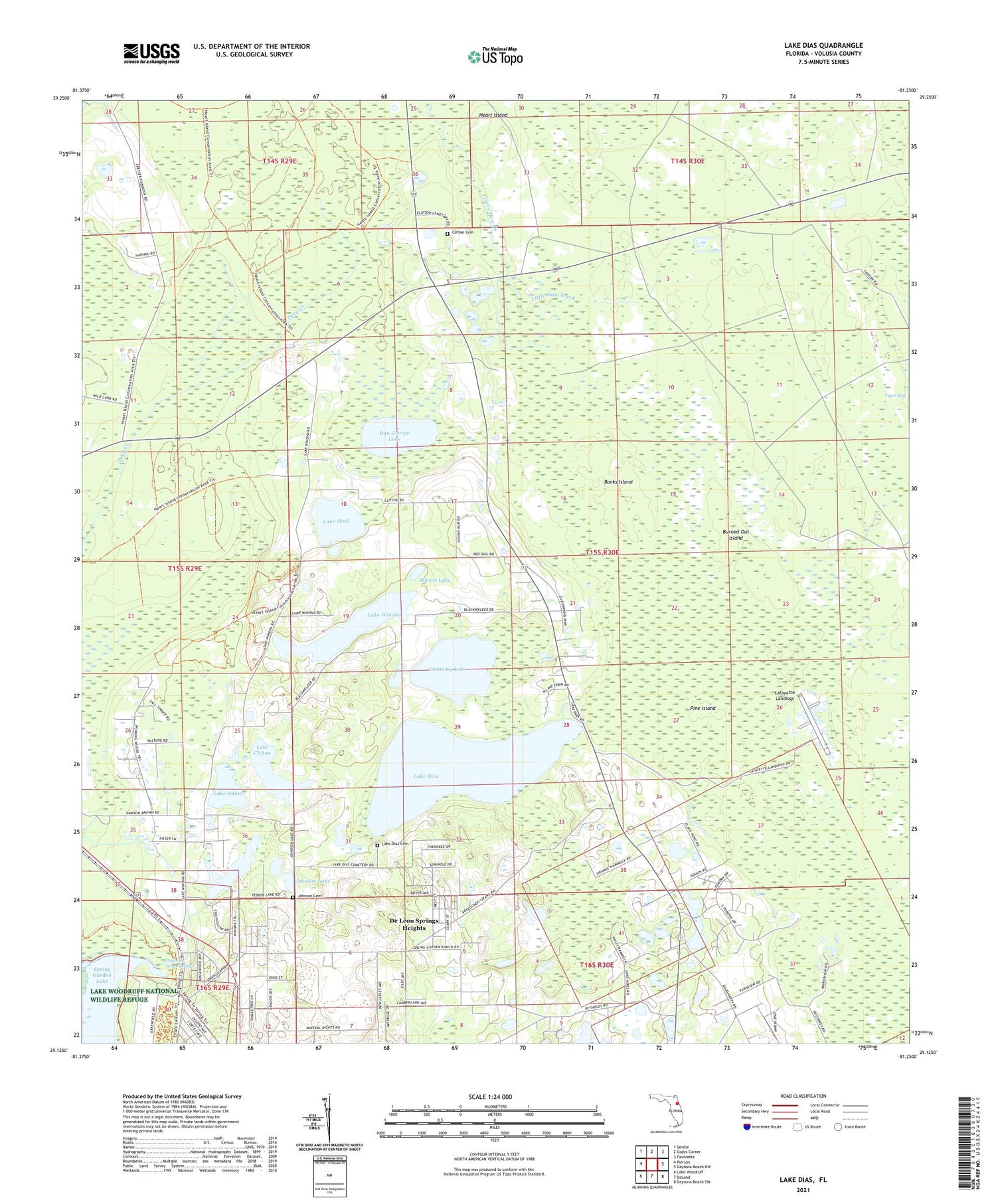
2024 topographic map quadrangle Lake Dias in the state of Florida. Scale: 1:24000. Based on the newly updated USGS 7.5' US Topo map series, this map is in the following counties: Volusia. The map contains contour data, water features, and other items you are used to seeing on USGS maps, but also has updated roads and other features. This is the next generation of topographic maps. Printed on high-quality waterproof paper with UV fade-resistant inks.
Quads adjacent to this one:
West: Pierson
Northwest: Seville
North: Codys Corner
Northeast: Favoretta
East: Daytona Beach NW
Southeast: Daytona Beach SW
South: DeLand
Southwest: Lake Woodruff
This map covers the same area as the classic USGS quad with code o29081b3.
Contains the following named places: Banks Island, Burned Out Island, Camp Winona, Caraway Lake, Clifton Cemetery, Dan George Lake, De Leon Lookout Tower, De Leon Springs Heights, De Leon Springs State Park, F M Arredondo Grant, Heirs of Williams Grant, Johnson Cemetery, Johnson Lake, Lafayette Landings, Lake Clifton, Lake Dias, Lake Dias Cemetery, Lake Odom, Lake Skull, Lake Winona, M E Levy Grant, Mirror Lake, Moses E Levy Grant, Pine Island, Ponce de Leon Springs, Spring Garden Ranch Mobile Home Park, Tedder Lake, Thomas Forbes Grant, Tomoka Wildlife Management Area Union-Camp Tract, William Panton Grant, ZIP Code: 32130


