MyTopo
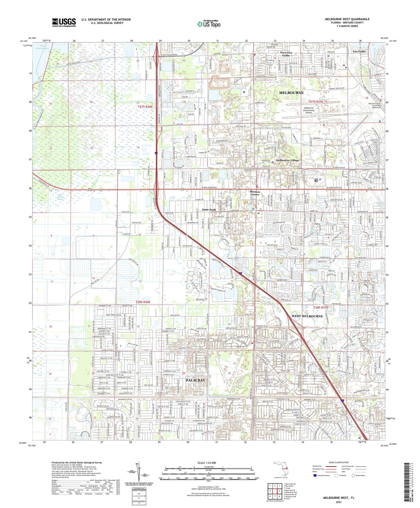
Melbourne West Florida US Topo Map
Couldn't load pickup availability
2024 topographic map quadrangle Melbourne West in the state of Florida. Scale: 1:24000. Based on the newly updated USGS 7.5' US Topo map series, this map is in the following counties: Brevard. The map contains contour data, water features, and other items you are used to seeing on USGS maps, but also has updated roads and other features. This is the next generation of topographic maps. Printed on high-quality waterproof paper with UV fade-resistant inks.
Quads adjacent to this one:
West: Deer Park SE
Northwest: Deer Park NE
North: Eau Gallie
Northeast: Tropic
East: Melbourne East
Southeast: Grant
South: Fellsmere NW
Southwest: Kenansville NE
This map covers the same area as the classic USGS quad with code o28080a6.
Contains the following named places: Aurora Plaza, Bethany Baptist Church, Bowe Gardens Shopping Center, Brevard County Fire Rescue Station 67 / 68, Brevard County Fire Rescue Station 82, Brevard County Fire Rescue Station 83, Brevard County Library System West Melbourne Public Library, Brevard County Sheriff's Office, Brevard County Sheriff's Office South Precinct, Brevard Mental Health Center and Hospital, Cape South Mobile Home Park, Church of Christ of Melbourne, Church of God of Prophecy, Church of the Good Shepherd, City of Melbourne, City of West Melbourne, Community Bible Church, Eau Gallie Estates Mobile Home Park, Eau Gallie Place Shopping Center, Elbow Creek, Evergreen Mobile Home Park, Faith Baptist Church of Palm Bay, Florida Air Academy, Florida Institute of Technology Alumni House, Florida Institute of Technology Brownlie Hall, Florida Institute of Technology CAPS Counseling Center, Florida Institute of Technology Community Psychological Services of Florida Tech, Florida Institute of Technology Holzer Health Center, Florida Institute of Technology Institutional Research Center, Groveland Mobile Home Park, Harbor City Elementary School, Holy Temple Church of the Living God, Interchange Square Post Office, June Park, June Park Baptist Church, June Park Census Designated Place, Korean Central Baptist Church, Lake Washington Square, Lakes of Melbourne Mobile Home Park, Lamplighter Mobile Home Park, Lamplighter Village III Mobile Home Park, Lochmoor Country Club, Lockmar Baptist Church, Lockmar Elementary School, Lone Palm Golf Club, Meadowlane Primary School, Melbourne Airport Police Department, Melbourne Fire Department Station 72, Melbourne Fire Department Station 73, Melbourne Fire Department Station 78, Melbourne Gardens, Melbourne Golf and Country Club, Melbourne International Airport, Melbourne Police Department, Melbourne Police Department Headquarters, Melbourne Spanish Seventh Day Adventist Church, Melbourne Square, Melbourne Square Mall, Melbourne Tillman Canal, Melbourne Village, Melbourne Village Police Department, Mintons Corner, Mintons Corner Shopping Center, Naval Air Station Melbourne, New Hope Evangelical Lutheran Church, Northgate Shopping Center, Palm Bay Christian Church, Palm Bay Seventh Day Adventist Church, Palmdale Presbyterian Church, Park Plaza, Praise Cathedral Church of God, Quail Run Mobile Home Estates, Ridgewood Mall, Riveria United Church of Christ, Riviera Country Club, Roy Allen Elementary School, Sarno Plaza, Seventh Day Adventist Church, Sweetwater Camp, The Church of Jesus Christ of Latter Day Saints, The Lakes of Melbourne Mobile Home Park, Town of Melbourne Village, Trailer Haven Mobile Home Park, Unitarian Universalist Church of Brevard, University Park Elementary School, WAOA-FM (Melbourne), Wesley United Methodist Church, West Eau Gallie Shopping Center, West Melbourne, West Melbourne Christian Center, West Melbourne First Baptist Church, West Melbourne Police Department, West Melbourne Post Office, West Melbourne Volunteer Fire Department, Westshore Junior- Senior High School, Wuesthoff Medical Center - Melbourne, WWIA-FM (Palm Bay), ZIP Codes: 32904, 32907


